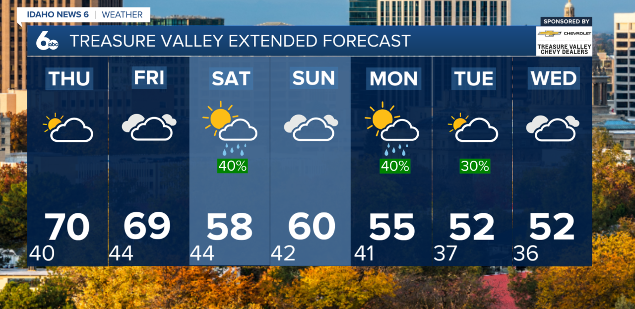
Unseasonably warm temperatures will continue across southwest Idaho through Friday, with highs running 10 to 20 degrees above normal. However, a major shift in the weather pattern is expected heading into the weekend, bringing gusty winds, rain, mountain snow and cooler temperatures.
Near-record highs possible through Friday
High pressure building over the region will keep conditions mild and dry through early Friday. Afternoon temperatures across lower valleys will climb into the mid-60s to around 70 degrees, putting several locations near record highs for this time of year.
Boise Forecast Highs vs. Record Highs
Nov. 11 70° 71°
Nov. 12 70° 70°
Nov. 13 69° 69°
Partly to mostly sunny skies will accompany the warm temperatures, although breezy conditions will persist. Southerly to southeasterly winds could gust between 15 and 25 mph Wednesday and Thursday.
By Friday, winds will become noticeably stronger as a storm system approaches from the Gulf of Alaska. Gusts could reach 35 to 50 mph across southeastern Oregon and far southwestern Idaho, with gusts of 20 to 40 mph elsewhere.
Rain and mountain snow arrive Friday night
A cold front will move through the region Friday night, bringing a 60% to 90% chance of precipitation.
Most locations can expect light rainfall totals between 0.10 and 0.25 inches, while mountain areas could receive up to half an inch of precipitation.
Snow levels will initially be around 7,000 to 8,000 feet before dropping to 6,000 to 7,000 feet overnight. Higher mountain elevations above 7,000 feet could pick up a few inches of snow.
Cooler temperatures and additional storms next week
Rain and mountain snow will gradually taper off Saturday morning as the first system exits the region. Afternoon temperatures will drop roughly 10 degrees compared to Friday, with breezy west to northwest winds continuing.
A brief break in the unsettled weather is expected late Saturday into Sunday before another storm system approaches.
The next round of precipitation is expected between Sunday night and early Tuesday, with Monday currently showing the highest chance of rain and mountain snow at 50% to 80%.
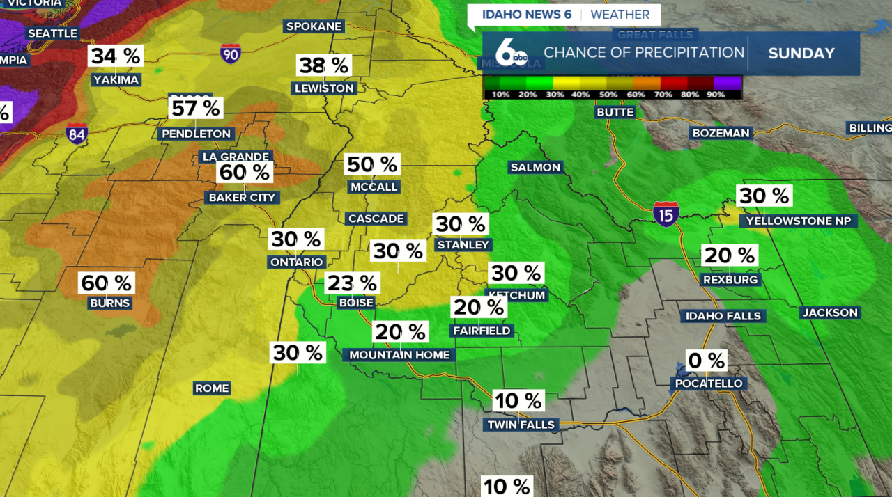
Snow levels could fall as low as 4,000 to 5,500 feet by the time precipitation ends, allowing additional snowfall across the mountains.
Temperatures will continue cooling, returning closer to seasonal averages by Tuesday.
The active weather pattern may continue into the middle of next week, with another storm system approaching Wednesday and precipitation chances increasing late in the day.
Enjoy the warm and drier weather while it lasts.