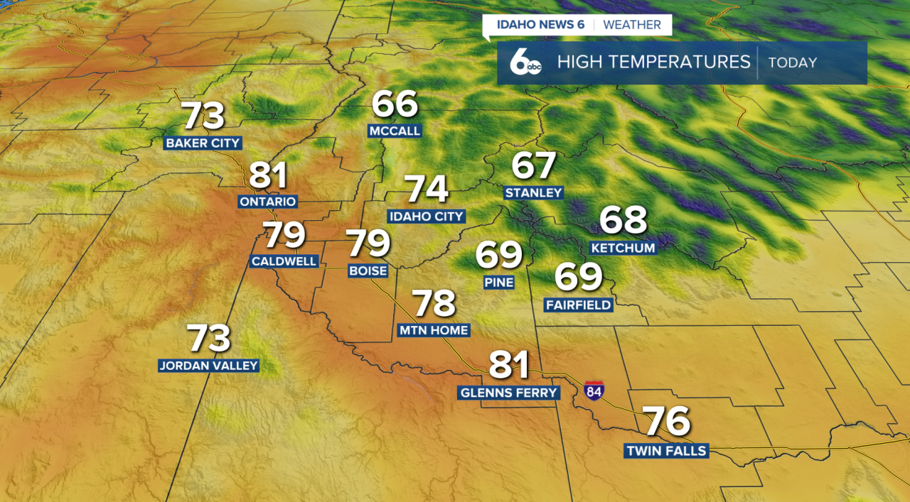
After a cool and breezy weekend, temperatures are finally beginning to rebound across Idaho. Highs today will climb back to near normal with lighter winds compared to yesterday, although communities east of Boise could still see afternoon gusts between 15 and 25 mph. Most areas stay dry, but a few isolated showers may pop up near the Nevada border and across the central Idaho mountains.
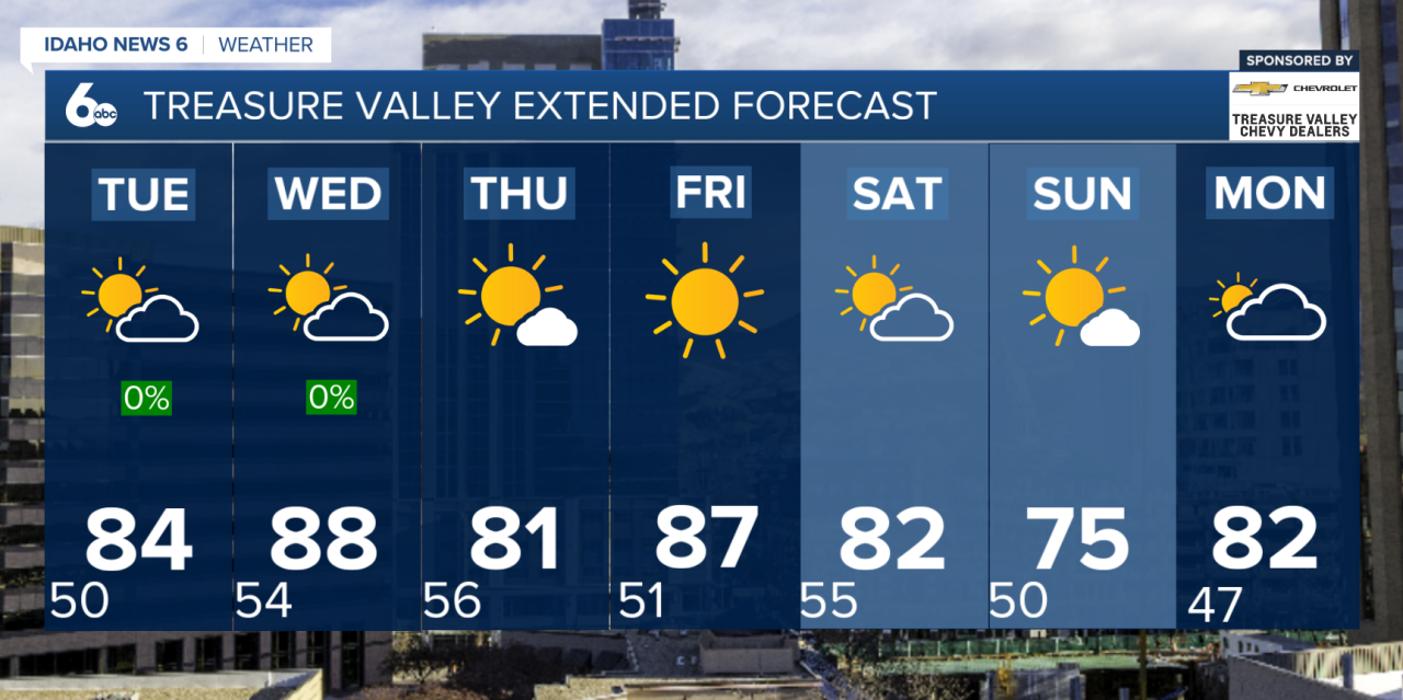
The warming trend continues Tuesday as high pressure builds overhead, pushing temperatures several degrees above normal. By Wednesday, many valley locations will be running 5 to 10 degrees warmer than average, making it the warmest day of the week so far.
Changes arrive Wednesday night as the next weather system approaches from the Pacific Northwest. The best chance for showers and thunderstorms will be across east-central Oregon and west-central Idaho, where rain chances climb as high as 20 to 50 percent. Areas farther south, including much of the Treasure Valley, are expected to remain mostly dry, though breezy conditions will develop as a weak cold front moves through.
Looking ahead to the weekend, another storm system will bring increasing winds and another chance for showers and thunderstorms, especially across northeast Oregon and the central Idaho mountains. Temperatures will cool back down Saturday and Sunday, with gusty winds likely accompanying the weekend weather change before warmer and drier conditions return early next week.