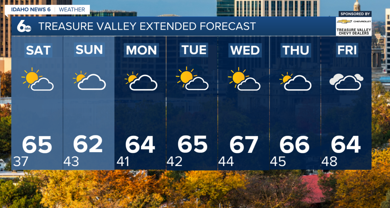
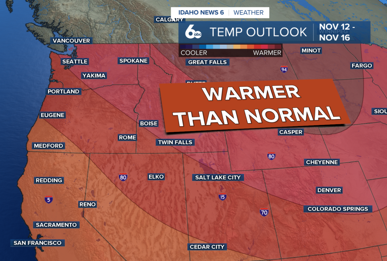
November is off to an unusually warm start across southwest Idaho and southeast Oregon, and temperatures are expected to climb even higher next week. By Wednesday, some locations in the Treasure Valley could approach or break daily record highs.
Friday will bring quiet weather across the region, with temperatures near to slightly above seasonal averages. High pressure will help keep skies mostly clear, although patchy morning fog may develop in sheltered valleys.
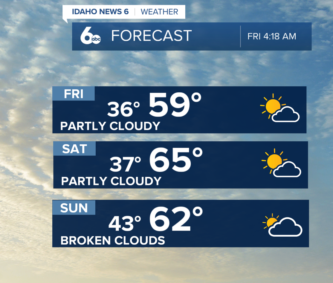
Saturday will be even warmer, with temperatures running 5 to 15 degrees above normal. Dry conditions will continue, making for a pleasant start to the weekend.
A weak cold front will move through the Pacific Northwest late Saturday into Sunday, bringing breezy conditions and a slight cooldown.
However, rain chances will remain limited. Northern Baker County and Idaho's west-central mountains have just a 5–10% chance of showers, while the Treasure Valley and most surrounding areas will remain dry.
Near-Record Warmth Possible Next Week
The biggest weather story arrives next week as high pressure strengthens across the region.
Temperatures will steadily climb beginning Monday, with the warmest conditions expected Wednesday. Afternoon highs in lower-elevation valleys could reach the mid to upper 60s, approximately 15 degrees above normal for this time of year.
Several locations, including the Treasure Valley, could approach or exceed daily record highs.
The unusually warm and dry pattern will persist through the middle of next week before a potential shift toward more unsettled weather late next week or into the following weekend.
Looking Ahead
While November typically brings cooler temperatures and increasing opportunities for mountain snow, the current pattern will keep much of southwest Idaho warmer and drier than usual.
Forecast models are beginning to suggest a possible pattern change toward the end of next week, although the timing and precipitation potential are uncertain.