Good morning, Idaho!
It’s Wednesday and the start of Treefort, we’re staying in that warm, spring-like pattern for one more day before a major shift moves in tonight.
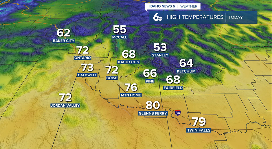
Temperatures today will once again climb to near-record levels, especially across the Magic Valley. Boise and the Treasure Valley stay very warm as well, though increasing clouds will take just a slight edge off yesterday’s peak heat.
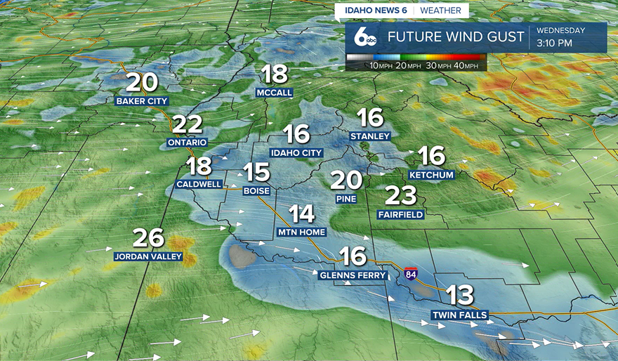
Along with the warmth, winds will pick up this afternoon. Northwest winds along the I-84 corridor could gust between 30 to 40 mph, especially across southern portions of the region. That means areas near the Idaho-Nevada border and southeast Oregon could see blowing dust and reduced visibility, along with elevated fire danger due to dry conditions.
Meanwhile, if you’re heading into the mountains, light showers continue across the west-central mountains. Snow levels remain high—above 7,000 feet—so any accumulation will stay limited to the highest peaks.
Forecast: Warm today, windy tonight, big cool down ahead
Tonight: Strong Cold Front Arrives
A strong cold front pushes through overnight, bringing another round of gusty winds—potentially up to 45 mph, with isolated higher gusts. This front marks the beginning of a sharp pattern change.
Thursday: Weather Whiplash
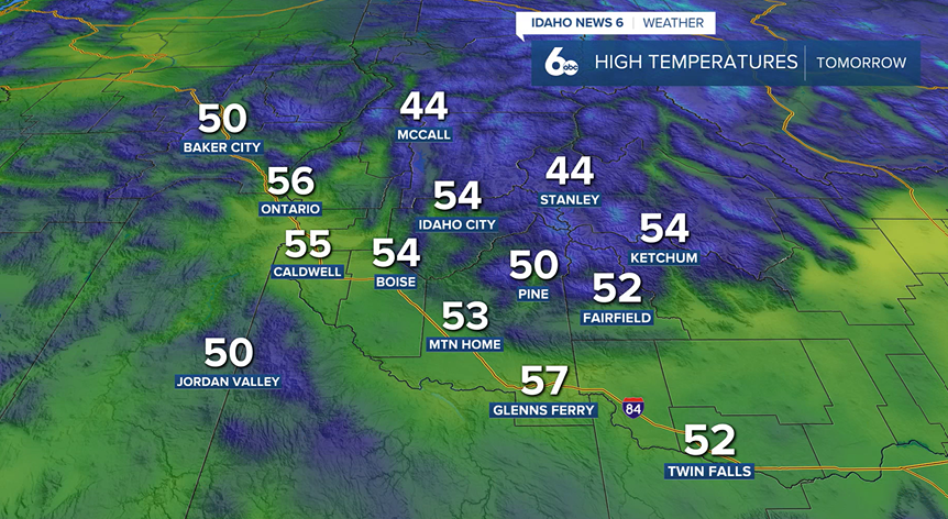
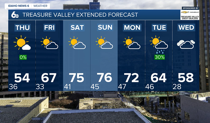
Get ready for a big drop. High temperatures will fall 25 to 30 degrees compared to today, with breezy conditions making it feel even cooler. Highs will land below normal for this time of year.
Looking Ahead
Spring keeps doing its thing:
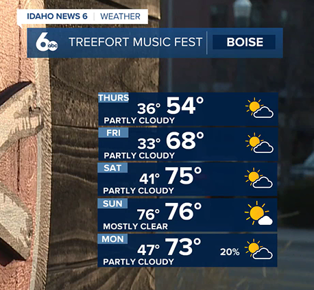
Friday: Quick rebound—temperatures jump back into the 60s
Weekend: Warm and dry, running 15–20 degrees above normal
Next Week: A more unsettled pattern returns with increasing chances for showers, gusty winds, and cooler temperatures
Classic Idaho spring… a little bit of everything.
Treasure Valley Extended Forecast
Treefort Music Festival Forecast