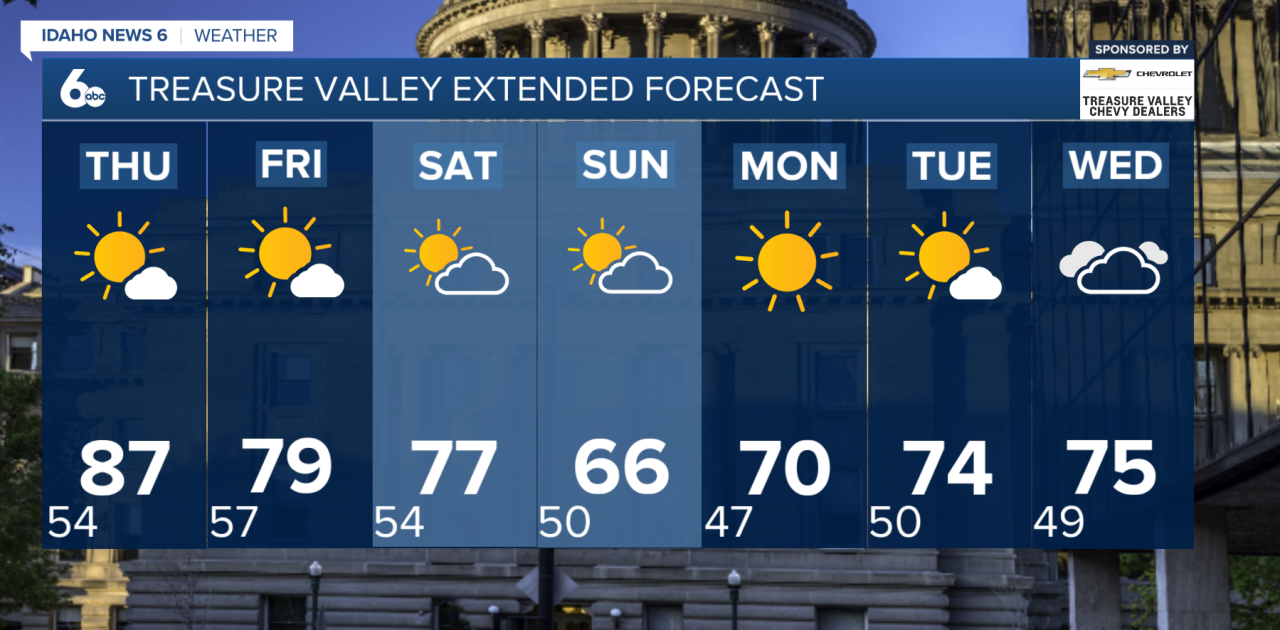
Good morning, Idaho! Dry and warmer weather will stick around through Thursday, but a major change is expected this weekend as a strong storm system moves through the region.
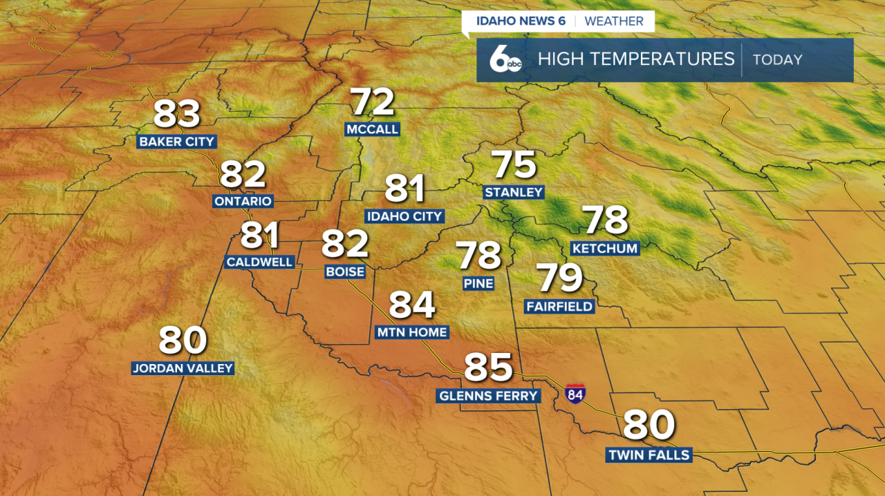
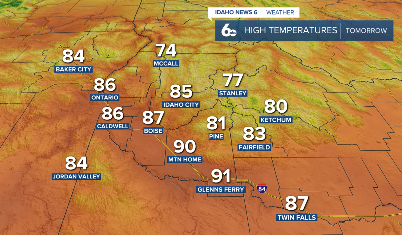
Wednesday and most of Thursday will stay dry as temperatures continue to warm. By Thursday afternoon, highs will reach the upper 70s and 80s across much of the region, with a few warmer spots approaching 90 degrees.
Changes begin Thursday evening as a cold front moves through. Rain is not expected with this first front, but gusty west winds and increasing clouds are expected.
The Weekend
Behind the front, Friday will be sunny, breezy and cooler. Afternoon temperatures are expected to drop about 5 to 10 degrees compared to Thursday. Skies will remain mostly clear Friday night with seasonably cool temperatures.
Saturday starts relatively quiet, but conditions will change quickly as a strong storm system and cold front move into the region later in the day.
The Boise State game kicks off at 4 p.m. Saturday, right around the time weather conditions could begin deteriorating. Fans heading to the game should be prepared for increasing winds, falling temperatures and the possibility of showers and thunderstorms as the evening progresses.
The exact timing of the front will become clearer as we get closer to Saturday, but anyone tailgating or attending the game will want to keep a close eye on the forecast.
Showers could continue into Sunday morning, with some periods of heavier rain possible as moisture wraps around the departing storm system. Windy and much cooler conditions are expected throughout the day.
Conditions should begin clearing from west to east by late Sunday. Sunday night will turn clear and cold, with some valley fog possible early Monday morning.
Warmer and Drier Next Week
Sunshine returns Monday as temperatures begin to warm. Another storm system is expected to develop off the Pacific Northwest coast next week, but current forecasts keep it far enough west for our area to remain mainly dry and warmer Tuesday and Wednesday.