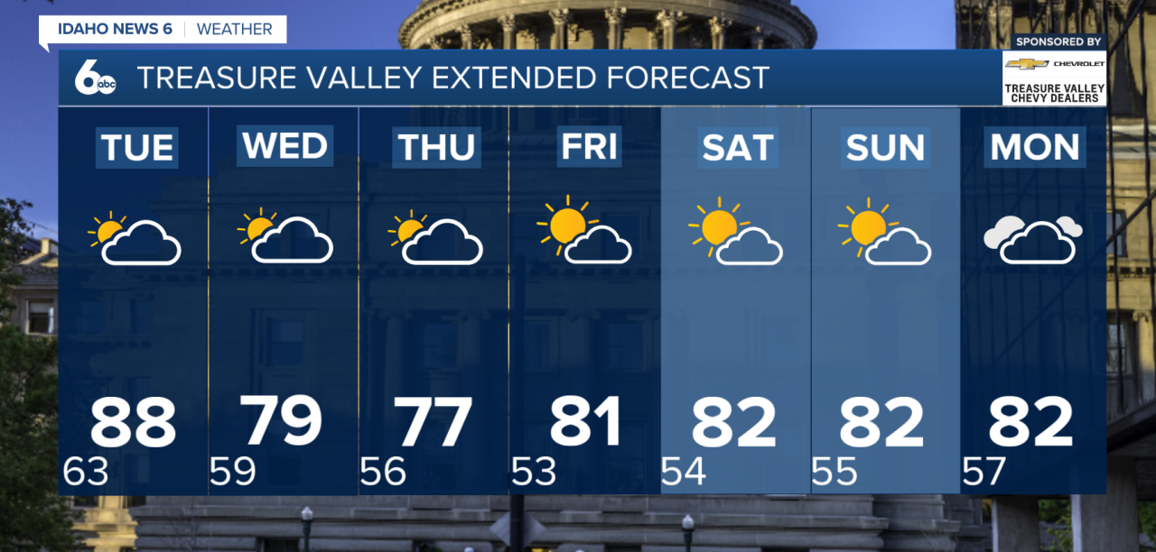
A warm start to the week will give way to a much cooler, windier and more unsettled pattern across southwest Idaho later this week.
Temperatures will climb back near normal Monday, with highs in the mid to upper 80s across the lower valleys. Most locations will stay dry, but a few thunderstorms could develop over the higher terrain south of Twin Falls during the afternoon and evening. The strongest storms could produce gusty outflow winds up to 40 mph.
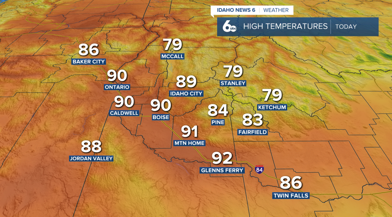
Tuesday will be the warmest day of the week. Valley temperatures will climb into the upper 80s to near 90 degrees, around 5 to 10 degrees above normal. Winds will also increase during the afternoon, especially across open terrain and higher elevations. The combination of gusty winds and low humidity could create concerns near ongoing fires.
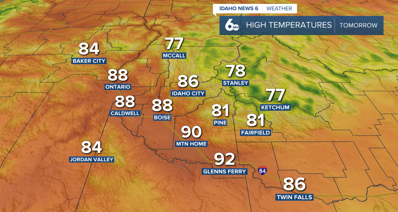
Changes begin Tuesday night as a strong area of low pressure approaches the Pacific Northwest. Shower and thunderstorm chances will increase first across southeast Oregon before spreading into the Idaho mountains Wednesday. The Treasure Valley and other lower elevations of southwest Idaho may miss out on much of the rain, while the mountains have a better chance of seeing precipitation.
By Thursday, cooler air settles into the region and sticks around through the weekend. Valley highs are expected to drop into the mid to upper 70s, about 5 to 10 degrees below normal.
The low-pressure system is expected to remain nearby through at least Monday, keeping periods of showers and thunderstorms in the forecast, especially across southeast Oregon and the West Central Mountains. Gusty afternoon winds will also remain possible each day.
There is still uncertainty surrounding exactly how much rain falls later this week. Tropical moisture from a system expected to develop near Baja California could eventually influence the pattern. Confidence is much higher that cooler, windier and periodically unsettled weather will continue through the weekend.