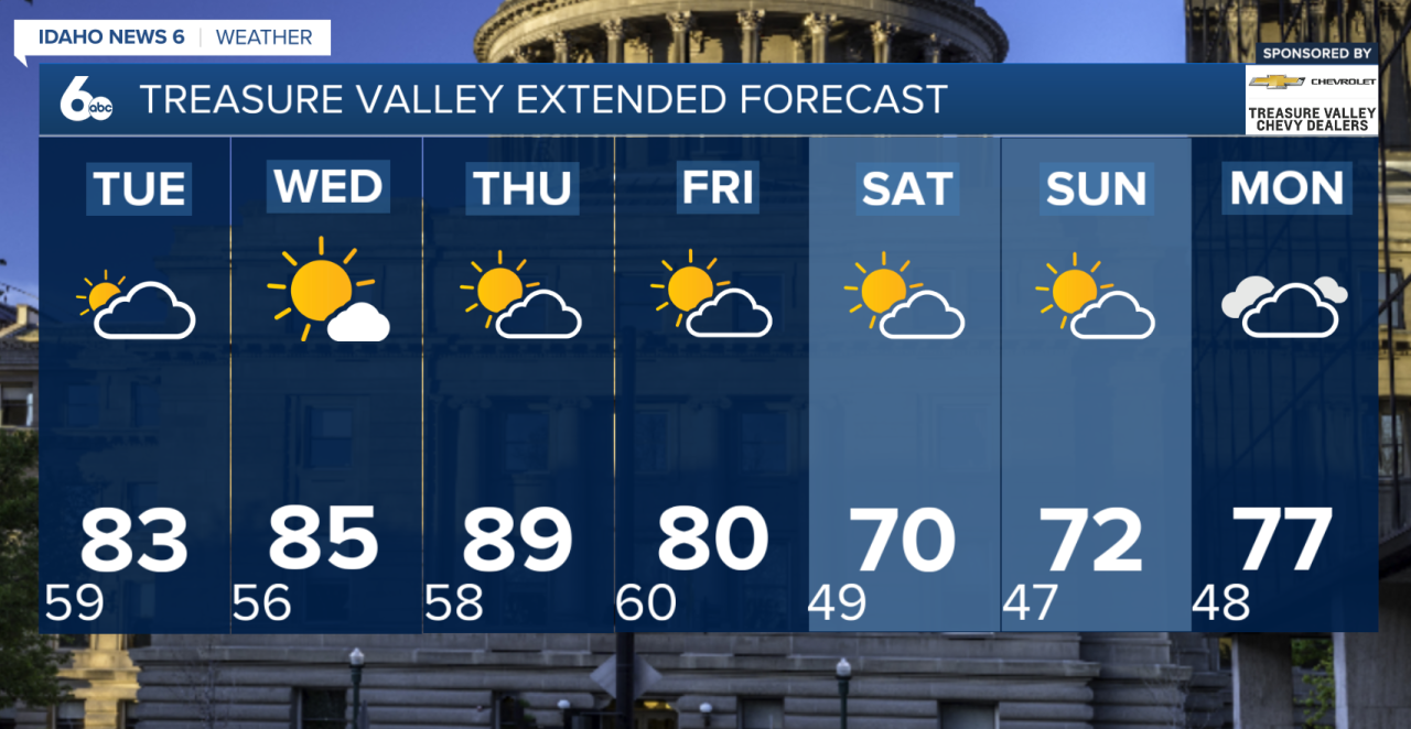
We’re kicking off the new week on a warm and mostly dry note, with temperatures continuing to climb through Thursday.
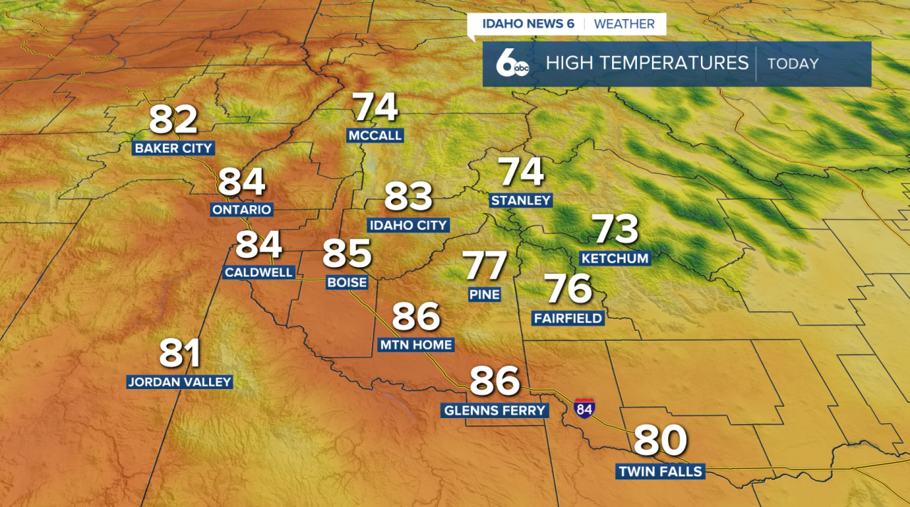
High pressure will keep most of the region dry today, with plenty of sunshine throughout the day. Afternoon highs will run about 5 to 10 degrees above normal and around 5 degrees warmer than Sunday.
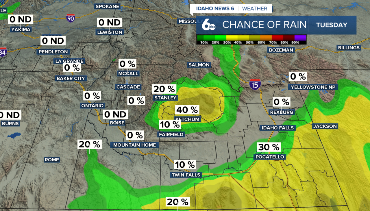
A small chance for showers and thunderstorms returns Tuesday afternoon as an area of low pressure passes through the Great Basin. Most of the activity will stay over the higher terrain, including the Central Idaho mountains and areas near the Idaho-Nevada border. Rain chances remain fairly low, around 20–30%, so most lower elevations should stay dry.
Warmer weather quickly takes back over Wednesday and Thursday. Thursday is expected to be the hottest day of the week, with temperatures nearing 90 degrees across some lower elevations and reaching the 80s in the higher terrain.
A change arrives just in time for the weekend. A trough moving into the Pacific Northwest will bring cooler temperatures Friday through Sunday, along with a slight chance for precipitation. The best rain chances will favor northeast Oregon and West-Central Idaho.
Temperatures should fall back near normal Friday before dropping 5 to 10 degrees below normal this weekend. There is still some uncertainty surrounding the exact timing of the cold front, but either way, a noticeable cooldown is expected by Saturday and Sunday.