Good morning, Idaho! As we head into Labor Day weekend, unsettled weather will stick around. Keep the umbrella handy if you have outdoor plans, as there are more chances of showers and thunderstorms throughout the holiday weekend.
Friday: Heavy Rain and Storms
Another wet and chilly day is ahead across southwest Idaho and southeast Oregon. A slow-moving storm system near the Oregon coast will continue sending showers through the region Friday.
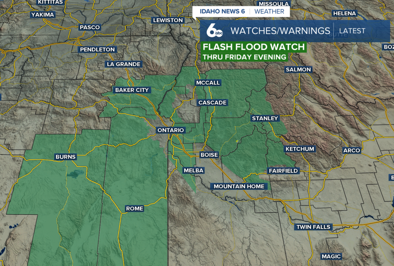
Some areas have already picked up moderate to heavy rainfall overnight. Additional heavy rain could create flooding concerns, especially around recent burn scars. A Flash Flood Watch remains in effect for many burn scar areas through Friday evening, with the Wapiti Burn Scar one of the areas of greatest concern early in the day.
As the atmosphere becomes more unstable, scattered thunderstorms are expected to develop later Friday. Storms will initially favor eastern Oregon before becoming possible across southwest Idaho during the afternoon. Owyhee County has a better chance of storms by mid-afternoon, with thunderstorms potentially reaching the Treasure Valley later in the day.
Any stronger storm could produce heavy rain and hail.
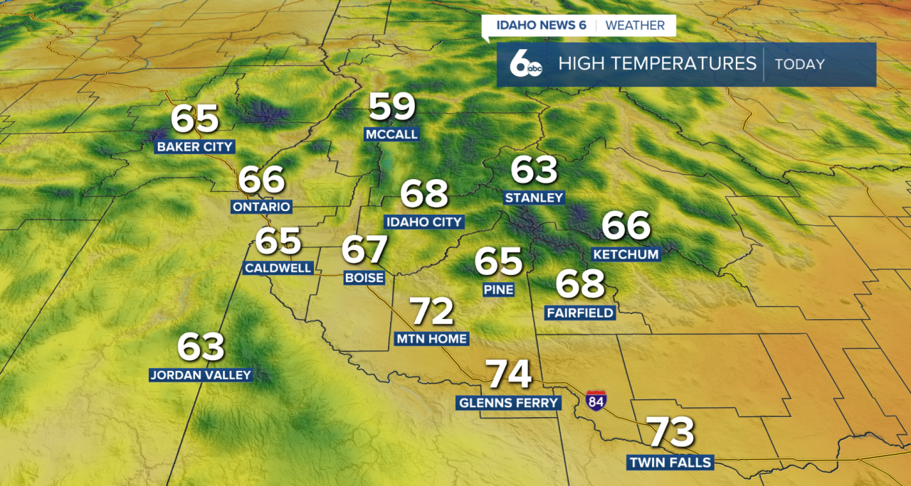
Temperatures will also be unusually cool, running about 10 to 20 degrees below normal. Colder air has even allowed some snow to fall at higher elevations.
Saturday: Drier, But Watch for Morning Fog
Conditions improve Friday night into Saturday as showers become less widespread.
After all the recent rainfall, areas of valley fog could develop early Saturday morning, potentially reducing visibility for the morning drive.
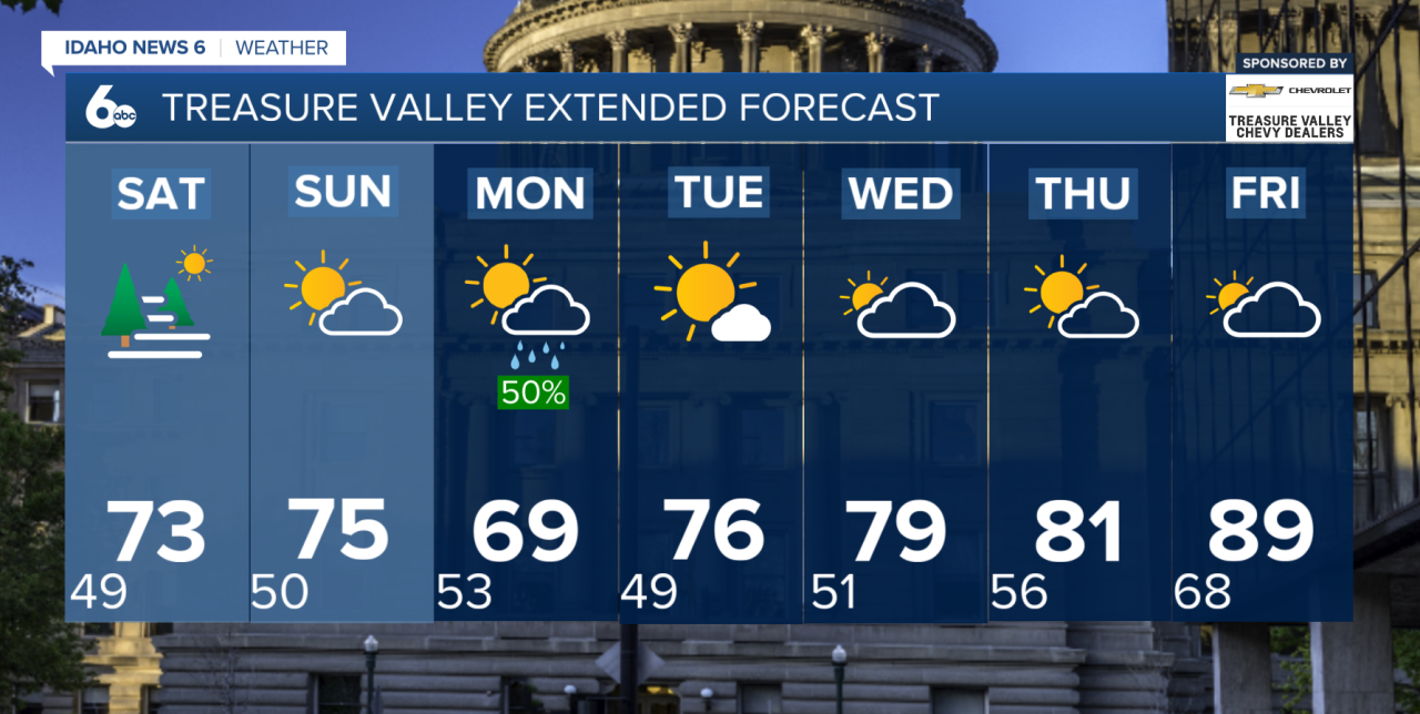
Saturday should provide a break from the wetter weather for much of the day, although temperatures remain around 10 degrees below normal.
Sunday: Rain Chances Return
The storm system will finally begin moving inland later in the weekend, bringing another increase in precipitation Saturday night through Sunday.
Showers will be possible Sunday, along with a chance for afternoon and evening thunderstorms. Temperatures remain cooler than normal, although Sunday should be slightly warmer than Saturday.
Next Week: Warmer With Storm Chances Returning
A noticeable warming trend begins Monday as high pressure builds over the region. Temperatures will gradually climb, returning to near normal or even a few degrees above normal by Wednesday and beyond.
Moisture could also return later in the week, bringing an increasing chance for thunderstorms. A few storms are possible as early as Wednesday afternoon, with better chances arriving Thursday and Friday.