

Good Morning, everyone, and Happy Hump Day! Just a reminder that this isn't the week to wash the car.
An active weather pattern is settling in across the region as an upper-level low that moved onshore in Northern California is sending moisture towards us.
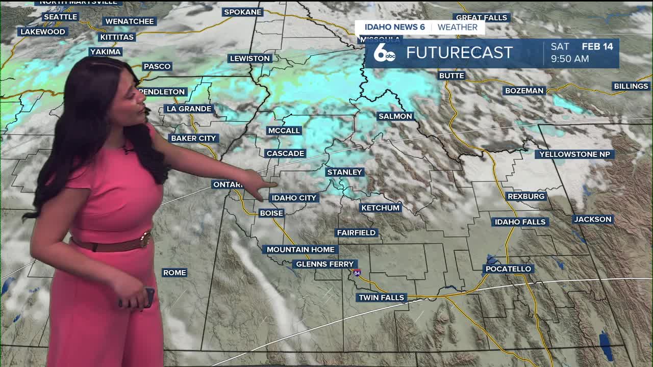
Showers that developed overnight will continue through this evening, moving from south to north across the area. Snow levels are currently between 3,000 and 5,000 feet, meaning valley locations will primarily see rain while higher elevations pick up fresh snow.
Shower activity will become more isolated after sunset, focusing on the Owyhee Mountains.
Fog Possible Thursday Morning
The upper-level low will linger near the California/Nevada border on Thursday, keeping some instability in place. If skies partially clear overnight and winds remain light, residual surface moisture could cause reduced visibility in valley areas, affecting Thursday morning's commute. By Thursday afternoon, partial clearing is expected. However, with cool air aloft and lingering instability, isolated showers may redevelop — particularly over higher terrain.
Brief Break Friday
Friday looks drier as a shortwave ridge builds into the region. This will provide a temporary break from widespread precipitation. However, shower chances return late Friday night as the next storm system approaches.
Active Weekend and Colder System Next Week
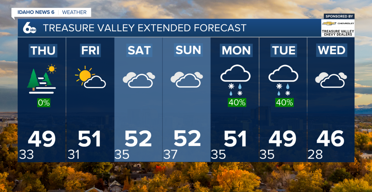
Forecast models show strong agreement that active weather will continue through the weekend and into next week. (Snow lovers, get your skis and board waxed)
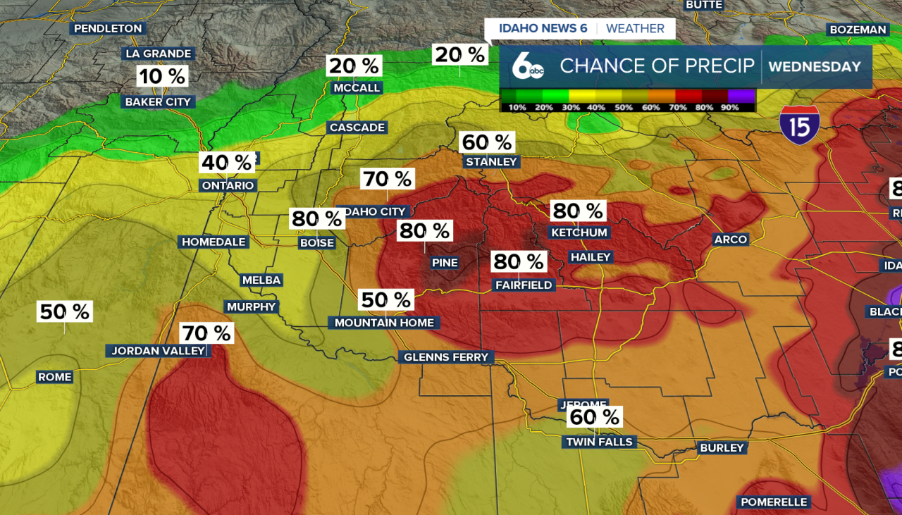
A system is expected to impact the region over the weekend, followed by a stronger storm early next week. Both systems will bring in colder air aloft and at the surface, increasing the potential for moderate to heavy snowfall. Right now, heavier models are picking up nearly 2ft of snow across the East and West Central mountains into next weekend.
Snow levels from the early-week system could approach valley floors, though it is still too early to determine exact impacts.

Seven-day forecast