

Good Tuesday Morning, everyone!
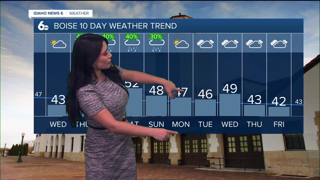
As we head into the New Year, high pressure remains firmly in place, allowing a surface-based temperature inversion to continue through at least Friday. Highs over the next couple of days will stay relatively mild for late December. While a typical December afternoon would hover near 36 degrees, temperatures will run a bit warmer than average, especially in the mountains. Nevertheless, still grab the warm jacket as you head out the door!

New Year’s Eve will remain cloudy and dry through midnight, making for perfect celebration weather. Rain chances increase late Wednesday night as southwesterly flow develops aloft, with light rain spreading from south to north after about 2 a.m. on New Year’s Day. Thursday will stay relatively mild with on-and-off showers throughout the day.
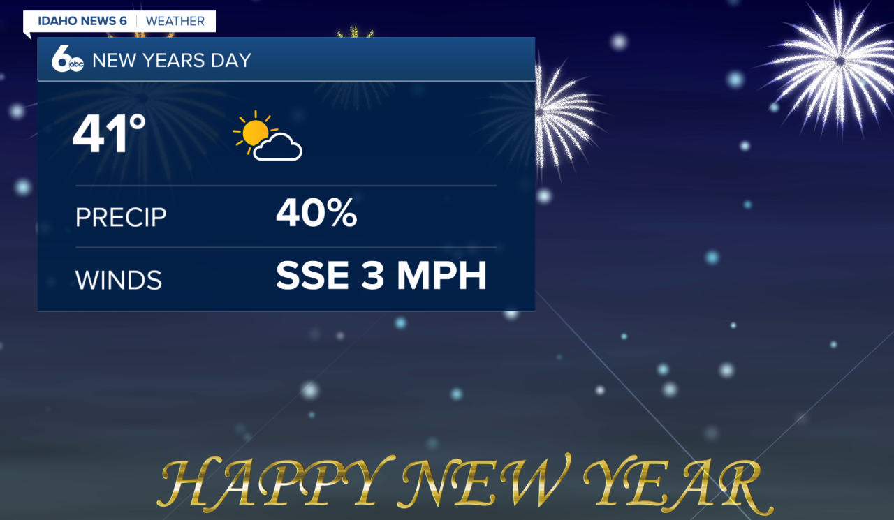
Snow levels on New Year’s Day will start near 5,000 feet in northern areas and around 6,200 feet farther south, gradually rising into Friday. Most valleys will see rain, while higher elevations pick up snow. In the coldest valleys of eastern Baker County, a brief period of freezing rain can't be ruled out just yet.
Rainfall totals from New Year’s Day through Friday night are expected to range from about a tenth to a quarter inch in southern areas, with higher amounts — up to around a half inch — possible north of the Snake Basin and across Baker County.
As southwesterly flow continues to dominate the region, rain will persist into the weekend, with milder temperatures and periodic showers expected.
Stay up to date right here Sophias Instagram
