


Happy Monday, it's a new week and a new month ahead- let's make it a great start.
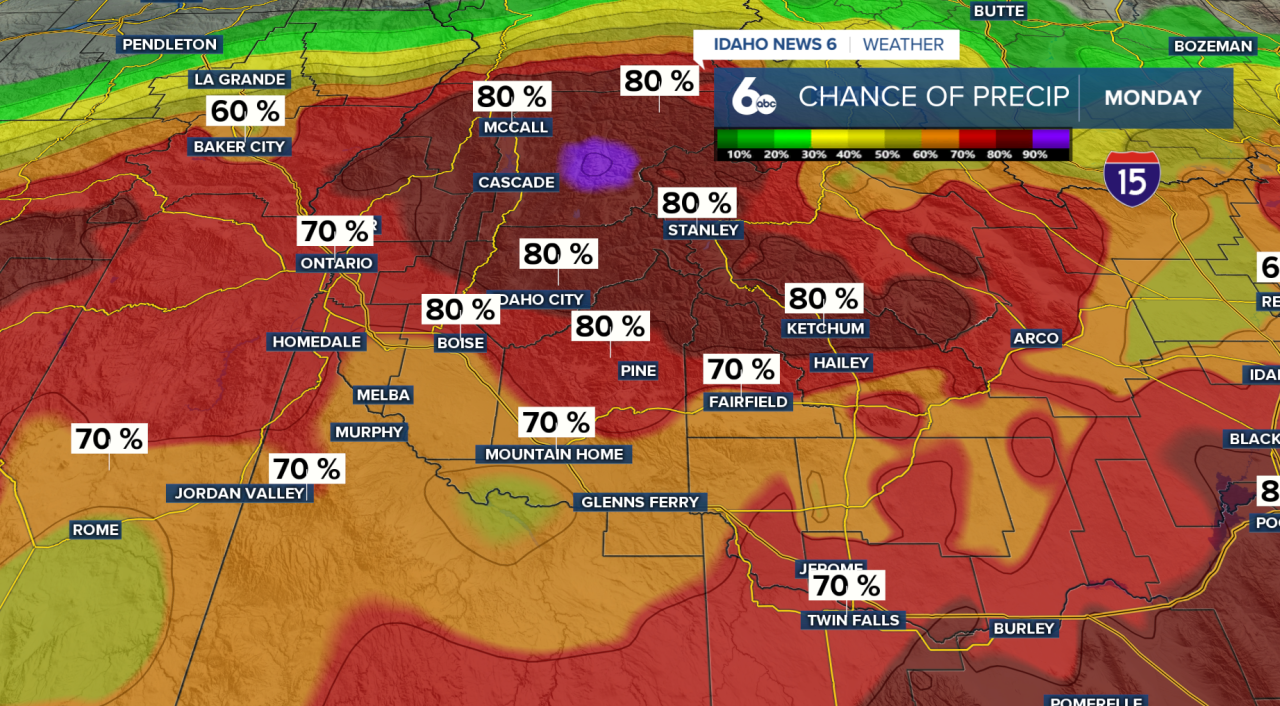
A weak system is tracking across NV/UT and into Wyoming, bringing scattered showers to the morning commute today. Prepare for extra time on the morning commute. Conditions begin drying out Monday evening, setting the stage for a brief warm-up.
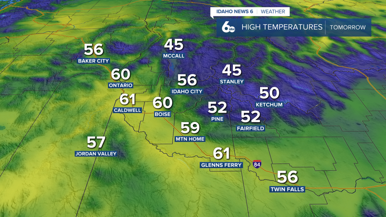
Tuesday will be the warmest day of the week. Temperatures across the Snake River Plain could climb towards the low 60s — about 5 to 10 degrees above normal for this time of year. Southeast winds will increase ahead of our next approaching system, making it breezy at times. If you love springtime weather, Tuesday will be a treat.
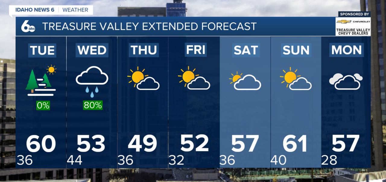
Changes arrive on Wednesday afternoon as a strong cold front pushes through the region. Winds will shift, and temperatures will begin to drop. Snow levels will fall to around 3,500 to 4,500 feet by Thursday morning, with mountain locations above 6,000 feet picking up 3 to 6 inches of snow.

Behind the front, Thursday looks blustery. The Snake River Plain, especially from Mountain Home east toward Twin Falls, could see wind gusts between 45 and 50 mph. It will be breezy area-wide, with temperatures cooling back to near or slightly below normal.
Forecast: Spring-like weather ahead of a cold front on Wednesday
Looking ahead to the weekend, northwest flow aloft will dominate as high pressure builds over the North Pacific. While most valley locations trend drier, slight chances for precipitation will linger over higher terrain due to orographic lift. Sunday appears to be the warmest day of the extended forecast, with temperatures once again running 5 to 10 degrees above normal.
In short: enjoy the spring-like warmth Tuesday — because midweek brings wind, cooler air, and a return to mountain snow.
Treasure Valley Extended Forecast
Stay up to date right here: @SophiaCruzWX