

We’re waking up to clear and cool conditions with a few patches of fog and low clouds early this morning. But changes are already underway.
An upper-level low moving into California is shifting our winds to a southwest direction — and that’s going to send some moisture our way. Expect clouds to gradually increase through the day.
Because of that southwest flow and some southeasterly surface winds, we’ll actually see a gradual warming trend, keeping snow levels between 3,000 and 4,500 feet — highest across southern areas.
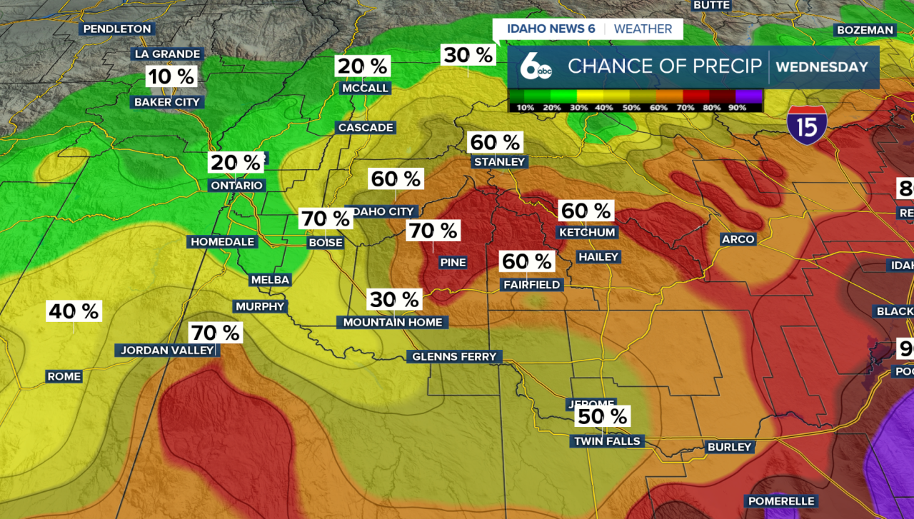
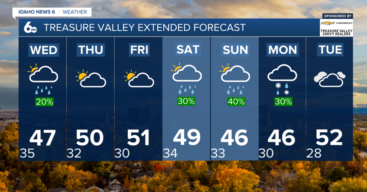
Showers will start early Wednesday morning, but the Treasure Valley will dry out by the afternoon. Meanwhile, scattered showers will linger into the evening for southern areas, including the Magic Valley.
By Thursday afternoon, weak ridging builds in, bringing mostly clearer skies for most of us. Southern areas may still see a slight chance (15–30%) of lingering showers.
🌦️ The Weekend
Friday looks dry and mild as weak ridging settles overhead.
By Saturday, the next system drops in from the Gulf of Alaska. There are two possible scenarios:
1️⃣ Warmer & wetter: The system stays offshore longer, keeping southwest flow overhead. That means elevated snow levels and above-normal temps continue.
2️⃣ Cooler shift: The system moves inland faster, bringing cooler air and possibly lowering snow levels toward valley floors. Confidence in this is lower.
Either way — we’re tapping into Pacific moisture. Expect higher precipitation chances (40–70%) through early next week.
📊 Looking Ahead
The Climate Prediction Center favors this unsettled pattern continuing into mid-month, with:
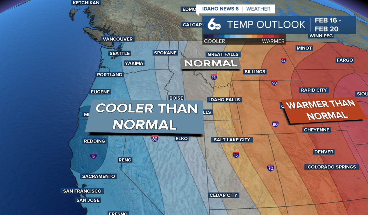
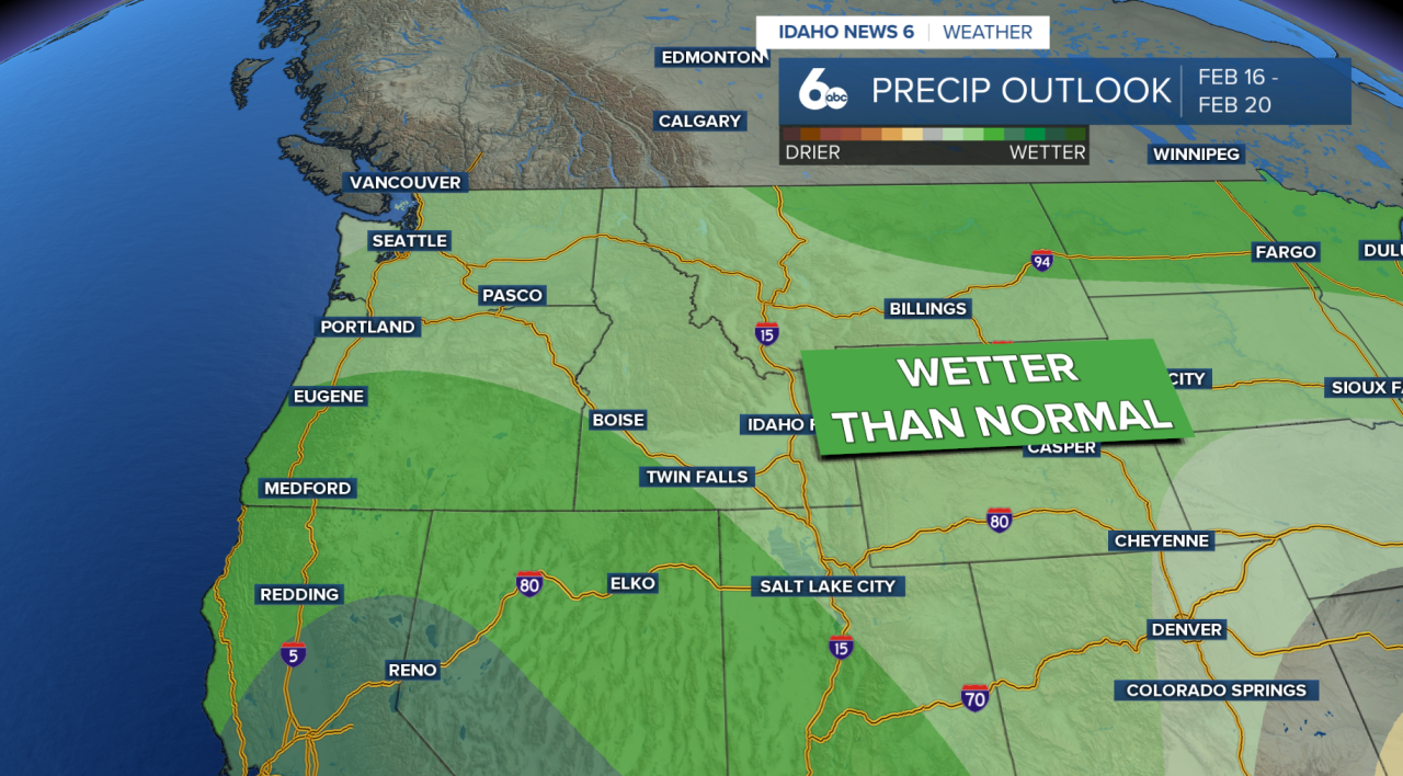
- Above-normal precipitation
- A decent chance at below-normal temperatures
Yes, conditions are trending wetter overall. Snow dances are working!
Seven-Day Forecast