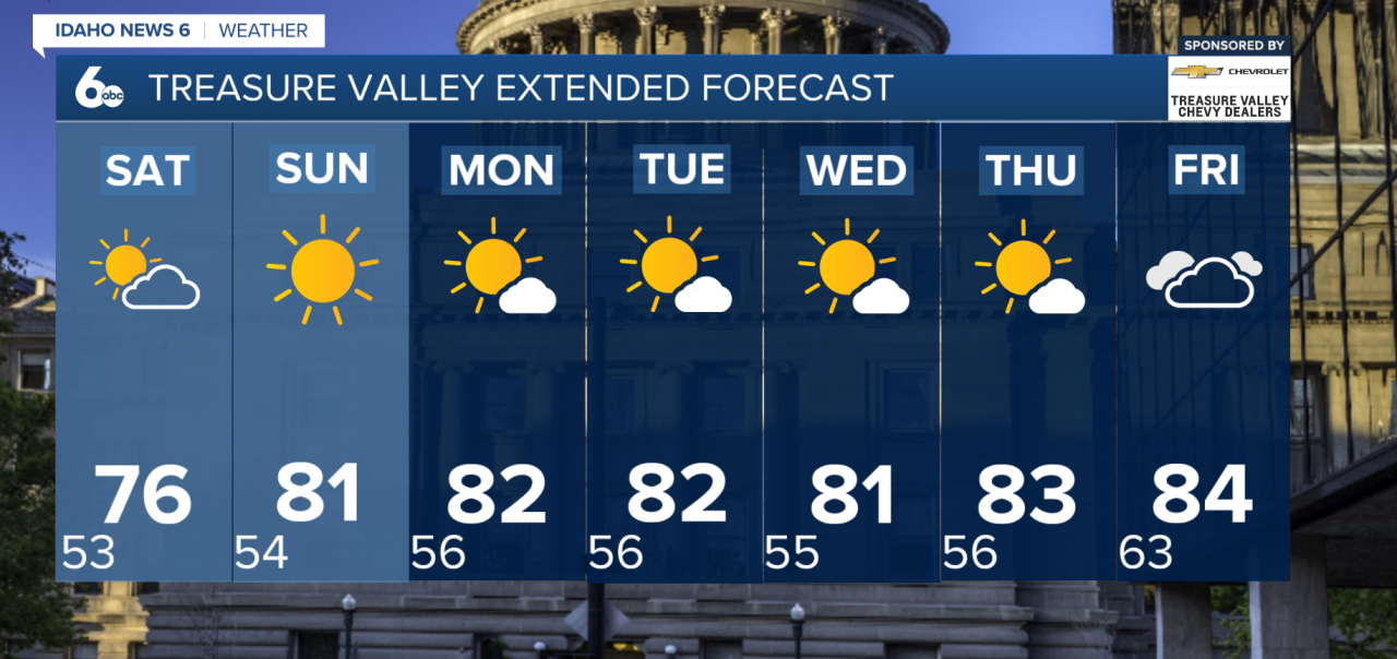
A low-pressure system will keep Southern Idaho cool and unsettled Friday, bringing another round of showers and scattered thunderstorms before warmer and drier weather returns this weekend.
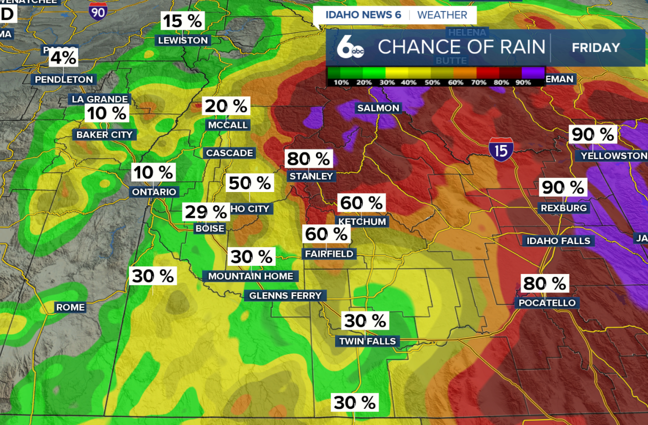
Showers will be possible throughout the day, with thunderstorms becoming more widespread during the afternoon and evening. The strongest storms are expected across Central Idaho, where gusty outflow winds up to 50 mph, small hail, frequent lightning, and brief heavy rain are possible.
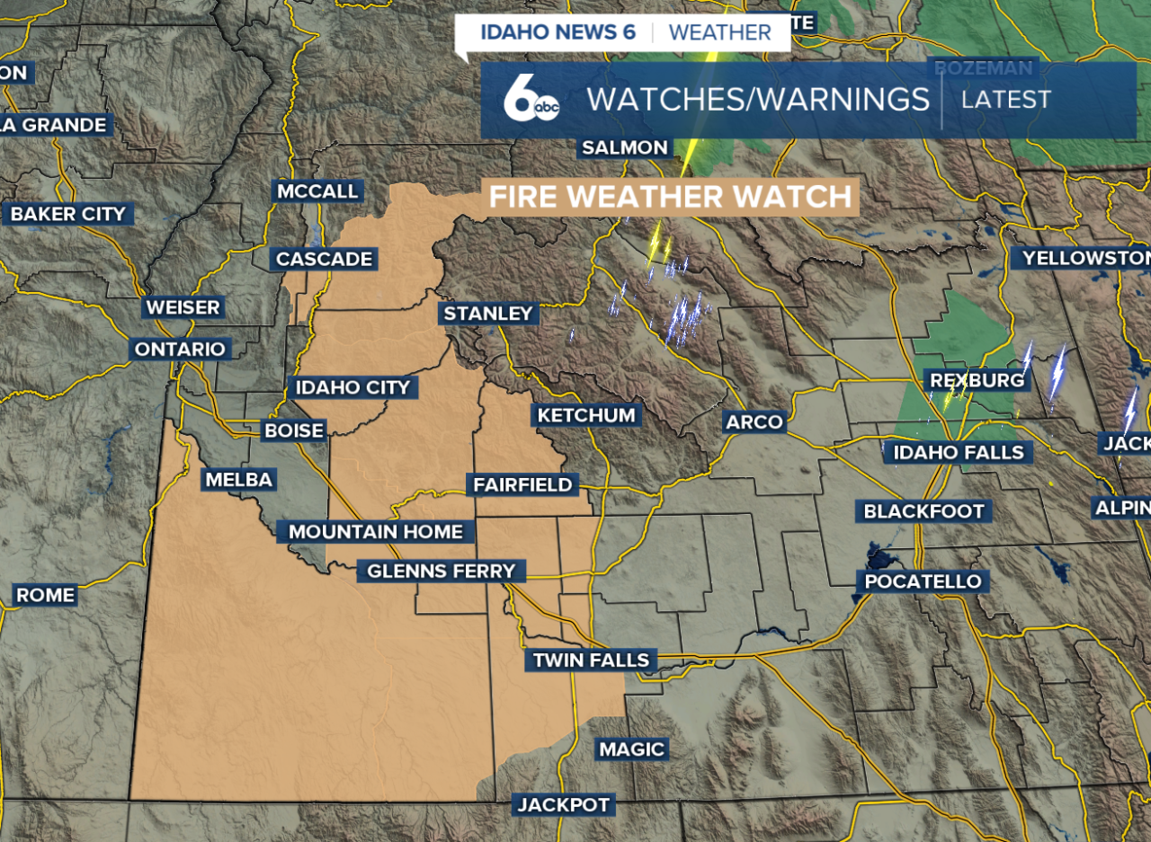
Fire weather will also remain a concern through Friday evening. A Fire Weather Watch is in effect due to the combination of low humidity, gusty winds and the potential for abundant lightning, which could increase the risk for new fire starts.
Storms will be moving fairly quickly, which should help limit overall rainfall amounts. Temperatures will also be noticeably cooler Friday as the center of the low moves overhead, with highs running about 5 to 10 degrees cooler than Thursday.
Thunderstorm activity will begin to decrease Friday night, but lingering showers could stick around into Saturday morning. Central Idaho and the higher terrain will have the best chance of holding onto showers through Saturday afternoon and evening.
The weekend will gradually improve as the low moves east and high pressure begins building back into the region. Temperatures will start warming later Saturday, with drier and sunnier conditions expected for most areas Sunday. By Sunday afternoon, temperatures could climb to around 5 degrees above normal.
The warmer pattern sticks around into early next week. Monday and Tuesday will generally stay dry and mild, although Central and Eastern Idaho will have a very slight chance of an afternoon shower. Temperatures are expected to remain around 5 degrees above normal through much of next week.
Another weather system could approach the Pacific Northwest toward the end of next week, but there is still plenty of uncertainty surrounding its track and potential impacts.