Good morning, Idaho!
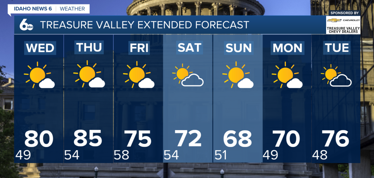
Warmer and drier weather is returning to southwest Idaho and southeast Oregon, but a couple of cold fronts will bring noticeable changes heading into the weekend.
Warmer Through Thursday
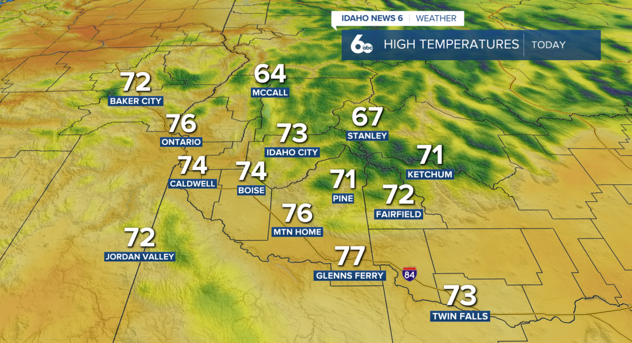
After several cool and wet days, sunshine and warmer temperatures will take over through most of Thursday. Highs will climb back into the 80s across the southern valleys, with Thursday expected to be the warmest day of the stretch.
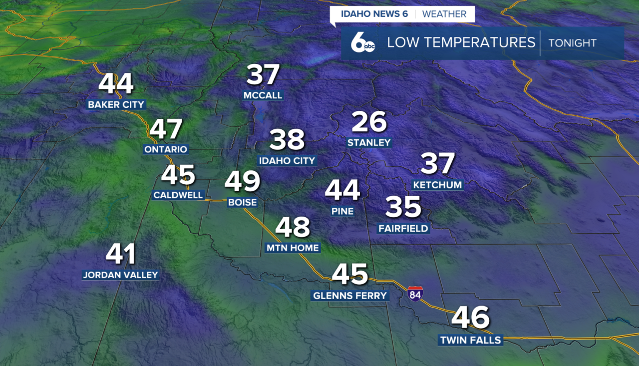
Despite the warmer afternoons, overnight and early mornings will remain cool, so grab a jacket before heading out the door!
Cold Front Arrives Thursday Evening
The first change arrives late Thursday as a cold front moves through the region. Rain is not expected with this front, but gusty northwest winds will pick up Thursday evening and Thursday night.
Behind the front, Friday will be cooler and breezy with plenty of sunshine.
Stronger Front Arrives Saturday
Temperatures briefly rebound Saturday before a stronger weather system moves into the region.
A strong cold front is expected to sweep through Saturday into Saturday evening, bringing gusty winds of at least 30 mph in some areas. Showers and thunderstorms will also be possible as the front passes.
Much cooler air settles in behind the system, making Sunday noticeably cooler.
Warmer and Drier Next Week
The cooler weather will not stick around for long. High pressure begins building back into the region Monday and Tuesday, allowing temperatures to warm again while dry and sunny conditions return.