Good morning, Idaho! ☀️
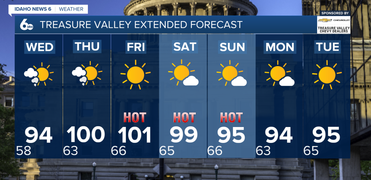
We're squeezing in one more day of comfortable weather, with highs in the upper 80s to lower 90s this afternoon. Enjoy it while it lasts, because the mid-90s return tomorrow, and we'll be back near the triple digits by Thursday.

Wildfire smoke will continue to impact southwest Idaho and eastern Oregon through the rest of the week as a warming trend sends temperatures back into the triple digits by Thursday.
A strengthening area of high pressure over the Pacific Northwest will allow temperatures to climb several degrees each day. Highs on Tuesday will be seasonable before warming into the upper 90s on Wednesday and reaching 100 degrees or higher in many lower valley communities by Thursday. Some areas with thicker smoke may run slightly cooler, but the overall warming trend is expected to continue.
Smoke from wildfires burning across Oregon and Washington will continue drifting into the region on northerly to northwesterly winds aloft. While afternoon mixing may improve air quality at times, smoky conditions are expected to linger, especially during the overnight and morning hours when smoke settles into the valleys.

Looking ahead to the end of the week, breezy winds are expected to return Friday and continue into the weekend, increasing fire weather concerns across the region. Despite the stronger winds and a shift in upper-level flow, the forecast remains dry with little to no chance of rainfall.
There are some early indications that moisture could begin moving into the Great Basin early next week, but it remains uncertain whether it will make it far enough north to bring any meaningful changes to southwest Idaho. Until then, hot temperatures and smoky skies are expected to remain the dominant weather pattern.