

Happy Monday, everyone!
Dry northwest flow aloft will keep us sunny and hot today. An upper-level high offshore will help boost temperatures into the mid to upper 90s for most, with triple digits possible in Ontario.

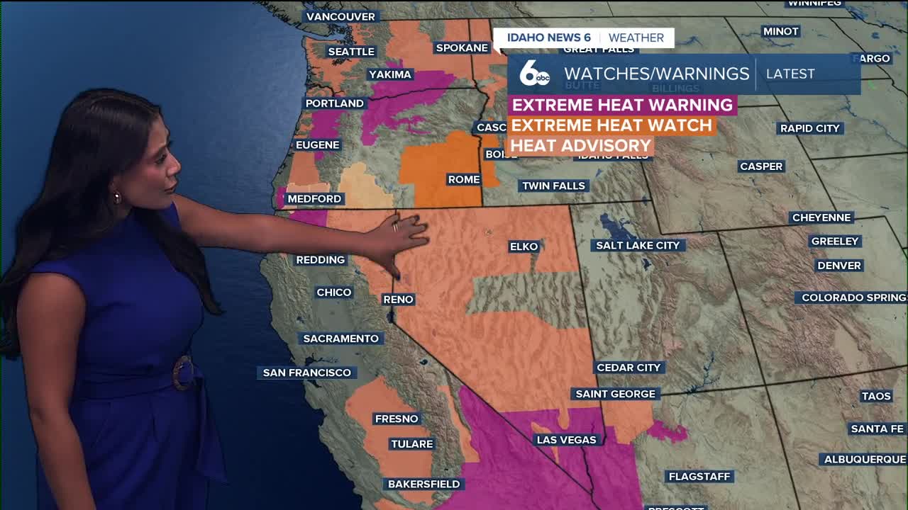
By Tuesday, heat will peak with triple digits across parts of southwestern Idaho—an Extreme Heat Watch is in effect for those areas. Even Wednesday stays hot, with highs still well above normal.
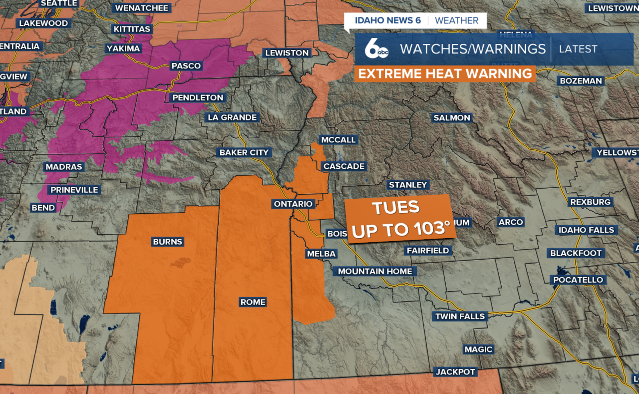

By midweek, moisture begins to creep back in. Southwest Idaho’s southern mountains could see a few storms Wednesday, and while most areas stay dry, isolated storms could pop up in parts of Baker, Malheur, and Valley Counties late Tuesday.
Stay up to date right here https://www.instagram.com/sophiacruzwx/
Today
Sunny and hot, with a high near 93. Light winds to start the day, then breezy conditions with gusts as high as 21 mph.
Tuesday
Sunny and hot, with a high near 98. Northeast wind 6 to 8 mph becoming south in the afternoon.
Wednesday
Sunny and hot, with a high near 95. Light winds to start the day, then breezy conditions with gusts as high as 21 mph.
Thursday
Sunny, with a high near 88.
Friday
Sunny, with a high near 88.
Friday Night
Mostly clear, with a low around 60.
Saturday
Sunny, with a high near 86.
Saturday Night
Mostly clear, with a low around 60.
Sunday
Sunny, with a high near 88.