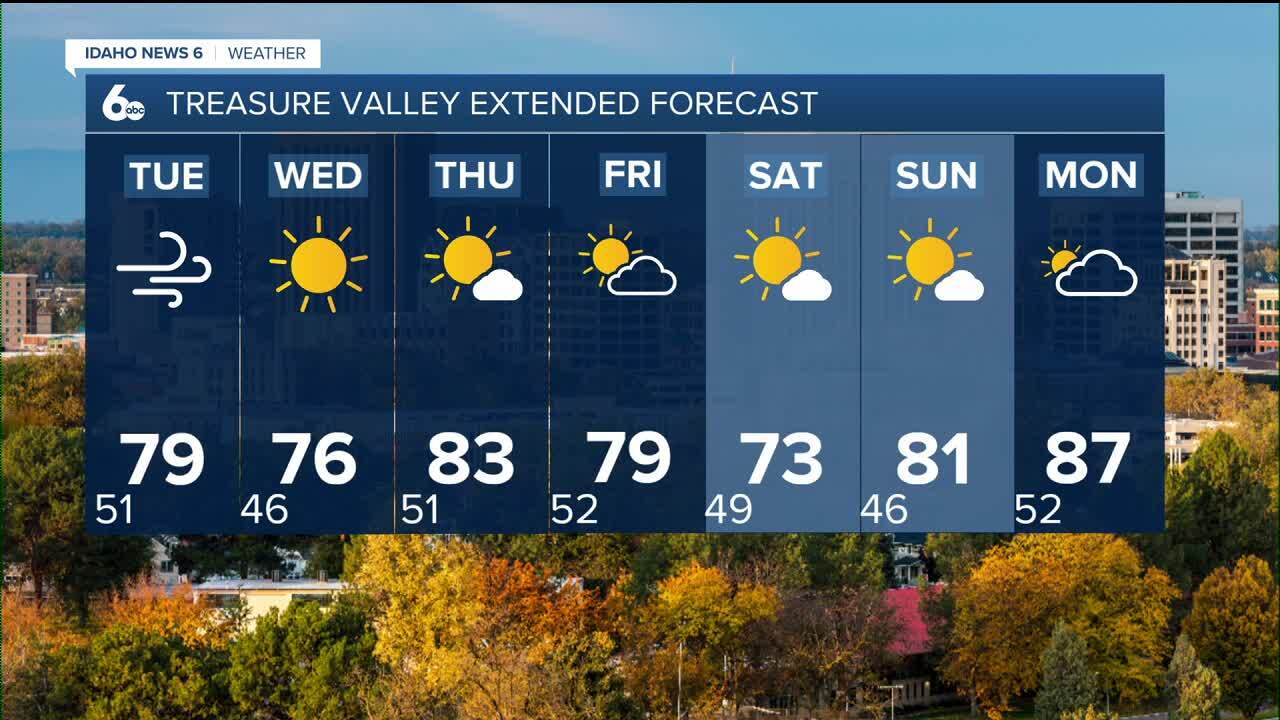


Nice and clear skies continue to be apart of the forecast windy weather is expected to start the week.
Idaho over the next day or so will be caught between to weather systems. A low pressure system to the east and a high pressure ridge to the west are counter spinning and will stream in windy conditions from the north to the south. The national weather service says gust on the valley floors could get up to 30-40 MPH.

Skies stay nice a clear across the board this week for Boise. Twin falls could see some showers pass Tuesday morning and Tuesday night. The national weather service has them at just a 20% chance of rain but the global forecasting system has shown light showers impacting the area. Wednesday moving forward there are no concerns of rain. We stay clear all the way into the weekend. Temperatures will fall and jump a bit over this next week but stay relativley warm.
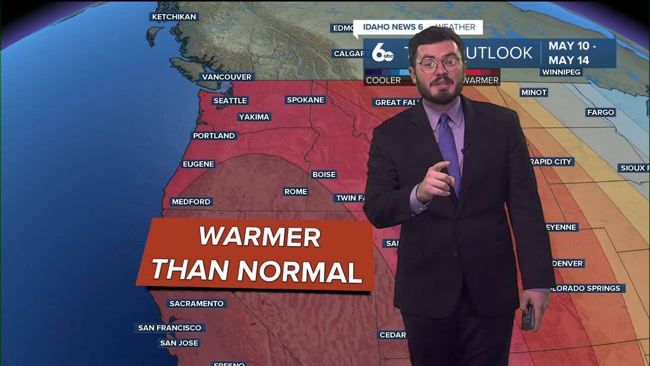
That warm trend isnt just hear in idaho. The entire western U.S. is trending warmer than usual in our 6-10 day outlook. We could see temperatures anywhere between 10-15 degrees above normal. Dry weather will also persist so no new rain is expected in the forecast.
Enjoy the awesome weather here in Idaho. Great conditions continue on.
Forecast outlook: Windy Tuesday but clear weather across the board.
EXTENDED FORECAST: