

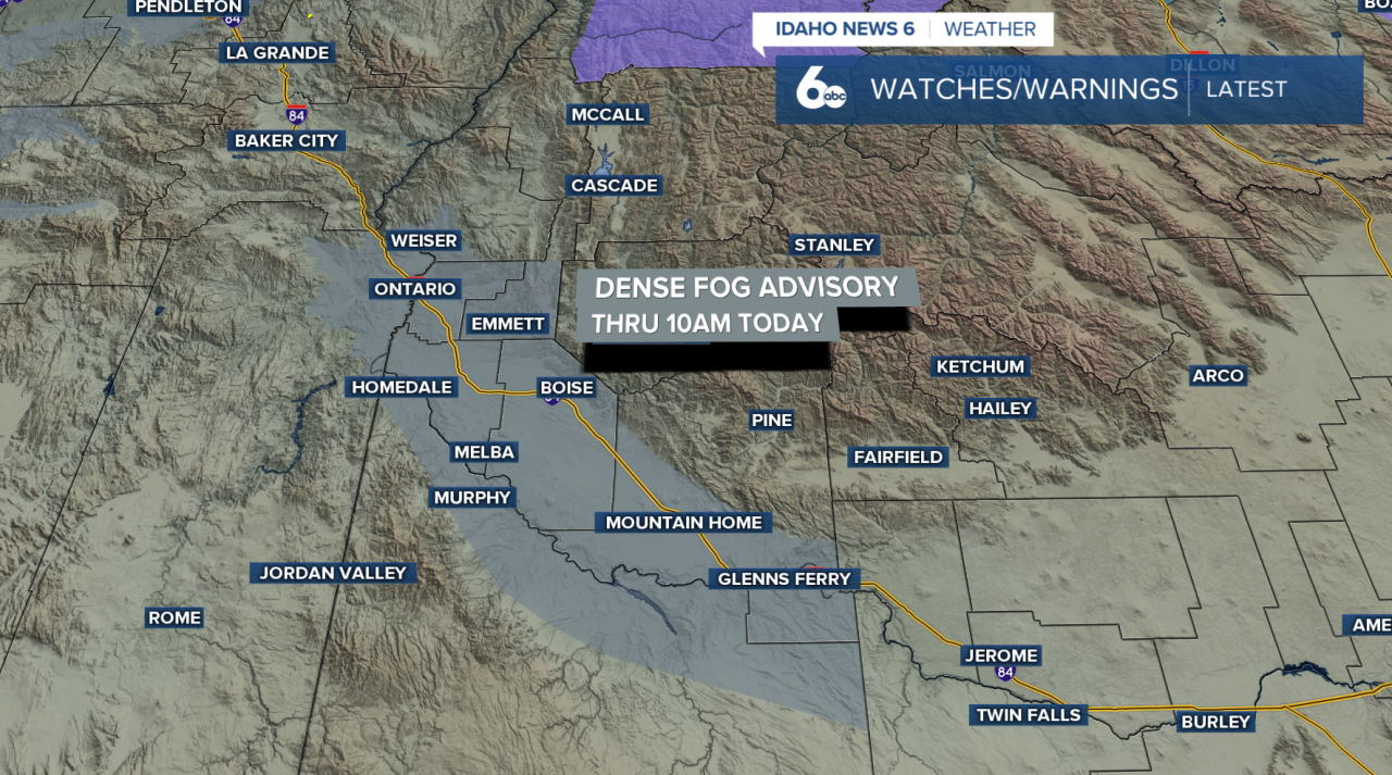
Fog is the big story to start the day. Light warm-frontal moisture has moved east, leaving fog across the valleys, with some areas dense. A Dense Fog Advisory is in effect this morning for the Lower Treasure Valley through Boise, so expect reduced visibility for the early commute.
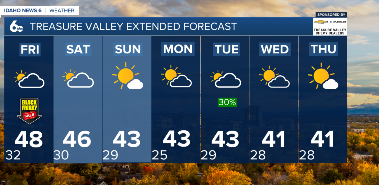
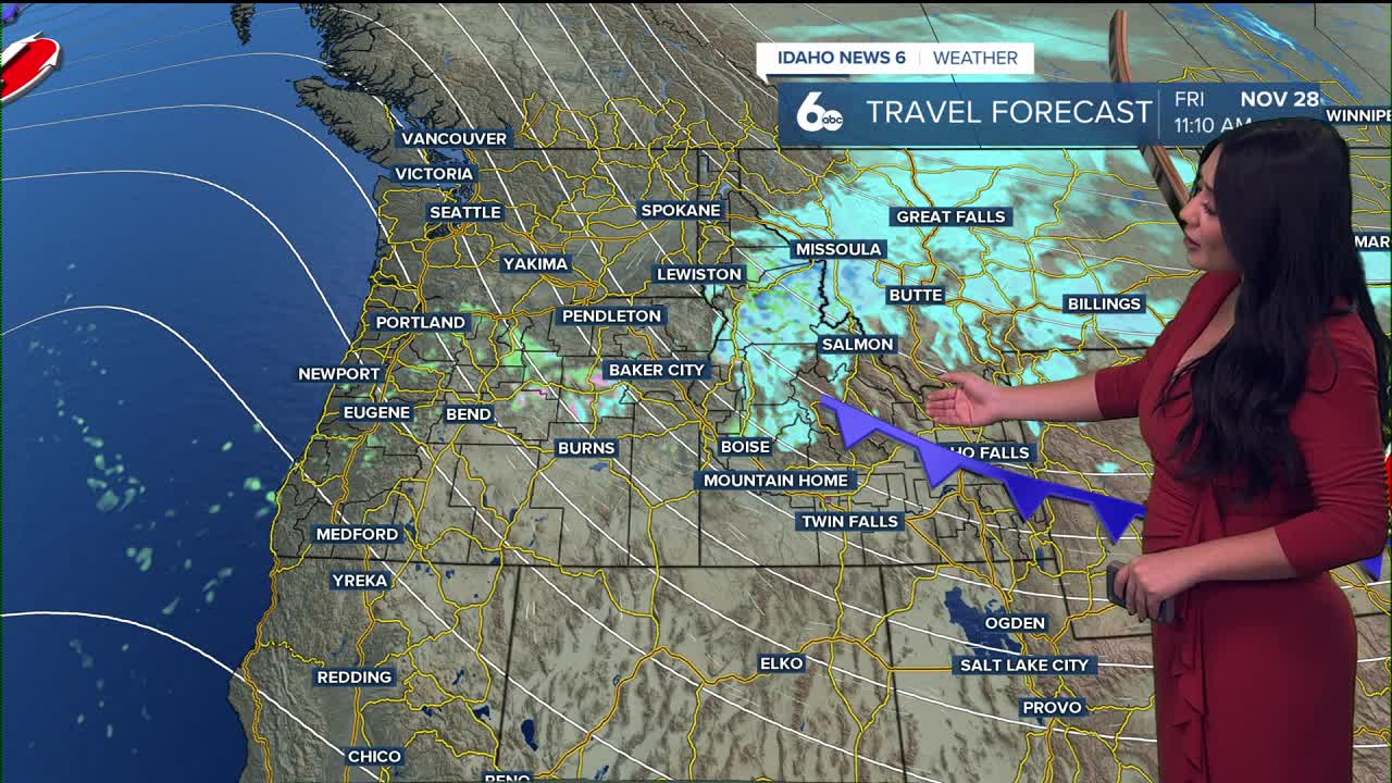
For the rest of today, we sit in the warm sector between two systems. That keeps conditions partly cloudy, dry, and milder than average. The next cold front is still offshore but moves inland tonight and into Idaho on Friday.

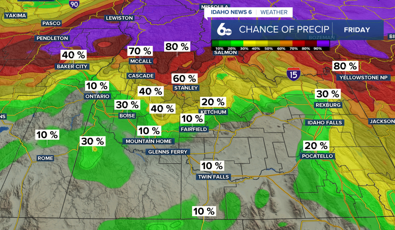
The front brings a quick round of rain and snow to Baker County early Friday. As it pushes into Idaho later in the day, the northern half of the region — mainly north of the Snake Basin — sees the better chance of precipitation. Behind the front, expect gusty northwest winds, especially in the Western Magic Valley, where gusts could reach 20–30 mph. Skies clear Friday night, and colder air settles in, particularly in the higher elevations.
Northwest flow delivers another weak system Saturday night. This one has the potential to bring the first light snowfall of the season to the lower southern valleys — including the Treasure Valley and the Western Magic Valley. For now, totals look light.
Sunday starts with the tail end of that system moving out as a ridge builds in, keeping the region dry through most of Monday. Valley highs hold in the low to mid-40s with snow levels between 2,000 and 3,000 feet.
Late Monday through Wednesday, a larger trough digs into the Northwest. There’s still some uncertainty on timing and strength, but precipitation chances return Tuesday into early Wednesday. Snow levels rise slightly, hovering between 3,000 and 4,000 feet.
By late Wednesday into Thursday, a brief ridge may build back in, bringing drier weather.