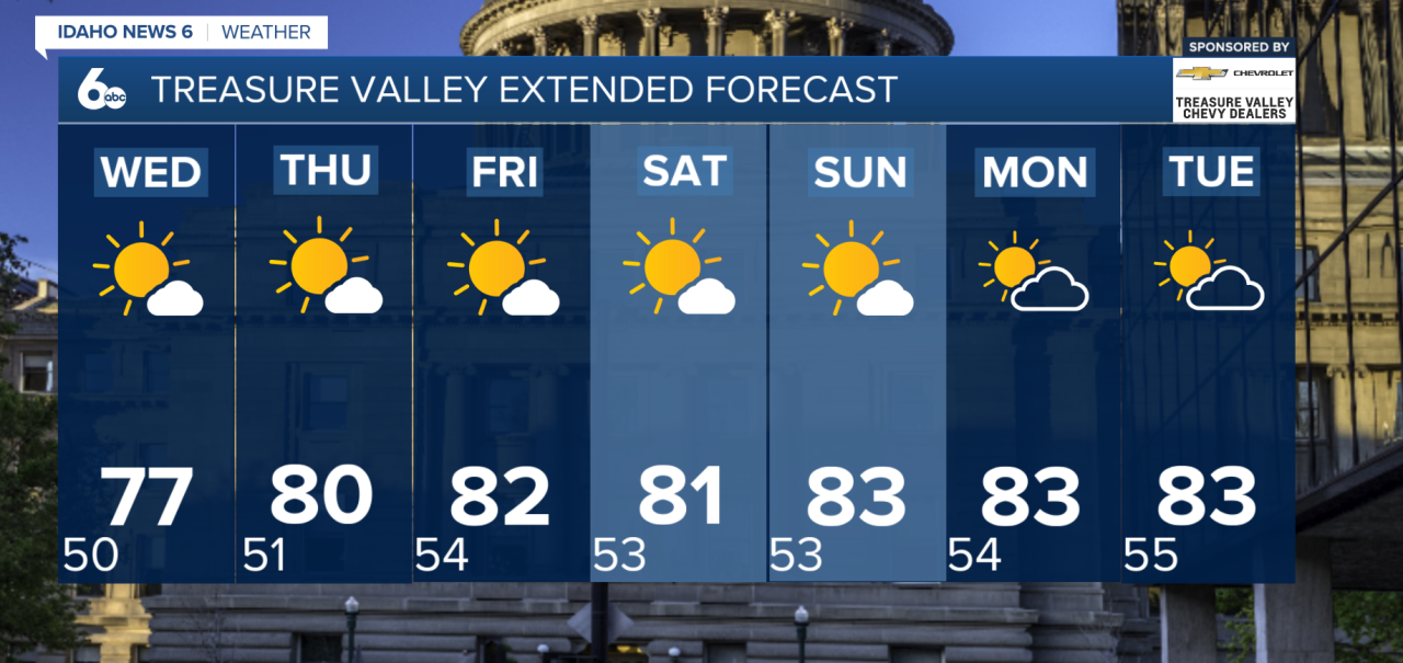
A warming trend is underway across southwest Idaho and southeast Oregon as high pressure strengthens over the region.
Grab the jacket this morning! Tuesday starts chilly, with temperatures in the 50s and mostly clear skies, then warms through the afternoon.
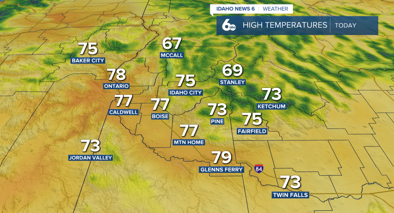
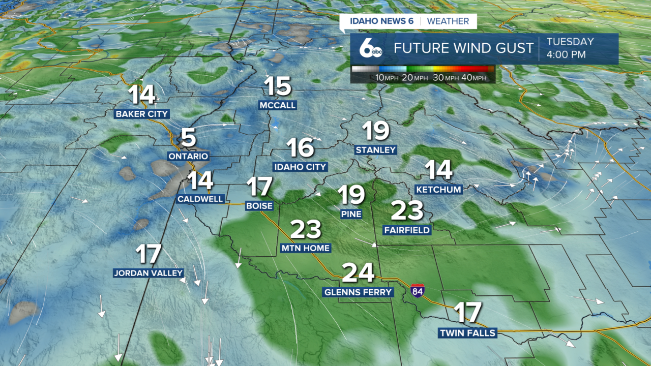
Breezy northwest winds will develop across the western Snake Plain and surrounding terrain later today, with another round of breezy conditions expected Wednesday afternoon.
Otherwise, dry and mostly sunny weather will dominate through Thursday. Temperatures will climb a little each day, with lower elevations reaching the upper 70s to low 80s by Thursday.
Even warmer weather arrives heading into the weekend as high pressure expands farther into the Pacific Northwest. Highs across the lower valleys are expected to reach the low to mid 80s Friday through the weekend, keeping temperatures above normal as we head into the first weekend of October.
A weak disturbance could bring more clouds and a slight chance of showers to parts of southwest and central Idaho late Sunday into Monday, although rain chances remain low. Warm and dry conditions are expected to return Tuesday.
Treasure Valley Extended Forecast