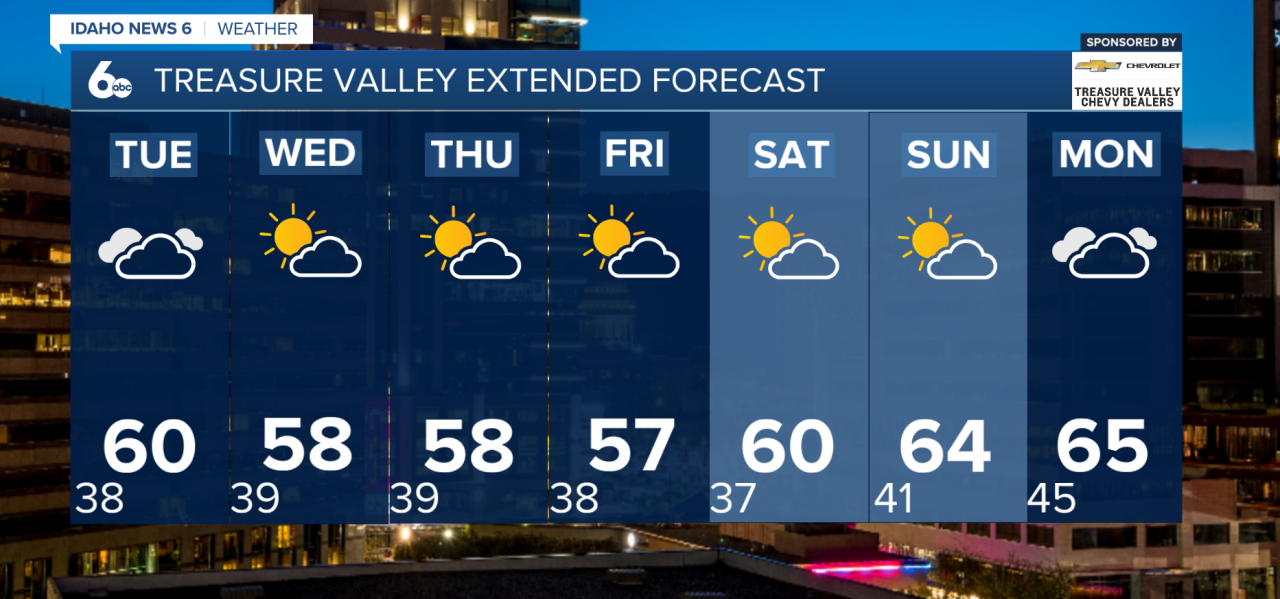
Good morning, everyone! A quieter weather pattern is settling into the region following this weekend's storm system. Expect a mostly dry week, occasional breezy conditions, and temperatures hovering near to slightly above seasonal averages.
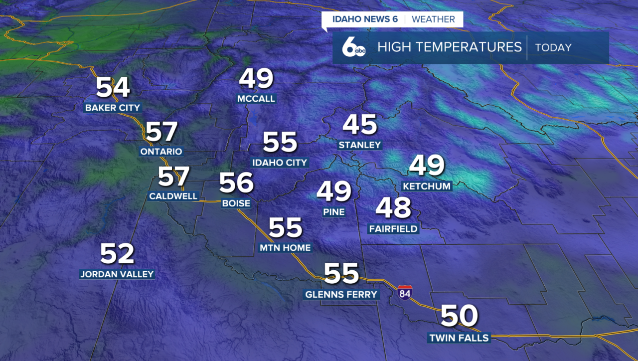
Monday: Sunshine returns!
Patchy fog and low clouds could linger through the morning, especially in sheltered valleys, before giving way to mostly sunny skies this afternoon. Breezy northwest winds will continue east of Boise into the Magic Valley early today but gradually weaken. Valley temperatures will remain similar to Sunday, while mountain locations warm a few degrees.
Tuesday: Breezy with a slight chance of showers
Another low-pressure system approaches the region, bringing increasing high clouds and stronger east to southeast winds. Gusts of 20–35 mph are expected across the Snake River Basin.
Temperatures will climb a few degrees ahead of the system. By Tuesday night, a 10–20% chance of showers develops near the Nevada border. Most valley communities should remain dry.
Wednesday–Friday: Mostly dry with isolated showers
Wednesday will bring lighter winds and dry conditions as high pressure briefly returns.
Two weak disturbances will move through Thursday and Friday, bringing a 10–30% chance of showers, primarily across northern mountain areas. Temperatures will stay near seasonal averages, with little significant precipitation expected.
Weekend outlook: Warming up!
High pressure strengthens heading into the weekend, allowing temperatures to gradually climb.
By Sunday, highs could reach around 5 degrees above normal. Expect generally dry conditions, although winds will begin increasing Sunday into Monday ahead of the next approaching system.
A slight chance of showers returns Monday night.