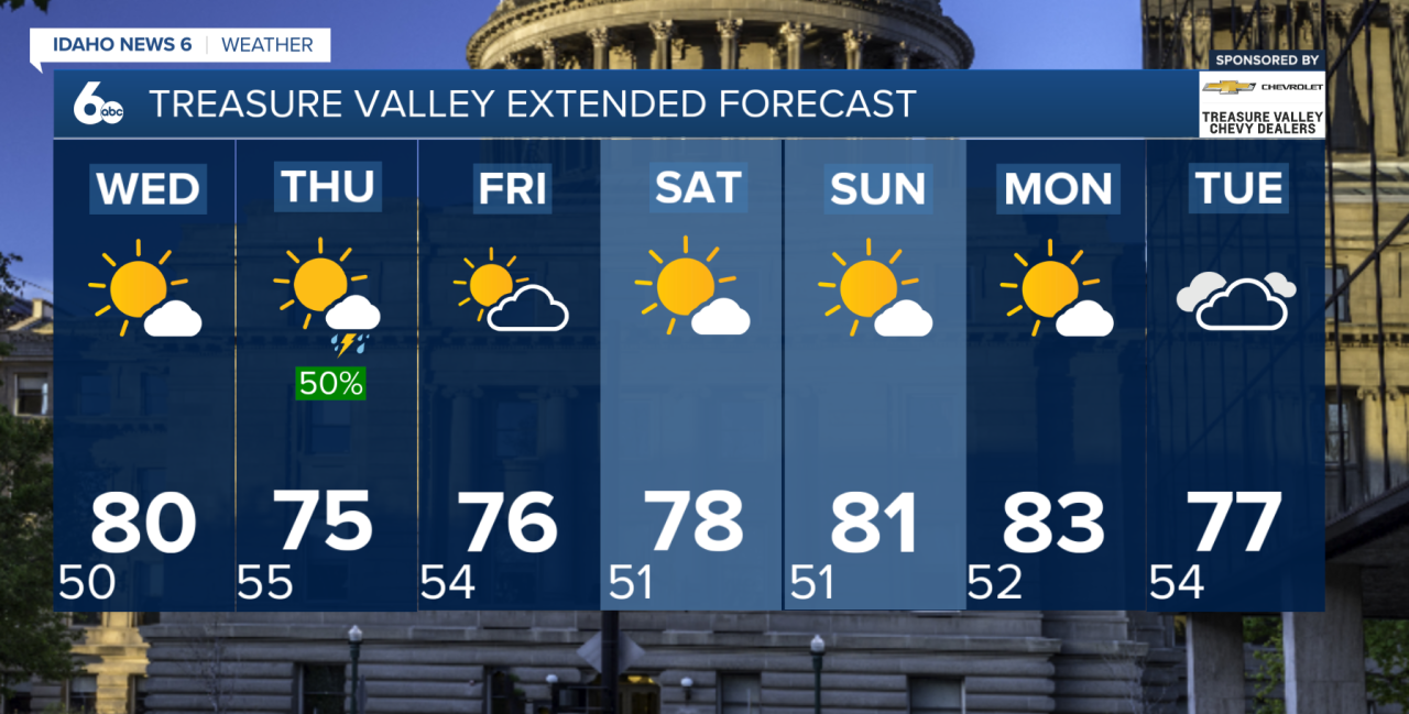
A quiet and slightly warmer stretch of weather is ahead for Southwest Idaho and Southeast Oregon before another round of showers moves in later this week.
Tuesday and Wednesday will feature mostly sunny skies, light winds and temperatures near seasonal averages. While afternoons will be relatively mild, colder conditions are expected in the higher elevations during the morning hours. Mountain valleys could see temperatures near freezing, allowing areas of frost and patchy fog to develop.
Changes begin Thursday as a low-pressure system moves inland from western Oregon. Rain chances will increase across the region, with isolated thunderstorms possible during the afternoon, mainly across northern areas. Most locations will only pick up light rainfall, generally around 0.05 to 0.15 inches through Friday. However, the West Central Mountains could receive closer to a half-inch to three-quarters of an inch.Winds will also pick up Thursday, particularly across south-central Idaho, where southerly gusts could reach around 35 mph.
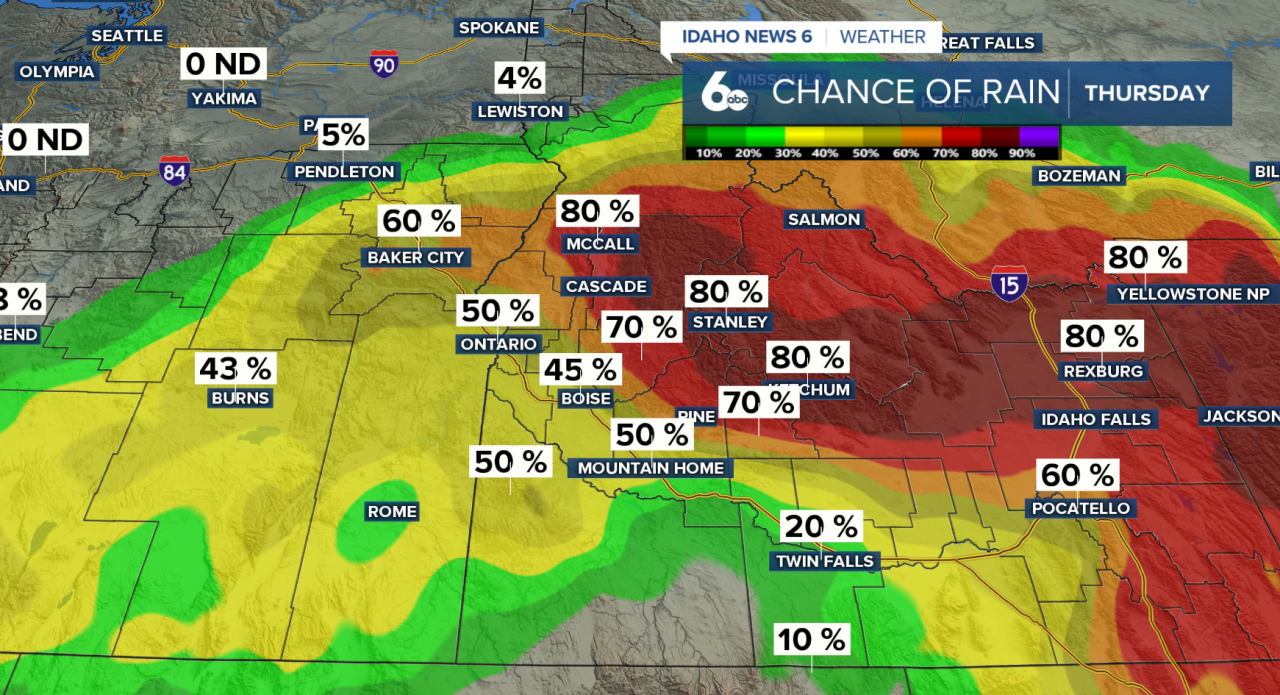
Despite the return of precipitation, snow levels will remain high—around 9,000 to 10,000 feet—keeping most of the precipitation in the form of rain.Showers will gradually become less widespread Friday, although Central Idaho and northeast Oregon will maintain the best chance for lingering rain and a few isolated thunderstorms through Friday night.
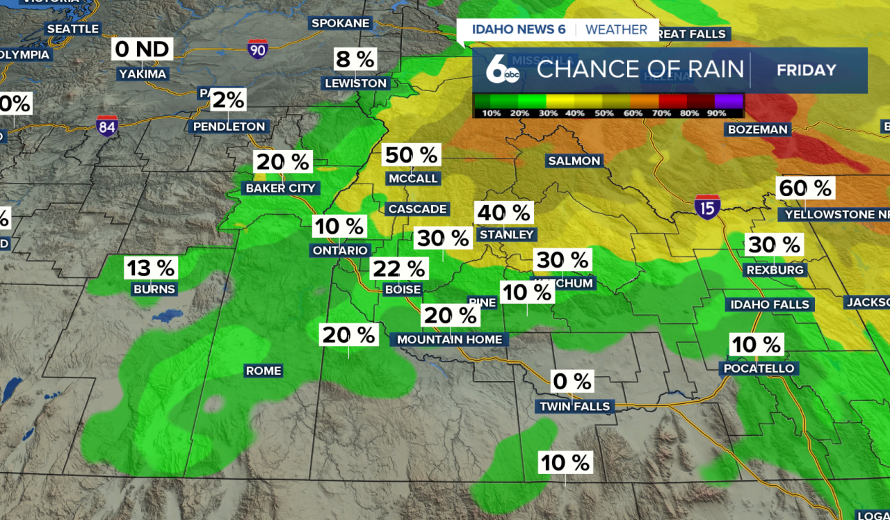
Temperatures will stay near normal through Friday before cooler air settles in Saturday as the low-pressure system moves across the region. A few showers could linger in the Central Idaho Mountains before conditions begin to dry out.
High pressure returns Sunday, kicking off another warming trend. By Monday, temperatures could climb a few degrees above normal. Another cold front may arrive Tuesday, bringing slightly cooler temperatures and another chance for mountain showers.