

Today
Happy Thursday, everyone! A few early showers will linger south of the Snake River Plain, mainly across the Magic Valley, before tapering out around sunrise. Skies clear through the day, but it stays cool with highs in the low 60s—around 5 degrees below normal. Northwest winds will kick up during the afternoon, with gusts between 20 and 30 mph, strongest east of Boise, so a light jacket will definitely come in handy.

Friday & Saturday
High pressure builds back in, bringing sunshine both days. Temperatures will stay on the cooler side Friday but rebound closer to normal by Saturday. With lighter overnight winds, colder pockets in agricultural valleys could drop into the mid-30s early Saturday morning—a Frost Advisory may be needed, especially for outlying spots. Be prepared to possibly cover your garden or crops.
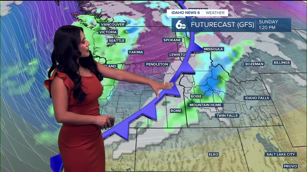
Sunday System – Rain Returns
A deeper trough dives in from British Columbia on Sunday, bringing more widespread rain, with heavier showers expected in the afternoon. Behind the cold front, a much cooler air mass settles in. Snow levels drop to around 5,000–6,000 feet late Sunday into early Monday, meaning our higher mountain passes could pick up a light mix.

Early Next Week – Cold Start, Gradual Warm-Up
Monday and Tuesday will be noticeably cooler with highs in the mid to upper 50s. A gradual warming and drying trend develops through the middle of next week as another ridge builds in.
Stay up to date right here https://www.instagram.com/sophiacruzwx/
Today
Sunny, with a high near 59. Northwest wind 9 to 17 mph. Cool and breezy! Carry the light jacket with you.
Tonight
Increasing clouds, with a low around 37. Northwest wind 8 to 13 mph becoming light west in the evening.
Friday
Sunny, with a high near 64. Calm wind becoming northwest 5 to 8 mph in the afternoon.
Friday Night
Clear, with a low around 36. North wind 5 to 8 mph.
Saturday
Sunny, with a high near 65. Northwest wind around 6 mph becoming east in the afternoon.
Saturday Night
Mostly clear, with a low around 43.
Sunday- Next Weather Maker moves in
A 50% chance of showers, mainly after noon. Partly sunny, with a high near 65.
Sunday Night
A 40% chance of showers, mainly before midnight. Mostly cloudy, with a low around 36.
Monday
Mostly sunny, with a high near 55.
Tuesday
Sunny, with a high near 58.
Wednesday
Sunny, with a high near 60.