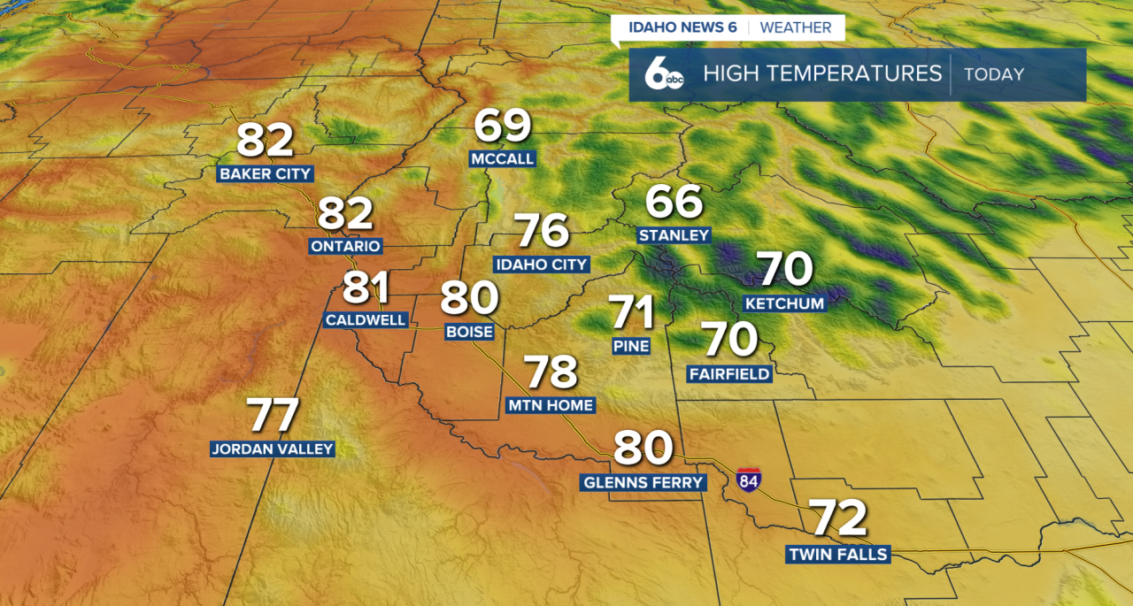
Southern Idaho is getting a quieter break in the weather today after Tuesday’s gusty winds and isolated thunderstorms. Winds will continue to ease through the afternoon, leaving behind mostly sunny skies and warm temperatures across the Treasure Valley, Magic Valley, and much of southeast Oregon.
A few isolated showers may still develop over the higher terrain and central Idaho mountains later today, but the majority of lower elevations will stay dry. Temperatures remain above average for early May, although highs today will be slightly cooler compared to earlier this week thanks to yesterday’s weak backdoor cold front.
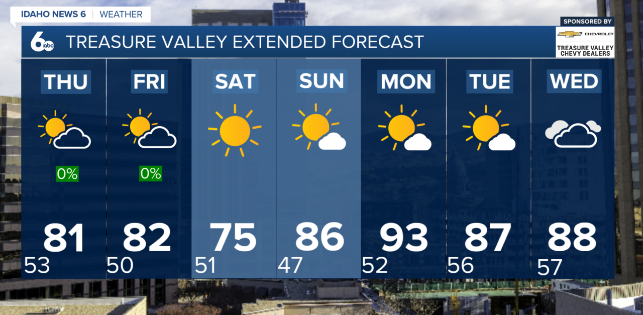
The calmer pattern continues Thursday with plenty of sunshine and temperatures warming another few degrees. By Friday into Saturday, a weak dry cold front moves through the region, bringing a small and temporary cooldown. Even with the cooler air, temperatures will still stay close to or slightly above normal, and precipitation chances remain very limited.
The bigger story arrives early next week as a strong ridge of high pressure builds across the western United States. That ridge will allow temperatures to rapidly climb, potentially bringing the hottest weather of the year so far to the region.
Forecast guidance currently shows highs running 15 to 20 degrees above average by Monday and Tuesday. Many lower valley locations across the Snake River Plain could climb into the upper 80s and low 90s, with current probabilities showing a 50–80% chance of reaching 90 degrees in some areas. Boise could see its first 90-degree day of the year if the current pattern holds.
Along with the heat, conditions are expected to stay very dry through much of next week, with little to no chance for widespread rain.