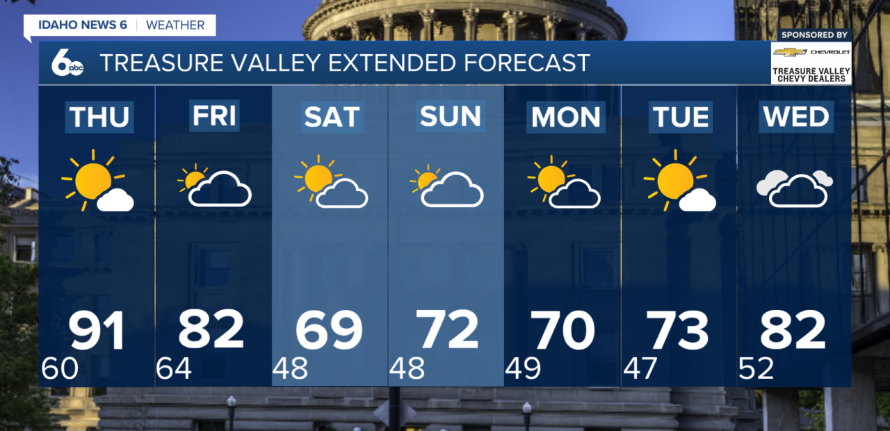
Wednesday will stay dry and warm across southwest Idaho and southeast Oregon, with temperatures continuing to climb. The hottest day of the week arrives Thursday, when highs will run around 10 to 15 degrees above normal. Many lower valleys, including the Treasure Valley, could reach the low to mid-90s.
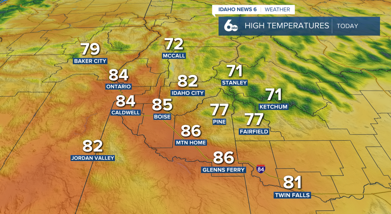
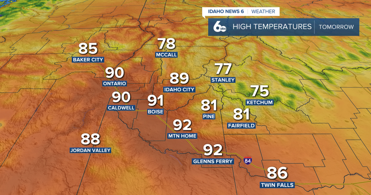
Winds will also pick up Thursday ahead of an approaching Pacific storm system. Southeast winds of 15 to 25 mph are expected across the Snake Plain, with gusts up to 35 mph. The combination of hot temperatures, dry conditions and stronger winds will create elevated fire weather concerns Thursday afternoon across southwest Idaho and southeast Oregon.
A strong cold front will sweep through the region Friday afternoon, bringing gusty winds and cooler temperatures. Ahead of the front, southwest wind gusts could reach 25 to 45 mph, especially south and west of the Snake Plain and along higher ridges. Winds will shift to the northwest behind the front but remain gusty at 25 to 40 mph.
Most of the moisture associated with this system will stay north of our area. The best chance for rain will be across northern Baker and Valley counties, where there is a 20% to 40% chance of precipitation.
The temperature drop will be most noticeable across eastern Oregon on Friday, where afternoon highs could be nearly 20 degrees cooler than Thursday. Southwest Idaho will remain relatively warm Friday, with lower elevations still reaching the low to mid-80s.
By Saturday, much cooler air settles across the entire region. Temperatures will fall around 5 to 15 degrees below normal. Another weaker system could move through late Sunday into early next week, helping keep temperatures cooler with breezy west to northwest winds.
For now, most of the weekend looks dry, although there is still some uncertainty surrounding moisture with the next system.