


Treasure Valley woke up to showers with some afternoon activity passing through. How much will storms impact the rest of the 4th of July and your holiday weekend? Here is your forecast.
More showers are on the way for tonight. The impact is more prevalent over the Western Treasure Valley. Our Futurecast shows showers west of Nampa moving in as the sun sets.
Skies clear out after tonight heading into Saturday with great conditions expected. Mid 80's are on the way with a return to the 90's by Sunday.
Triple digits are returning on Tuesday with 102° expected as the high. Get out and enjoy the cooler temperatures this weekend. They don't last long.
Happy Independence day! Pay attention to skies tonight and have an awesome weekend!
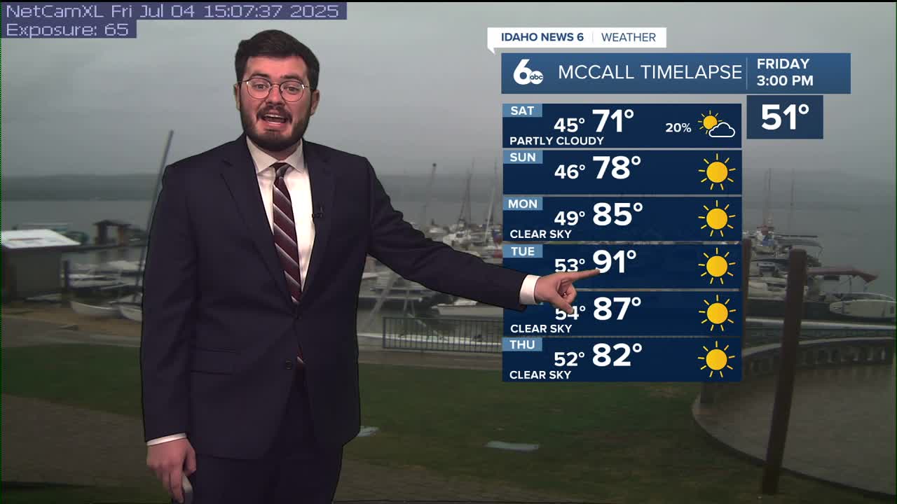
Saturday
Sunny, with a high near 82.
Sunday
Sunny, with a high near 89.
Monday
Sunny and hot, with a high near 97.
Tuesday
Sunny and hot, with a high near 102.
Wednesday
Sunny and hot, with a high near 100.