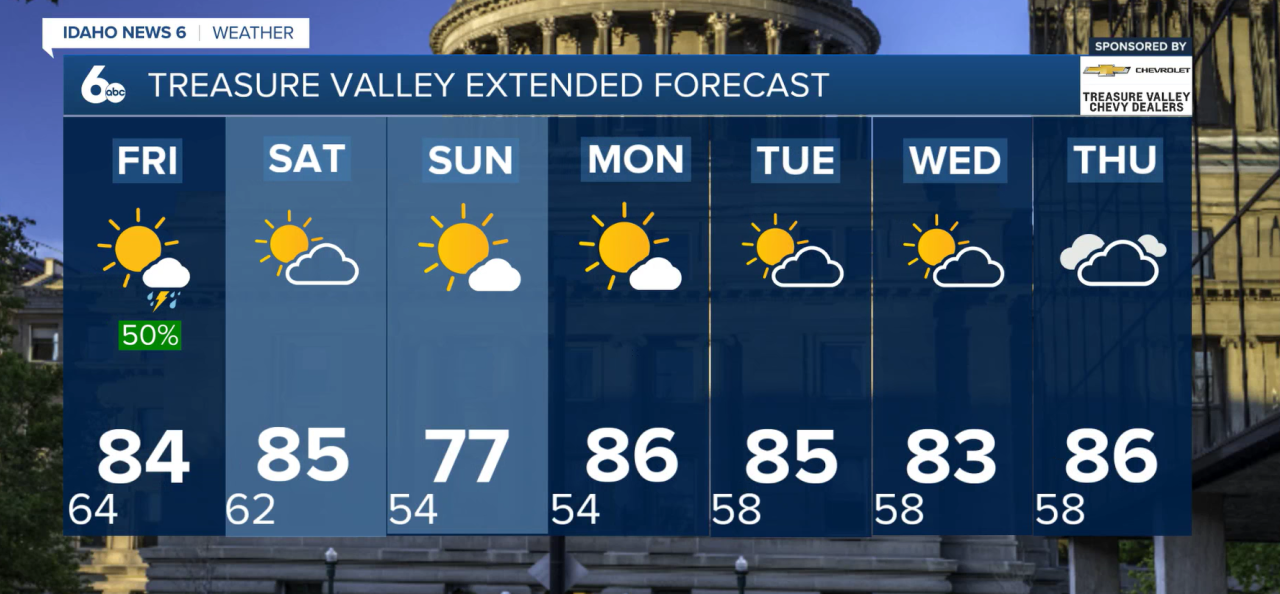
Southwest Idaho will see one more warm day Thursday before a wetter and cooler weather pattern moves into the region Friday.
Isolated thunderstorms are possible Thursday afternoon, mainly across the central Idaho mountains and southern Twin Falls County. While widespread severe weather is not expected, storms could produce gusty and erratic outflow winds up to 45 mph, especially across the Magic Valley and southern Twin Falls County.
Breezy southwest winds are also expected Thursday afternoon across parts of eastern Oregon and the southwest Idaho highlands. Temperatures will remain above normal before a noticeable cooldown arrives to end the week.
Rain Chances Increase Friday
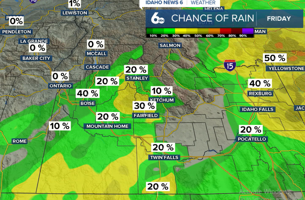
More moisture moves into the region Friday, bringing scattered to widespread showers across southwest Idaho. A band of steadier rain is expected to develop from near the Nevada, Oregon and Idaho border and extend northeast through the region.
A few isolated thunderstorms will also be possible. Unlike some of the drier storms we've seen this summer, Friday's showers and storms will be capable of producing wetting rain.
Showers and isolated thunderstorms could continue into Saturday morning before drier air gradually moves in from the west. Most locations are expected to receive less than a quarter-inch of rain.
Temperatures will also take a noticeable drop Friday and Saturday, falling about 10 to 15 degrees compared to Thursday. Highs will run a few degrees below normal for late August.
Cooler Pattern Continues Next Week
The cooler weather is expected to stick around into next week as a series of weather systems move through the Pacific Northwest.
Sunday will remain cool behind a cold front before temperatures briefly warm Monday. Another cold front is expected Tuesday, bringing another round of cooler air for Tuesday and Wednesday.
By later next week, temperatures could fall as much as 10 to 15 degrees below normal as a stronger trough settles over the Pacific Northwest.
There is still plenty of uncertainty in the forecast that far out, so the timing and strength of next week's cooldown could change over the coming days.