Happy Monday, Idaho!
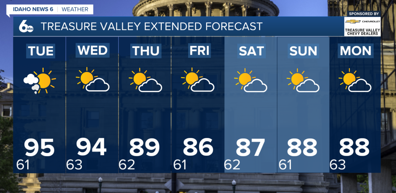
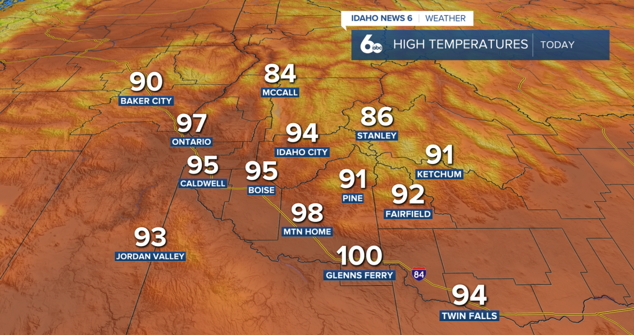
Hot, dry, and smoky conditions will stick around through Wednesday across southwest Idaho and eastern Oregon. Afternoon highs will reach the low to mid-90s in the valleys, with mountain communities staying in the 80s. Skies will remain hazy from wildfire smoke, and breezy afternoons will continue.
The forecast begins to change by Wednesday as moisture from the southwest starts moving back into the region. While most areas will stay dry through Tuesday, a few isolated thunderstorms could develop near the Nevada border Wednesday afternoon. Because the lower atmosphere remains very dry, any storms that form could produce strong, gusty winds.
By Thursday, thunderstorm chances increase across much of southwest Idaho and parts of eastern Oregon as a weather system moves into the Northwest. A few storms may even linger into Thursday night and early Friday. Showers and thunderstorms are expected to continue into the weekend, especially across the Central Idaho Mountains and areas near the Nevada border.

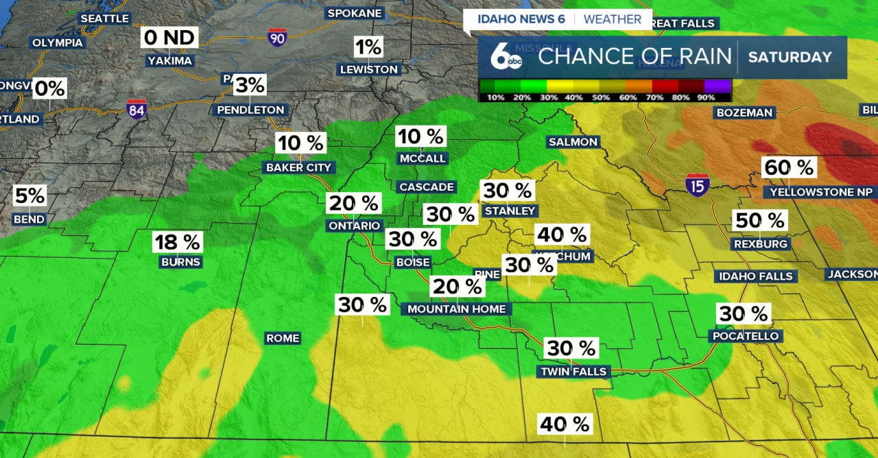
As more moisture moves in, heavy rainfall becomes a greater concern, particularly over recent burn scars and steep terrain where localized flooding is possible. Temperatures will also become more comfortable, settling closer to seasonal averages by the end of the week.
Treasure Valley Extended Forecast