

Hump day! We’re heading into the middle of the week — let’s keep pushing through together!
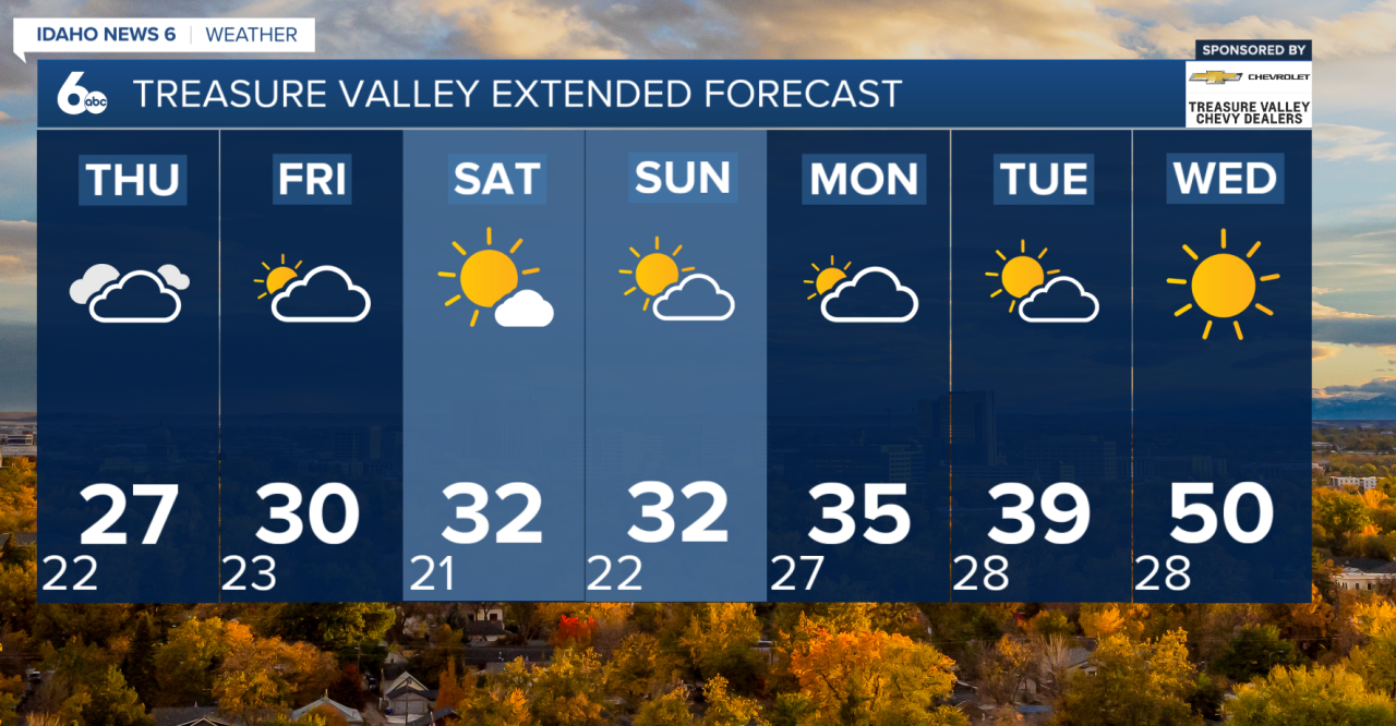
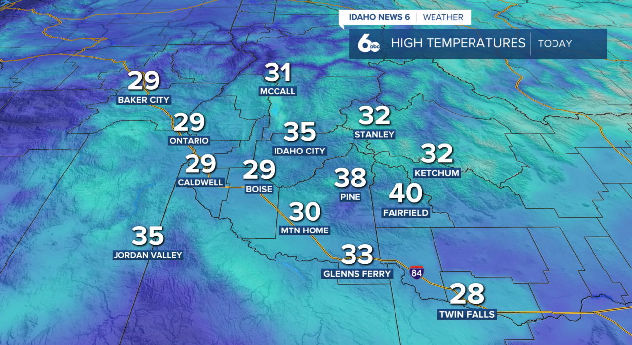
An upper-level ridge is still parked over the region, keeping a stubborn deck of low stratus and fog locked into the Treasure Valley and Snake Basin. That’s why afternoons have been staying so cold, with highs struggling to climb above freezing.
As for when the inversion breaks — it’s still tricky. Low clouds are expected to persist through Friday for most valley locations below 5,000 feet, and we could even see a few flurries at times under the thicker cloud cover.
Looking ahead to the weekend, cooler air aloft moves in Saturday, which may help mix out some of the fog and low clouds and actually allow valley temperatures to warm a bit — but confidence is low.
By early next week, a ridge looks to rebuild again, which could strengthen another inversion and bring back the same pattern.
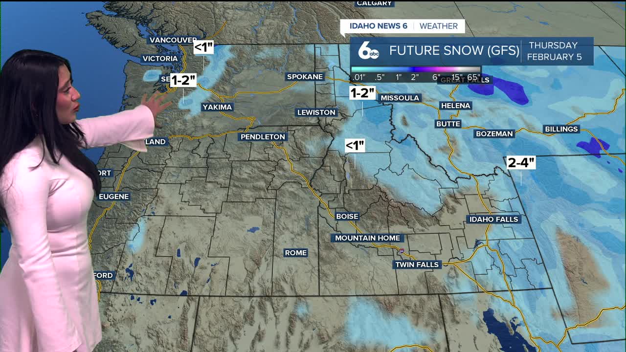
Mountains stay in the clear with mild daytime temps and cold nights, while valley temperatures remain below normal. The next chance of snow looks to arrive early February and is very minimal, with accumulations hovering between 1"-2".
Mother Nature is simply reminding us that the sunshine is still up there… sometimes you just have to go find it.
Hang on, Idaho will get through this together!