

Good Morning Idaho!
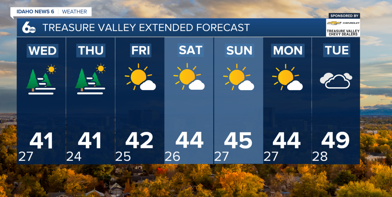
A persistent high-pressure system will continue to dominate the region through the end of the week and into the weekend, bringing quiet but stagnant weather conditions. Valley locations will remain cool, with recurring episodes of fog and mist, while higher elevations experience slightly milder daytime temperatures.
Over the short term, patchy fog will be the primary weather concern, especially during the overnight and early morning hours. Fog development will depend on how quickly temperatures cool overnight and the amount of high cloud cover present. Where fog develops, visibility may drop below five miles, particularly during the morning commute. Fog is expected to redevelop most nights through Thursday.
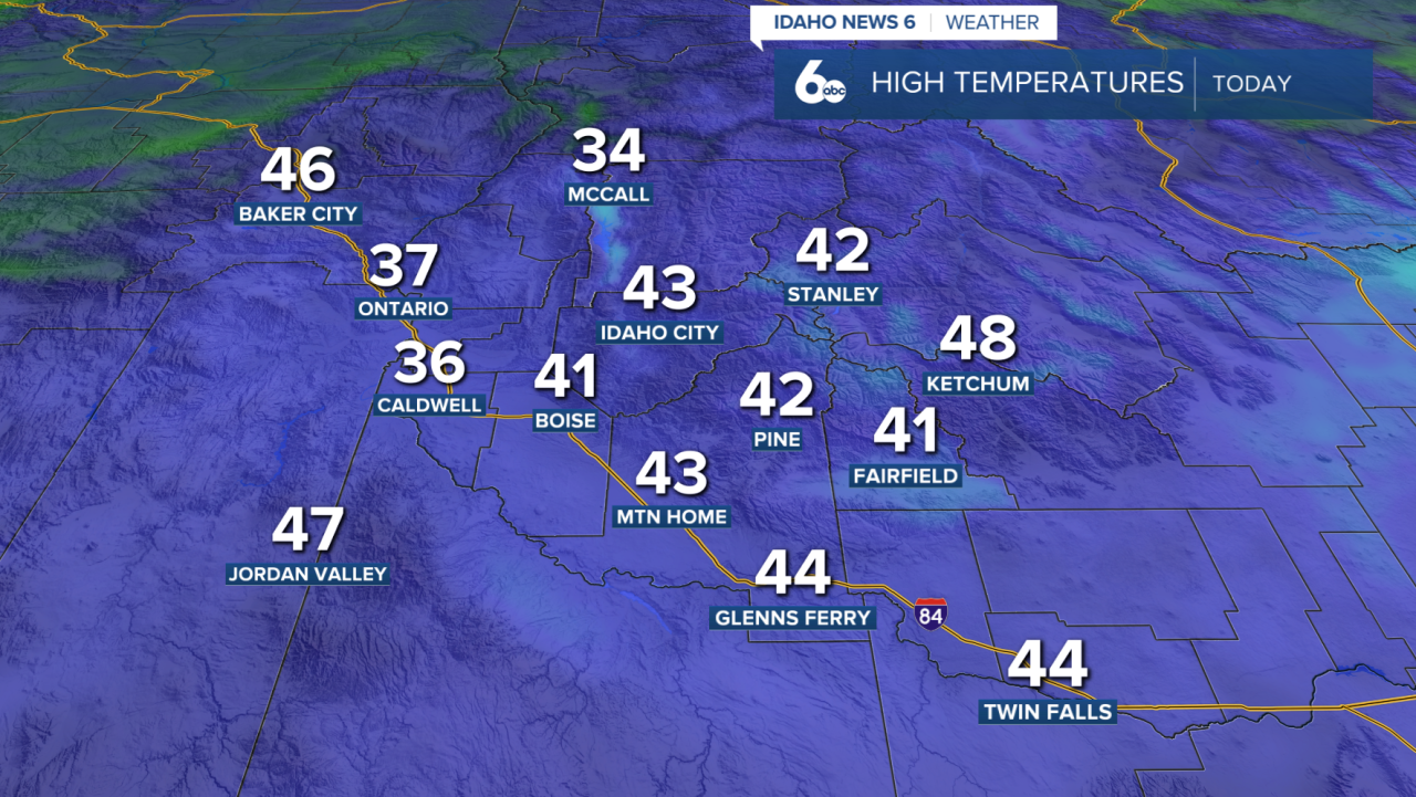
Afternoon highs in Treasure and Magic valleys will remain on the cool side, while the East and West Central Mountains warm into the mid-30s to near 40 degrees each afternoon.
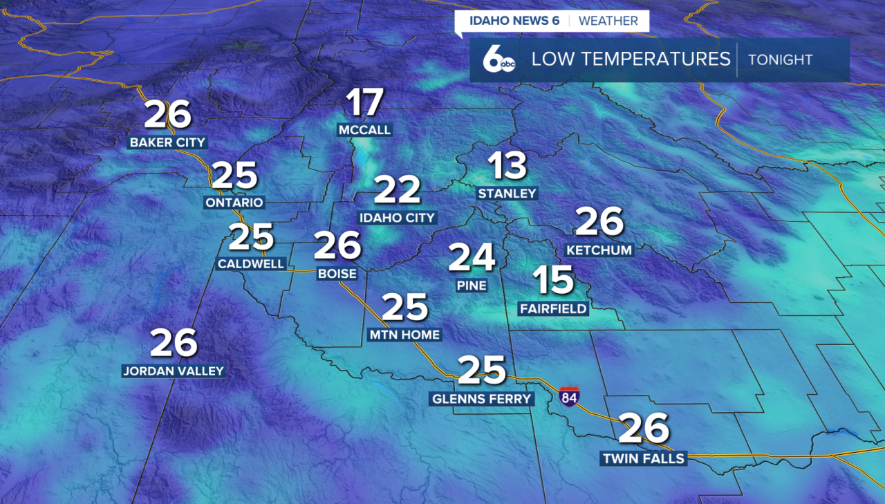
Looking ahead to early next week, high pressure will remain firmly in control as it shifts north toward British Columbia. This will keep Idaho locked in a pattern of stable, dry weather with little day-to-day change. Temperatures will stay similar to recent days, with slight cooling possible depending on how widespread low clouds and fog become. Overnight conditions in mountain valleys will be especially cold, with lows falling into the teens.
A potential break in the stagnant pattern may arrive late next Tuesday into Wednesday. Models suggest an upper-level trough could move into the region, bringing increased cloud cover, improved air mixing, and a chance for precipitation.
Until then, expect continued calm weather, and chilly nights.