Happy Baby Friday!
After unsettled weather and scattered showers on Wednesday, Thursday will be much quieter. West to northwest flow continues today, with some low clouds lingering along the Nevada border this morning. Those clouds will decrease this afternoon as a weak ridge builds overhead.
Temperatures will warm several degrees on Friday. Meaning the bluebird weather holds through Friday.
Forecast: Spring-like weather and a slight chance of showers this weekend
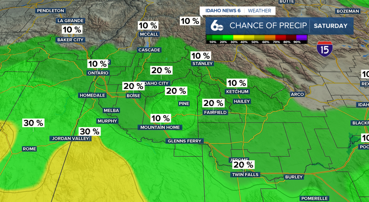
Our next chance of precipitation arrives Saturday afternoon as a weak system tracks across Oregon into the Great Basin. Expect a 30–50% chance of showers. Snow levels will range from around 5,000 feet near Baker City and McCall to near 8,000 feet close to the Nevada border. Minimal mountain snow accumulation is expected.
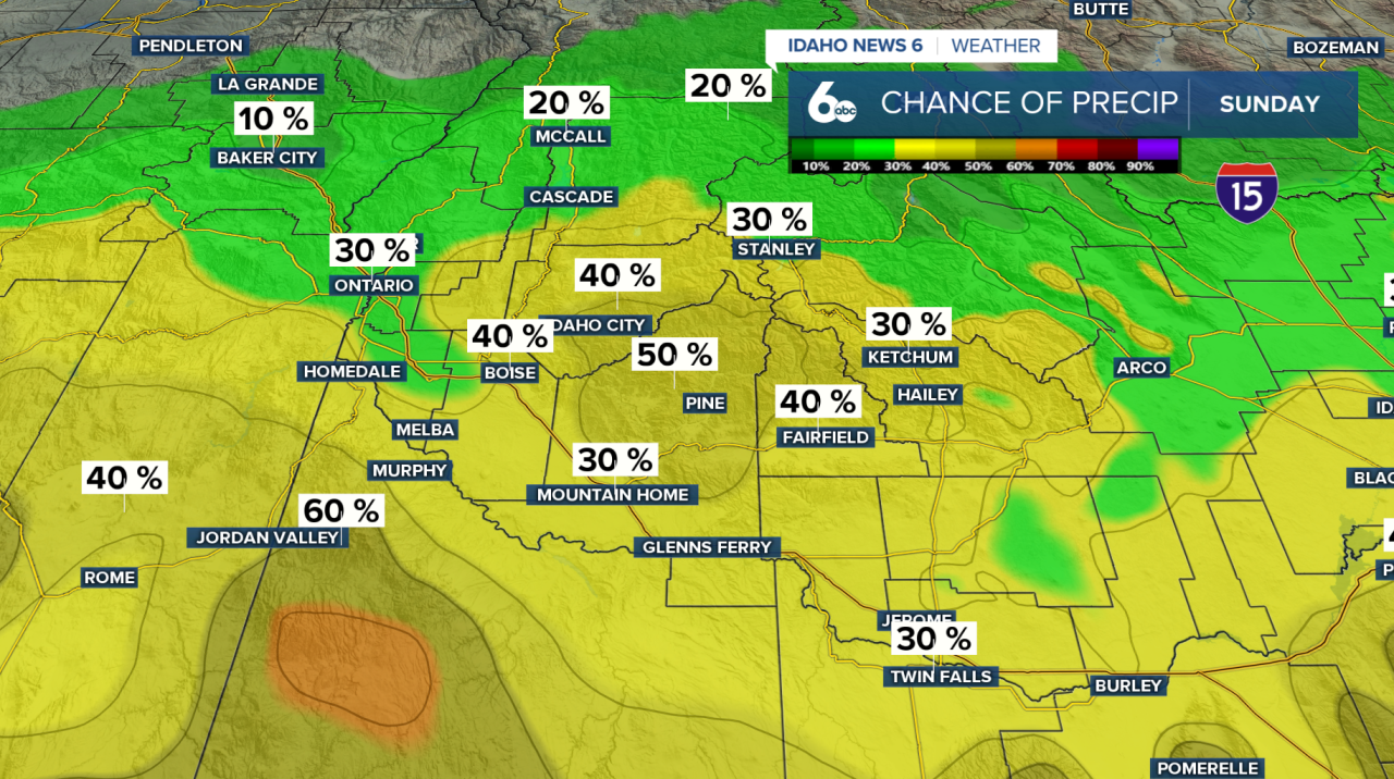
The unsettled pattern continues into Sunday with a 30–50% chance of precipitation before tapering to 10–20% by Monday.
Drier conditions return Tuesday as upper-level ridging builds ahead of the next cold front expected Wednesday.
Seven-Day Forecast
As we head into the new month, there’s still a slight chance of showers on Sunday before precipitation tapers off by Monday. The first week of March looks fairly mild, with ridging building in on Tuesday ahead of the next cold front on Wednesday.
Temperatures will trend warmer early next week.

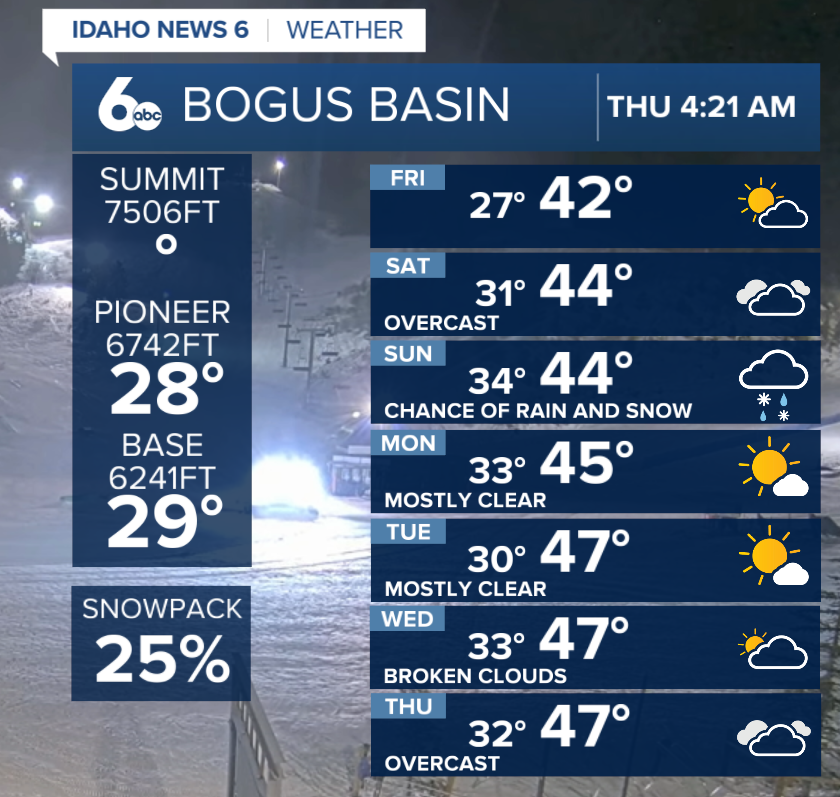
Bogus Basin Forecast
Spring-like weather makes a return to Bogus Basin this weekend as temperatures climb well into the 40s and even low 50s at times. Expect a mix of rain and snow showers Saturday into Sunday, with afternoon highs rising into the mid-50s on Sunday.
The week ahead looks mild, with temperatures even warmer, pushing into the 60s by Tuesday. Time to start bringing out those lighter spring break jackets for the mountain!