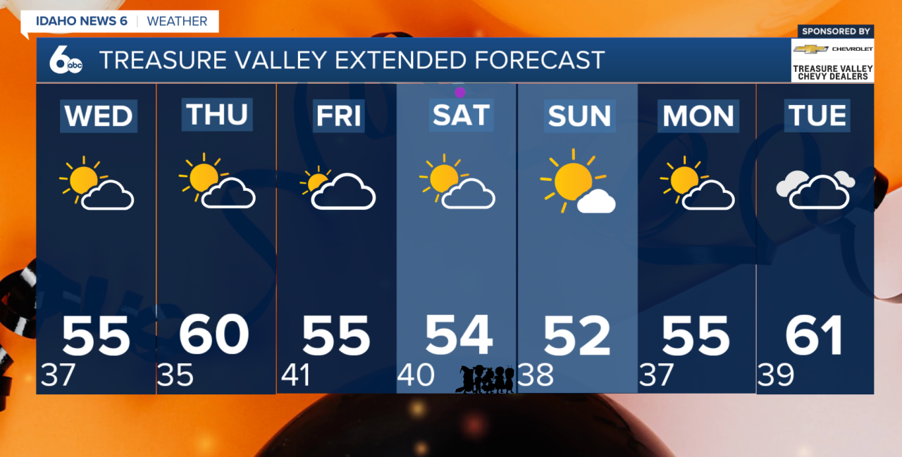
Good morning, everyone! An unsettled weather pattern continues across southwest Idaho and eastern Oregon today as another weak cold front moves through the region. Isolated to scattered showers are expected, with the greatest coverage across our northern mountain communities, where rain chances range from 30–60%.
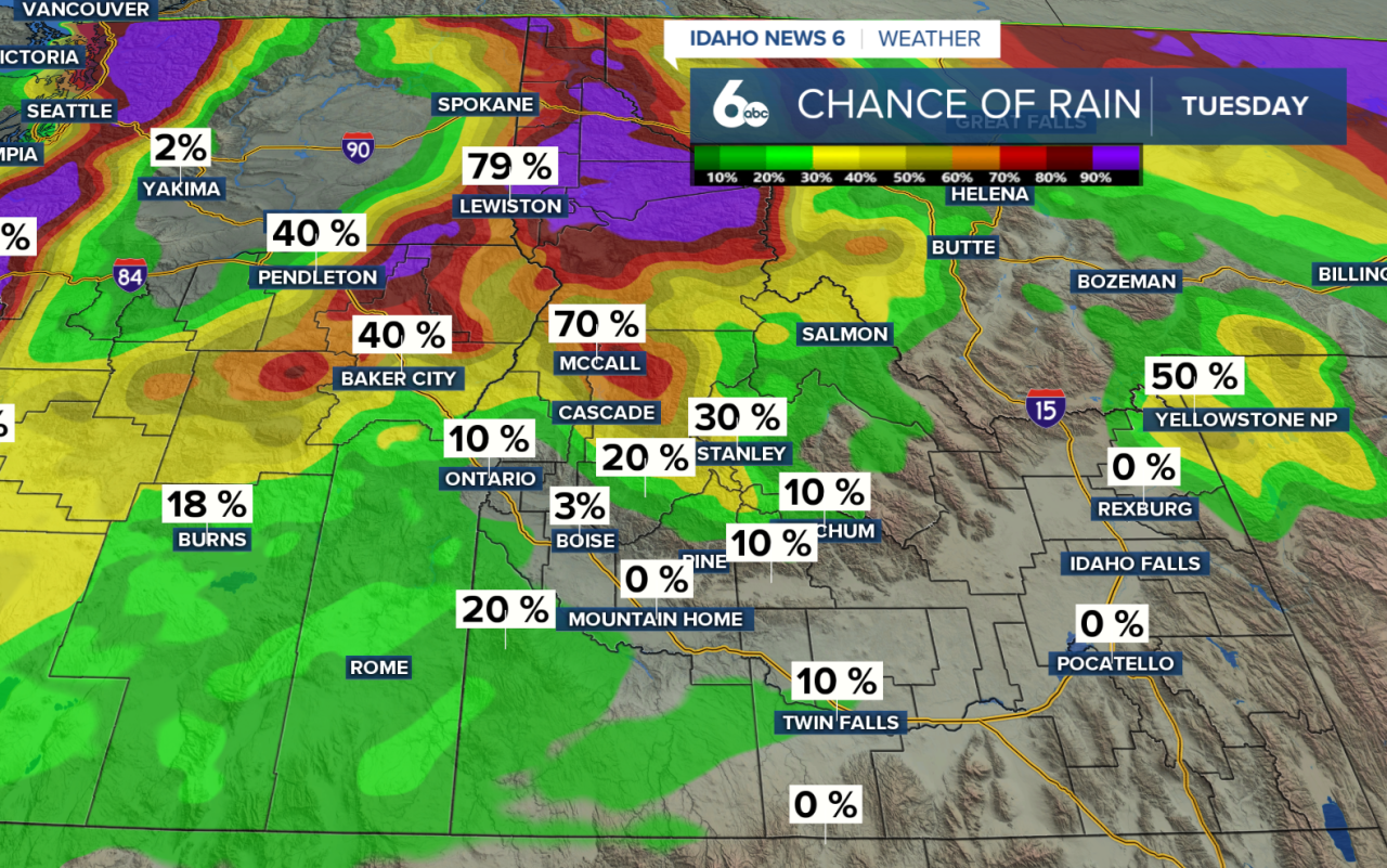
For the Treasure Valley, rain chances remain below 10%, meaning most locations will stay dry, although a stray shower can't be ruled out. Eastern Oregon has a slightly higher chance of showers, around 10–20%.
A few afternoon showers could produce graupel, or soft snow pellets, at lower elevations. An isolated lightning strike is also possible, although chances remain below 10%.
Snow levels will range from 4,500 to 6,500 feet, with minor accumulations expected mainly above 6,000 feet.
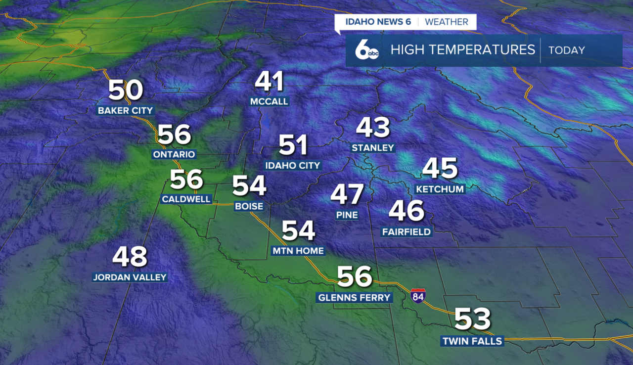
Afternoon highs will reach the 50s across the Snake River Plain, while mountain valleys and higher elevations remain in the 40s.
Wednesday–Thursday: Clearing Skies and a Brief Warm-Up
Showers will gradually taper off through Wednesday, with clearing skies allowing temperatures to drop overnight. Patchy fog could develop in sheltered mountain valleys.
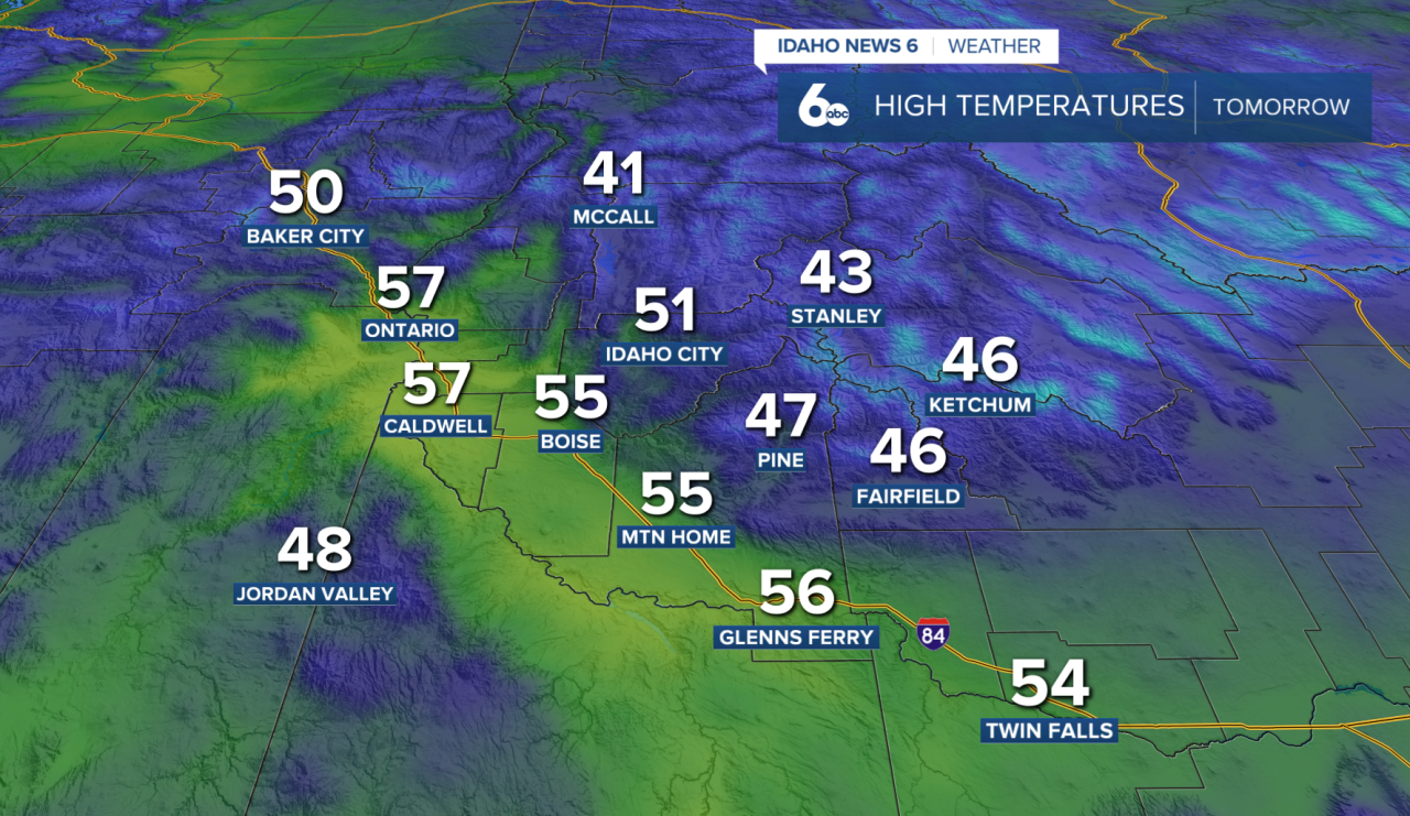
Wednesday remains chilly, with temperatures around 5 degrees below seasonal averages. By Thursday morning, lows could fall near 30 degrees across lower elevations, while higher mountain basins and portions of eastern Oregon dip into the teens and 20s.
Thursday brings a welcome break from the unsettled weather, with dry conditions and afternoon temperatures climbing roughly 5 degrees warmer than Tuesday and Wednesday.
Friday–Sunday: Rain and Mountain Snow Return
Another Pacific weather system approaches Friday, bringing increasing precipitation chances to the higher terrain of southwest Idaho.
Rain and mountain snow chances will increase Saturday afternoon and continue building into Sunday as a cold front crosses the region.
Snow levels will generally range between 5,000 and 7,000 feet, keeping most accumulations above 6,000 feet. Higher elevations have a 30–50% chance of receiving more than 2 inches of snow between Saturday afternoon and Sunday.
For those planning Halloween activities Saturday evening, rain is possible, but it is too early to determine exactly when and where showers will develop. Keep an eye on the forecast as we get closer to trick-or-treating.
Looking Ahead
Drier conditions return Monday as high pressure builds across the region. Temperatures will remain near or slightly below seasonal averages into early next week.