

Good Morning Everyone!
It’s a soggy start across the Treasure Valley. Definitely grab the umbrella before heading out. Roads along I-84 will stay wet through the day, and Highway 55 could be a little tricky early on with a rain/snow mix in higher elevations.
Either way, plan for extra time on both the morning and afternoon commute today.
WATCH: Weather Forecast calls for more precipitation as mild weather arrives for the second half of the work week
This system is tapping into a really impressive plume of subtropical moisture — near-record levels for late February — which means steady, occasionally heavy precipitation today.
There are also multiple weather watches and warnings across the Gem State.
Watches/Warnings
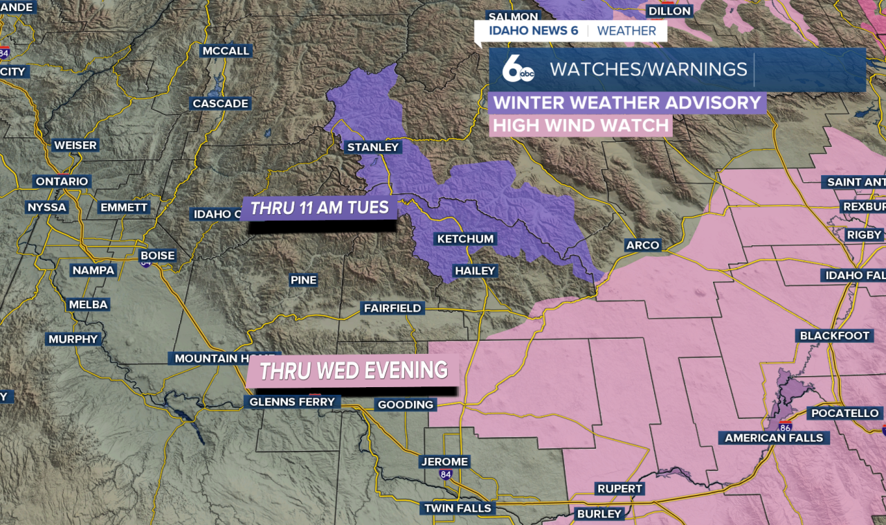
Due to higher snowfall totals, advisories are in effect. A Winter Weather Advisory remains in place through 11 AM today, with snow totals between 2 and 7 inches. This will mainly impact Highway 93 from Sula to Lost Trail Pass, as well as Lolo Pass. Expect minor to moderate winter driving conditions, especially during the morning hours.
In addition, an Avalanche Watch continues through noon Tuesday for the Salmon River Mountains, West Central Mountains, and surrounding areas. Heavy new snowfall on top of an already unstable snowpack could trigger natural avalanches, and human-triggered slides will also be possible. Backcountry travel in avalanche terrain is strongly discouraged.

Winds will also be gusty in the higher elevations, especially near the Nevada border, with gusts up to 40 mph. A High Wind Watch remains in effect from Late Tuesday into Wednesday afternoon, where gusts could reach 60 mph. Put away any loose items around the home; 60 mph gusts are considered damaging.
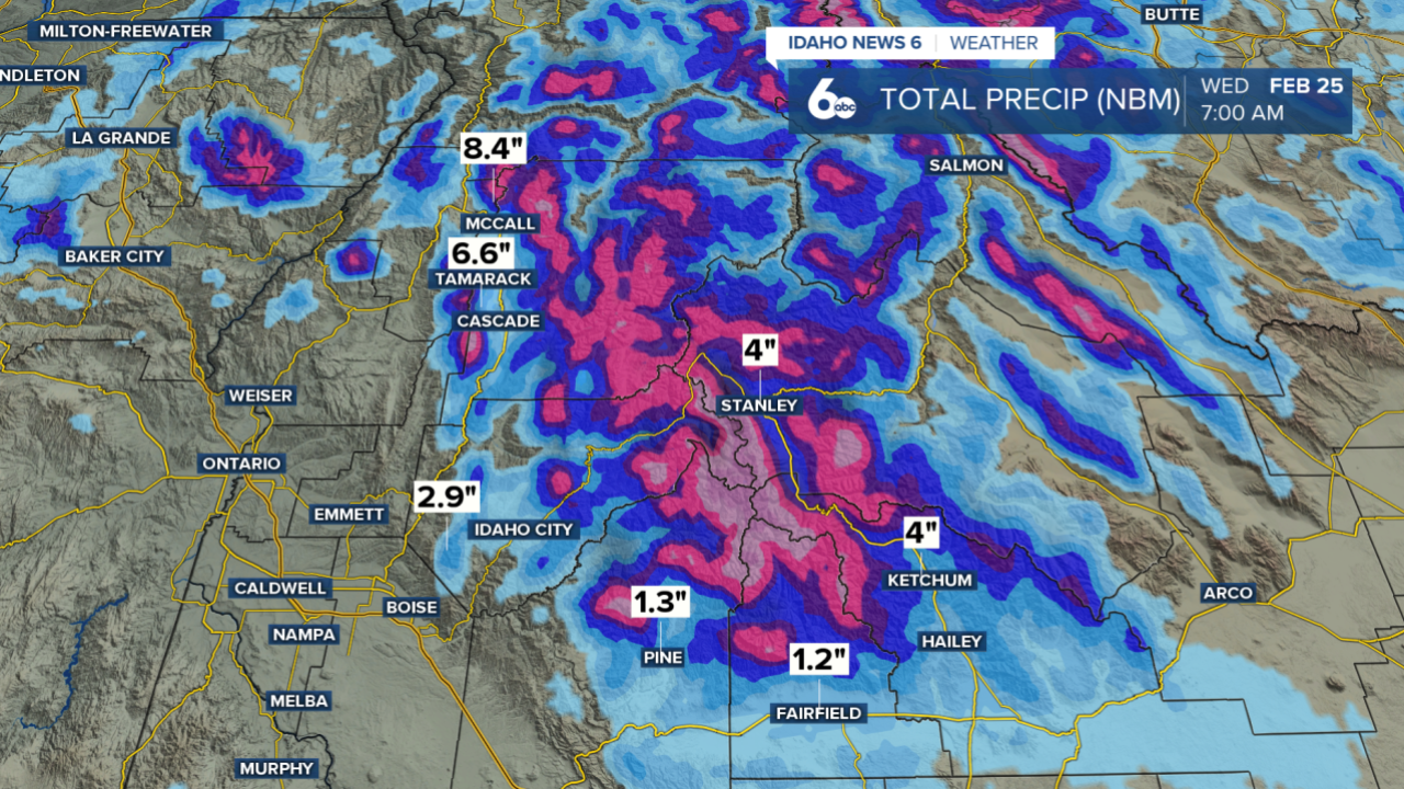
Snowfall Totals
Valley locations will generally pick up between a quarter and three-quarters of an inch of rain, with a few spots possibly nearing an inch. In the mountains, strong westerly flow will squeeze out even more moisture. Above about 6,000 to 7,000 feet, 8 to 16 inches of snow looks common, and the highest peaks could approach two feet.

Snow levels start around 5,000 to 7,000 feet this morning, so places like McCall may wake up to some light snow before changing over to rain this afternoon as levels climb closer to 7,000 to 8,500 feet.
Because this is a mild system, rain falling on existing snowpack below the snow line could increase the risk of rock and mud slides near steep terrain.
Treasure Valley 7-Day Forecast

Showers turn more scattered tonight and into Wednesday as a cold front drops south. Snow levels fall back down to around 4,000 to 5,000 feet behind the front, and mountain valleys could see a light dusting before things dry out later Wednesday into Thursday.
Looking ahead — a weak system could bring light precipitation Sunday, but early next week trends much warmer, with highs pushing into the 60s by Tuesday.
ALSO READ | State Highway 21 to close between Grandjean and Banner Summit due avalanche risk