

Happy Friday, Idaho!
Mark your calendars — sunshine is trying to return this weekend, but it may not be a clean break right away.
Low clouds and patchy fog are still locked into the valleys below about 5,000 feet, and even though cooler, drier air is pushing in from the north, forecast models may be too aggressive at clearing us out. So while we should see improvement, some areas could stay socked in longer than expected, especially the more stubborn valley locations.
Friday: Mostly cloudy for many, but as northerly winds pick up, that breeze will help erode the low stratus from north to south. Some towns may finally break into sunshine later in the day, while others hang onto the gray a little longer.

Saturday into Sunday: Another dry front moves through, and this is when we have the best shot at a bigger change. If the dry air can fully win out, we could see much more sunshine by late Saturday into Sunday, and it’ll feel like a total day-and-night difference compared to what we’ve been stuck under lately.
Even with more sun, temperatures stay on the cool side — still about 5 to 10 degrees below normal.

Next week: We start to see a gradual warm-up as warmer air moves in aloft, and an upper-level ridge begins rebuilding. That also means a temperature inversion may redevelop, which can keep valley temps from warming as fast, while higher elevations warm more efficiently. Overall, it looks like a slow climb back toward the lower 40s in the valleys heading into early next week.
Looking ahead: Late week, the ridge may weaken a bit, and right now there’s only a small chance of mountain snow showers — around 10%, and that chance is trending lower. Models have been struggling with the long-term pattern, so we’ll keep watching how that evolves.


Day by Day Forecast:
Today
Mostly cloudy, with a high near 29. Northwest wind 5 to 14 mph.
Tonight
Mostly cloudy, with a low around 19. Light NW wind bewteen 5 to 9 mph.
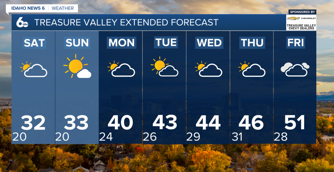
Saturday
Mostly cloudy through mid morning, then gradual clearing, with a high near 30. Light NW winds between 5 to 14 mph.
Saturday Night
Mostly clear, with a low around 20. North wind 6 to 11 mph.
Sunday
Sunny, with a high near 32. North wind around 7 mph.
Sunday Night
Partly cloudy, with a low around 24.
Monday
Partly sunny, with a high near 35.
Tuesday
Mostly sunny, with a high near 38.
Wednesday
Partly sunny, with a high near 38.
Thursday
Mostly sunny, with a high near 38.