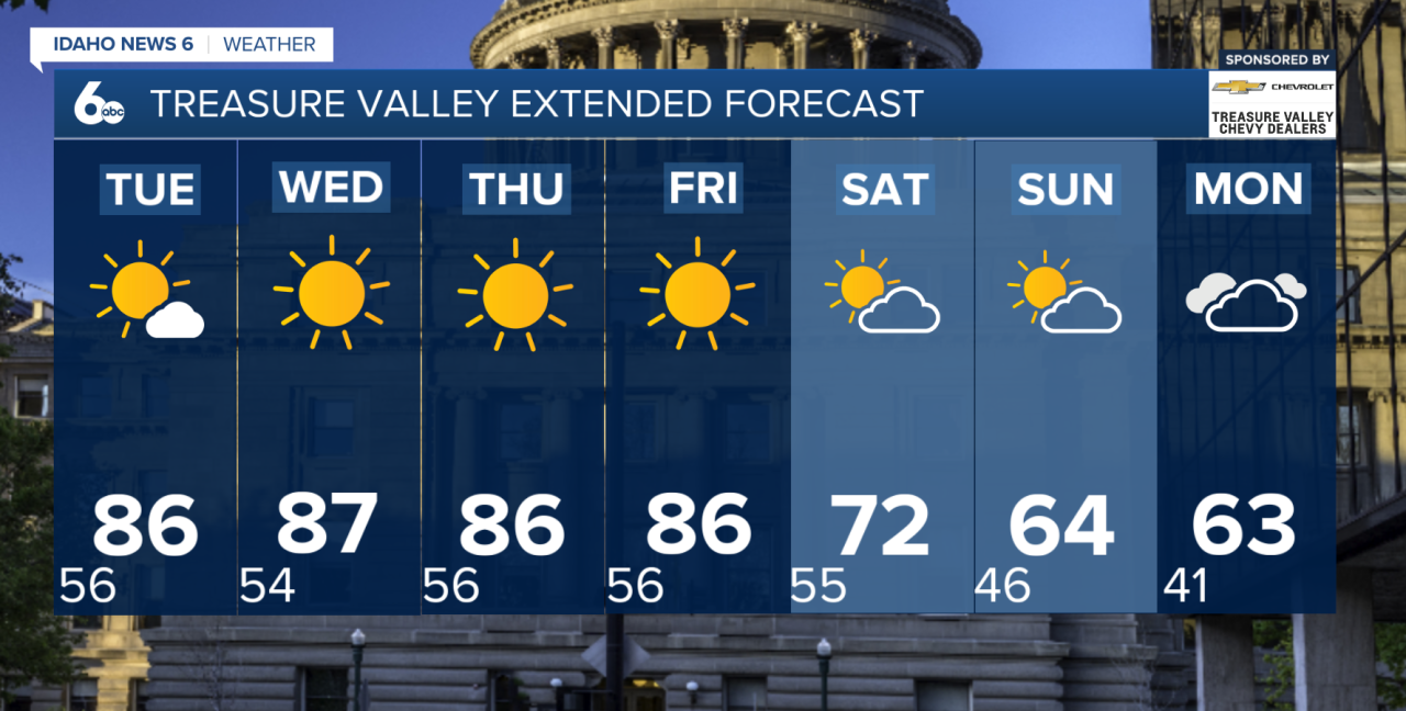
A stretch of record or near-record warmth will continue across southwest Idaho and southeast Oregon this week before a major pattern change arrives this weekend.
High pressure remains in control today, keeping conditions mostly sunny, dry and unusually warm for early October. Highs across the lower valleys will climb into the mid to upper 80s, while mountain locations reach the 70s to lower 80s. That puts afternoon temperatures roughly 15 to 20 degrees above normal, with records in jeopardy at several locations.
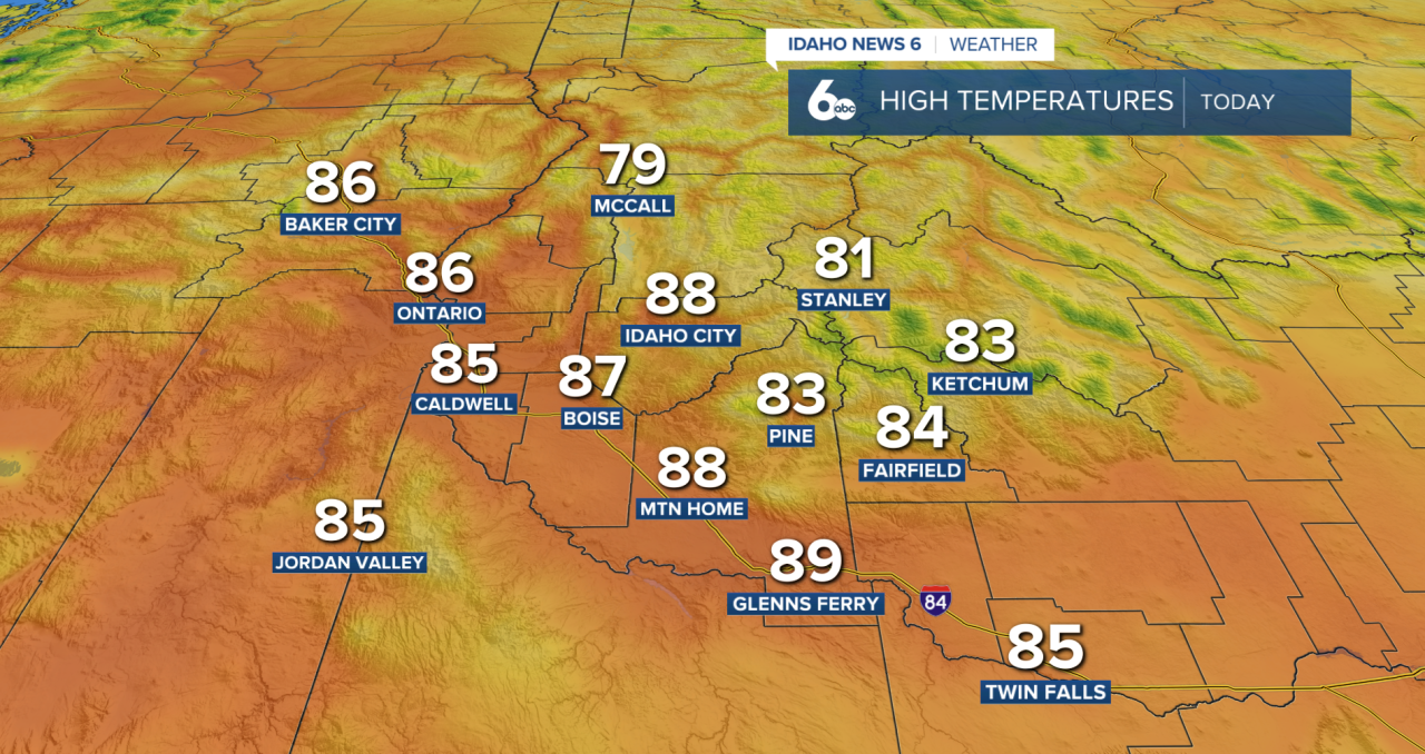
Most areas stay dry today, but a weak disturbance moving across northern Nevada could spark a few showers or thunderstorms near the Idaho-Nevada border late this afternoon and evening. Rain will be limited, but any showers or storms could produce gusty outflow winds approaching 40 mph.
The heat isn't going anywhere just yet. Temperatures remain well above normal Tuesday through Friday, with highs continuing to run about 10 to 20 degrees above average under mostly clear skies.
A significant change arrives this weekend. A cold front is expected to move through Saturday, bringing breezy winds and a 10 to 15-degree drop in temperatures compared with Friday. There is still some uncertainty surrounding exactly when the front moves through, which could affect Saturday's highs.
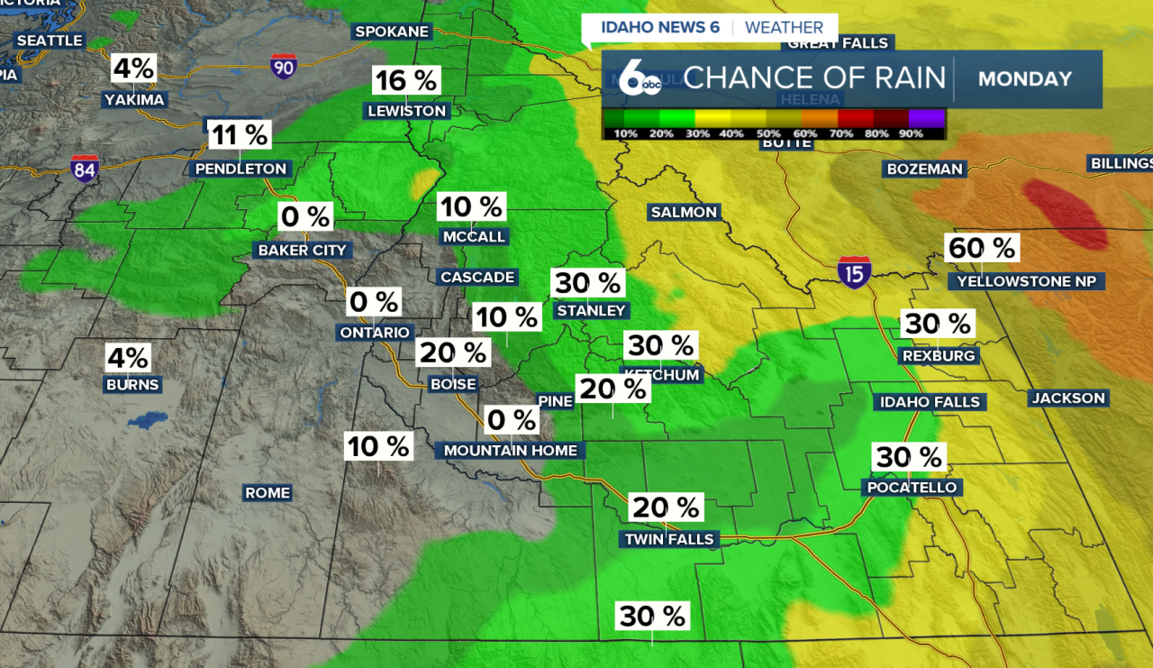
Even cooler air settles in Sunday and Monday as a stronger storm system develops over the Pacific Northwest. Temperatures could fall another 10 to 15 degrees, bringing a much more fall-like feel to the region.
The system will also bring a chance for precipitation, particularly across central and south-central Idaho. Rain is possible in the valleys, while high-elevation snow could make an appearance in the mountains.
Treasure Valley Extended Forecast