


Today is shaping up to be one of the hottest days we’ve seen so far this year across southern Idaho and eastern Oregon. High pressure parked over the western U.S. is sending temperatures soaring into the mid to upper 90s across the lower valleys this afternoon — around 20 to 25 degrees above average for mid-May. This will be enough to set new temperature records across the region today.

Most areas will stay sunny and dry through the day, although a few afternoon clouds may develop across south-central Idaho. A stray thunderstorm can’t be completely ruled out, but chances remain very low.
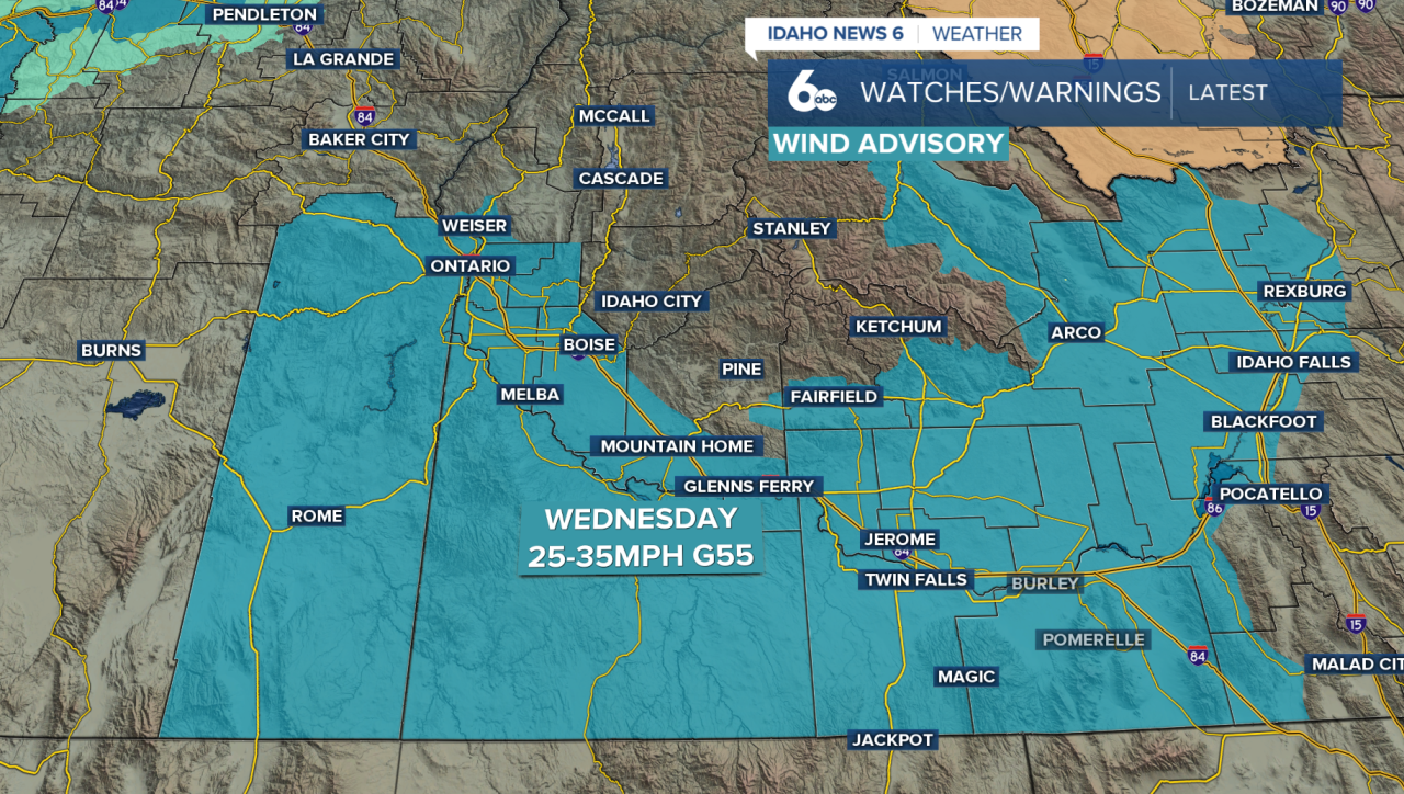
The weather pattern completely flips by Wednesday as a strong Pacific storm system pushes inland. That system will drag a powerful cold front across the region, bringing strong winds, cooler temperatures, and scattered showers.

Winds will rapidly increase Wednesday afternoon, especially across the Magic Valley and southern Idaho. Sustained winds of 25 to 35 mph are expected, with gusts up to 55 mph possible in some spots. Because conditions will stay fairly dry in lower elevations, blowing dust and reduced visibility may also become an issue at times. A wind advisory is in place across eastern Oregon and SW Idaho from noon Wednesday into Midnight. Secure loose items around the home.
Along with the wind comes a major temperature drop. After near-record heat tuesday, temperatures will fall back closer to normal by Thursday. Scattered showers and a slight chance of thunderstorms will develop Wednesday afternoon and evening, mainly across south-central Idaho and the mountains.
Showers could linger into Wednesday night, especially across the higher terrain where snow levels may drop enough for a little light snow near the peaks by Thursday morning.
The cooler pattern sticks around heading into the weekend too. Friday looks slightly warmer, but another system could cool temperatures back down Saturday and Sunday with a few isolated mountain showers and even some light snow above 6,000 feet in the northern mountains. Temperatures this weekend are expected to run several degrees below normal before warming back up early next week.
