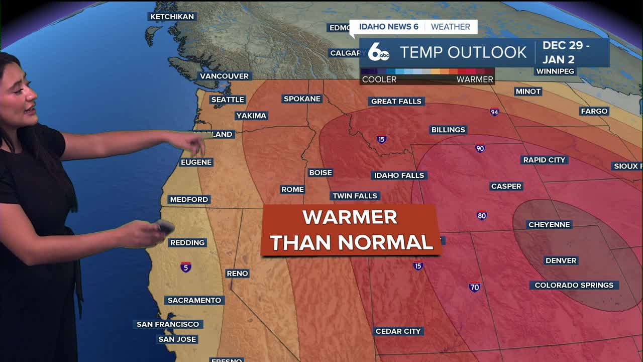


Good morning, Idaho! We have another unseasonably warm afternoon ahead!
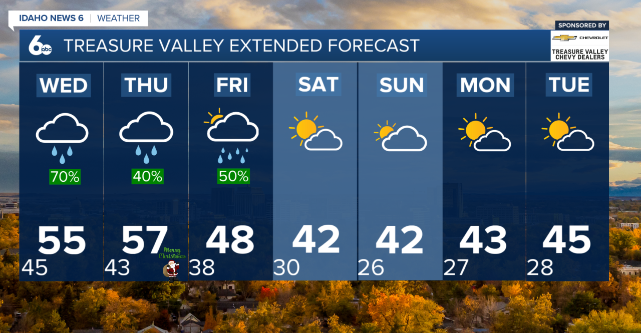
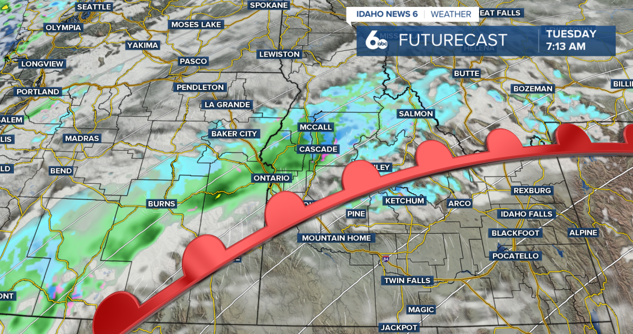
A warm front continues to lift north across southwest Idaho and eastern Oregon today, bringing increasing clouds and a return to rain for parts of the region. Early precipitation has been spotty, but rain becomes more widespread later this morning and afternoon as deeper Pacific moisture moves inland. West central Idaho and Baker County will see the most consistent rainfall, while areas farther south may stay mostly dry through much of the day. Snow levels remain high—between 6,000 and 8,000 feet—so valley locations will see rain, while higher elevations will see snow.
Patchy fog and low clouds may slow today's morning commute, especially in the lower Treasure Valley and other sheltered basins. Visibility will improve by late morning as the warm front moves northward. Behind it, mild air settles in, pushing afternoon temperatures well above normal. Many southern valleys will climb into the 50s!

Winds pick up late tonight into Wednesday as a cold front approaches. Gusty south to southwest winds may reach advisory levels in southern Idaho’s highlands and parts of southern Twin Falls County, with gusts up to 50 mph. Late Wednesday into Wednesday night, the cold front moves through, bringing a round of widespread rain. The heaviest precipitation is expected in the Boise Mountains, though most locations will experience steady rainfall.
Behind the front, temperatures cool slightly, but not enough for valley snow. Snow levels gradually lower into Christmas morning—down to around 5,000 feet in northern areas and near 7,000 feet in the south. With wet conditions and saturated ground, there is an increased risk for rock slides in steep terrain.
Christmas Day stays unsettled as scattered showers linger, though temperatures remain mild—still running 10 to 15 degrees above average. If you're looking for a white Christmas, the mountains will be the spot to head to.

Snow levels fall to valley floors by early Saturday, but moisture will be limited. Light valley precipitation and minor mountain snowfall are expected before drier weather returns this weekend. High pressure then builds in, bringing quieter conditions—but also the potential for lingering fog and low clouds in the valleys.
Stay up to date right here Sophias Instagram