

Happy Friday!
The weekend is here, and it will be perfect for any outdoor activities! Be sure to enjoy the sunshine.
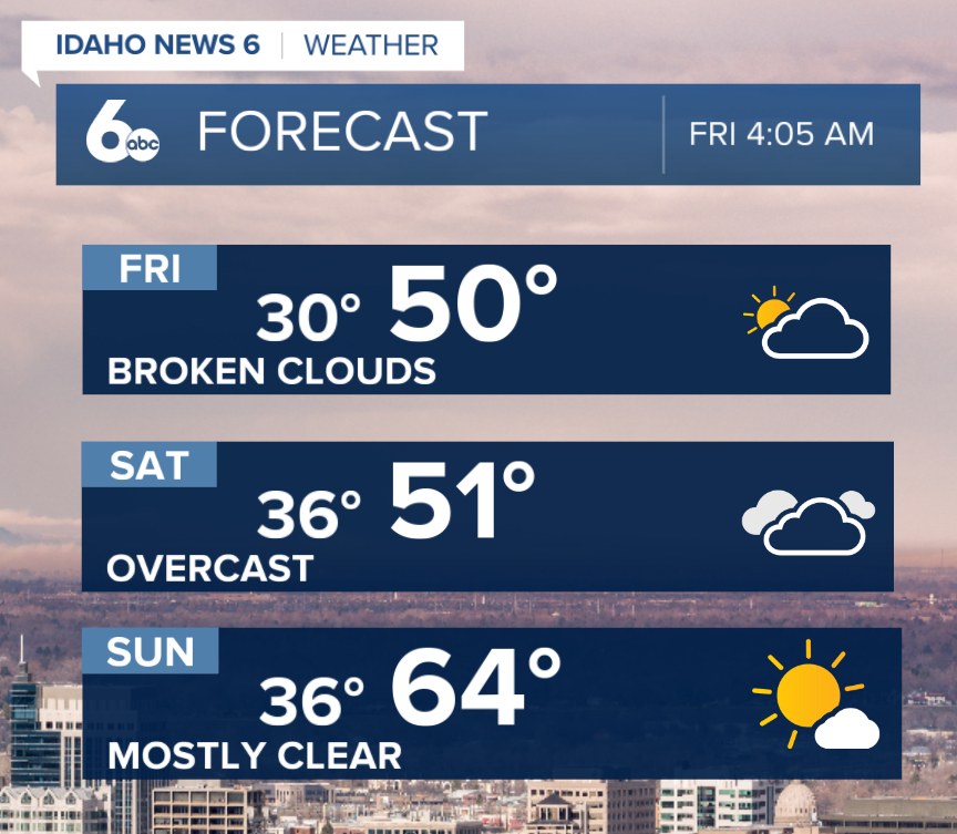
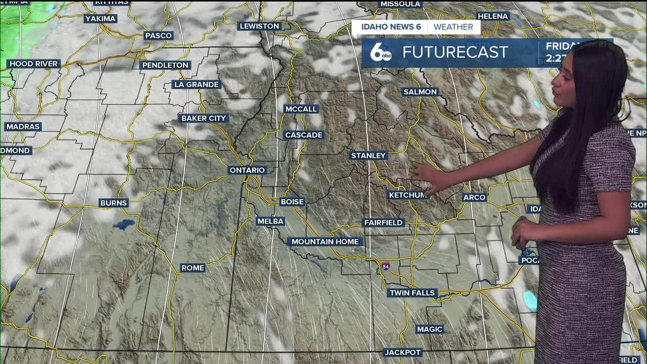
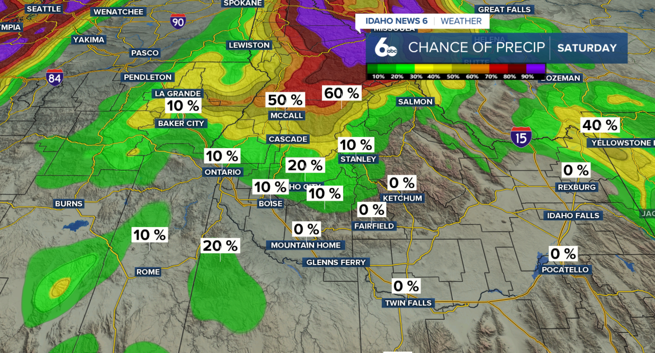
A ridge of high pressure building across the Intermountain West will bring quiet and dry conditions through the weekend. Aside from a few high clouds drifting overhead, most lower elevations will stay dry. There is a slight chance of light snow and rain showers across the west-central Idaho mountains and near Baker County, this evening and Saturday Morning- but any accumulation will be minimal.
FULL FORECAST: Spring-like temps arrive after snowstorm delivers powder to Bogus Basin
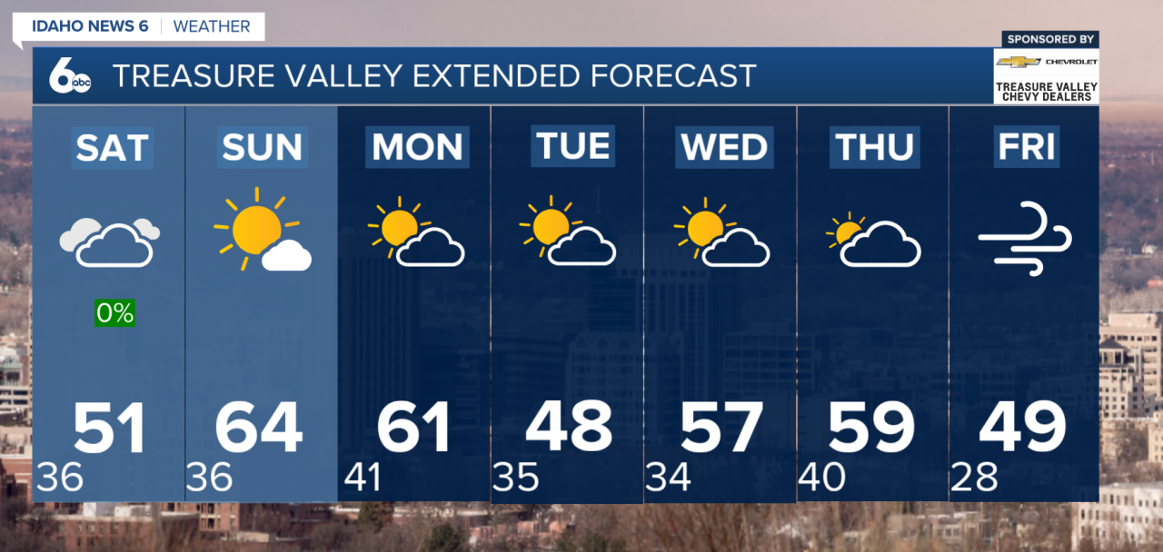
Temperatures will continue to warm heading into the weekend. Highs on Saturday will climb to around five degrees above normal, with Sunday bringing even warmer conditions. By Sunday afternoon, many valley locations will see temperatures reach the mid-50s to near 60 degrees, offering a taste of spring.
Winds will stay fairly light thanks to the ridge overhead, although north to northwest breezes could still produce gusts up to around 20 mph in the Magic Valley and across the higher terrain of southeast Oregon during the afternoon hours.
Looking ahead to early next week, changes arrive Monday as a Canadian trough drops south and strengthens the jet stream across the northern U.S. This will bring increasing precipitation chances to the north along with strong gusty winds through much of the week, while temperatures cool and snow levels begin to drop Monday night into Tuesday.
Bottom Line: The weekend will be fairly dry for valley floors, so enjoy it and get outside. Shower chances will continue mainly across the west-central mountains, with areas there staying a bit unsettled — hold off on washing the car just yet.
Treasure Valley Extended Forecast