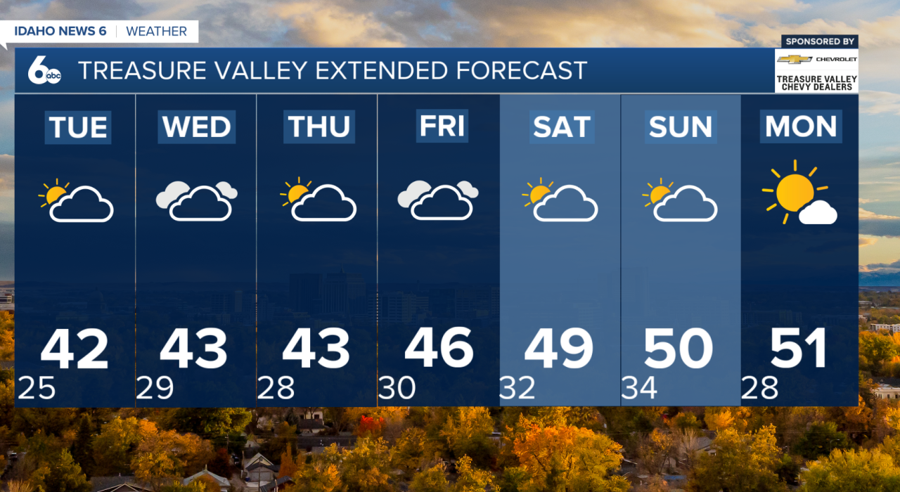


At the end of January, the weather pattern stays mostly calm for the next several days. High pressure will slowly build over the region, keeping conditions dry, while temperatures gradually warm up on Monday and Tuesday. We’ll also see some high clouds drifting overhead at times, but they won’t bring any precipitation.
One thing to watch: a temperature inversion is expected to strengthen Monday and Tuesday. That means valley locations could stay cooler and a bit more stagnant, while higher elevations may feel milder and see brighter skies. The good news? This inversion won’t be as strong as last week’s.

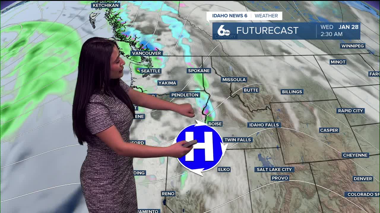
By Wednesday, a weak cold front slides through, bringing a 10–30% chance of showers. If we do see precipitation, snow levels will sit around 3,000 to 4,000 feet, and little to no accumulation is expected in the valleys. Models are hinting at nearly an inch in the West Central Mountains—so hug your snow-lover friends.

Looking ahead:
A strong ridge of high pressure continues to dominate much of the West, keeping the main storm track well north of us. That said, northeast Oregon and west-central Idaho could still get clipped by a few weak systems into the weekend.
The best chances for a few showers come:
- Friday (20–40%)
- Sunday into Monday (20–40%)
 Idaho News 6
Temperatures trend warmer through the extended forecast, with the potential to run 5 to 10 degrees above normal by late week and into the weekend.
Bottom Line: Mostly dry and quiet weather this week, a small shower chance on Wednesday, then a few hit-or-miss chances late week with overall warming temperatures.