After a stretch of active weather, we’re catching a brief break before the next system arrives.
Today will bring drier conditions and near-normal temperatures across the region. Weak ridging moving in from the Pacific will help keep skies calmer, making for a relatively quiet day with no major weather impacts. If you have outdoor plans or need to get ahead on errands, today will be the best window before conditions turn more unsettled again.
That changes quickly heading into Wednesday.
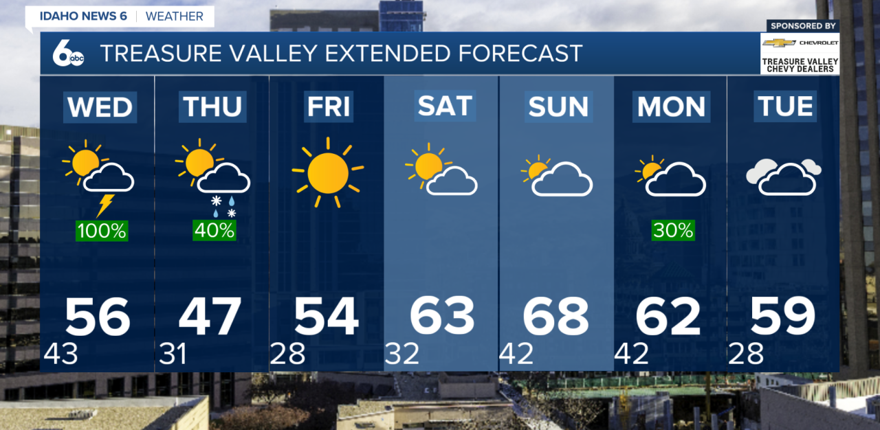
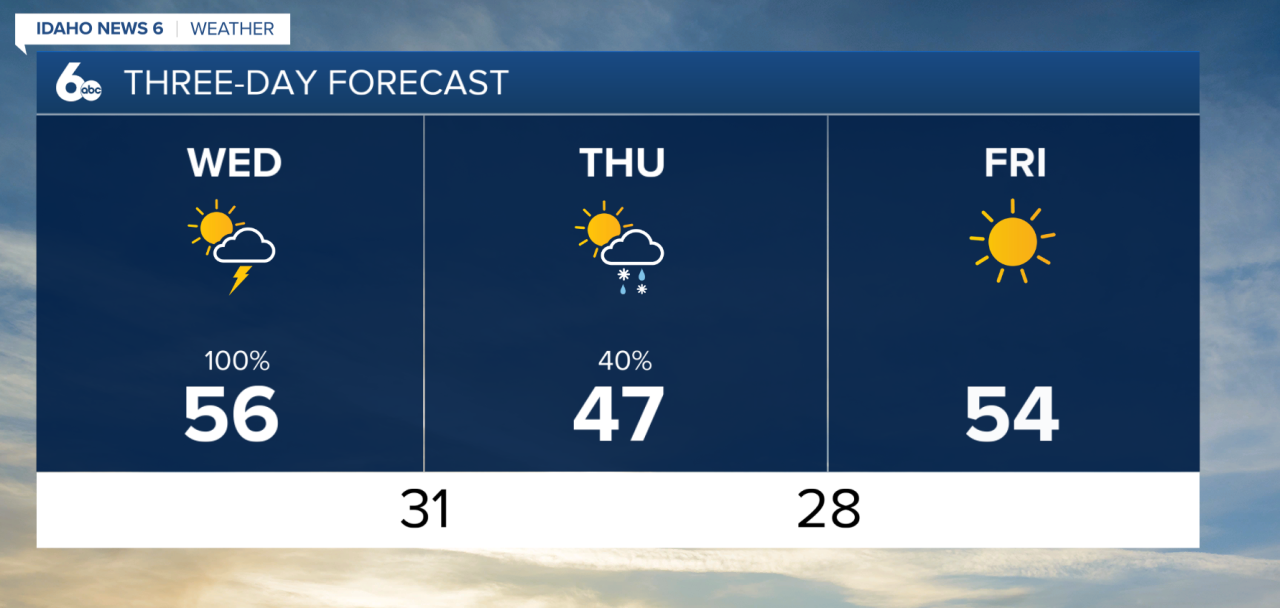
A new system dropping in from the Gulf of Alaska will begin to spread rain across the valleys and snow in the mountains starting early Wednesday, continuing through the day and into the evening. Snow levels will start off relatively high—generally around 5,000 feet in northern areas and closer to 6,500 feet further south—meaning most lower elevations will see rain for much of the day.
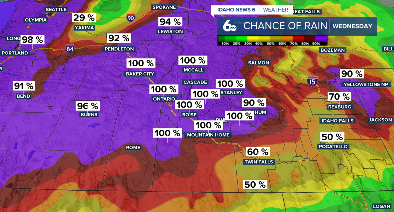
By Wednesday afternoon and evening, a cold front will push through SW Idaho, ushering in a much colder air mass. As this colder air arrives, snow levels will begin to drop steadily, eventually reaching valley floors late Wednesday night into early Thursday morning.
At this point, rain will be winding down as temperatures get cold enough for valley snow. A mix of rain and snow will be possible into Thursday. Right now, there’s about a 20% chance of a light dusting (around a half inch) in the Treasure Valley, with slightly higher chances and amounts possible in parts of the Magic Valley.
Even if snow doesn’t materialize in lower elevations, the cold air behind the system will be significant.
Thursday will feel much colder, with breezy conditions developing as the system exits. Skies will begin to clear Thursday night, allowing temperatures to drop efficiently. Overnight lows are expected to fall into the teens and 20s, setting the stage for several mornings of freezing temperatures.
From Thursday through Saturday, subfreezing mornings are expected across the entire region. This could pose a risk to early-season vegetation, so it’s important to cover or protect sensitive plants.
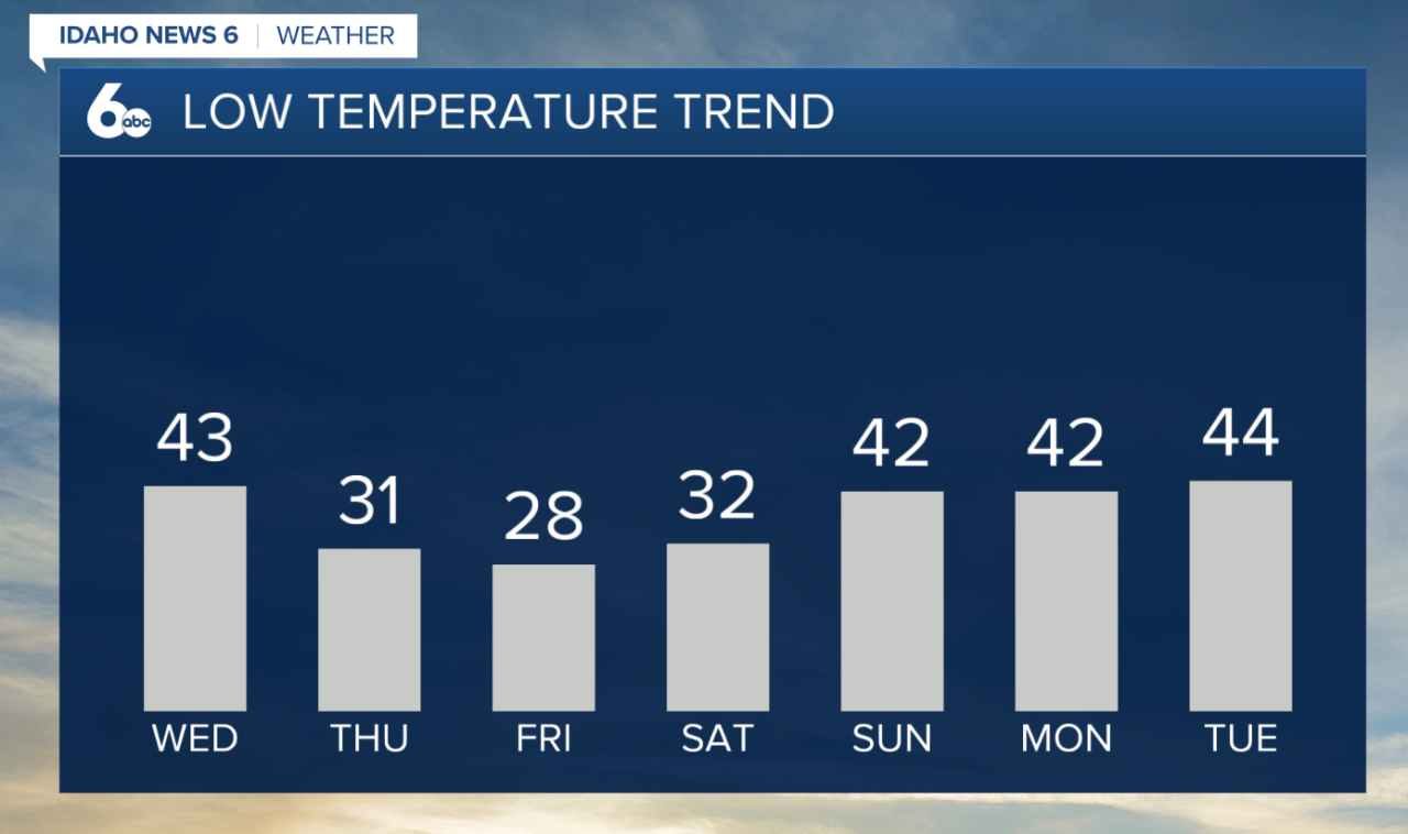
Looking ahead, the pattern begins to shift again by the end of the week. Friday will mark the start of a gradual warming and drying trend, although temperatures will still run slightly below normal at first. By the weekend, highs will continue to climb, eventually returning to above-normal levels by Sunday.
That break may be short-lived, though. Another system is expected to develop early next week, likely bringing renewed chances for rain and mountain snow sometime between late Sunday and Monday. While the exact timing is still uncertain, confidence is increasing that unsettled weather will return.
Enjoy the dry day ahead before the next round of showers.
Forecast: Quiet today before rain, valley snow, and a late week freeze