

An atmospheric river event known as the Pineapple Express is impacting the West Coast today.
Tropical moisture stretching all the way back to Hawaii will bring widespread precipitation, strong winds, and rapidly changing snow levels across southwest Idaho and southeast Oregon through the end of the week.
Today: Rising Snow Levels & Increasing Impacts
This morning, cold air left behind from yesterday’s system is allowing snow to fall at valley floors, especially in higher valleys and mountain communities. As a warm front lifts north, snow levels will rise quickly—reaching 7,000 to 8,000 feet by this afternoon across southeast Oregon and southern portions of the Snake Plain.
Baker County could see a brief period of moderate to heavy snow around midday, with towns like Halfway potentially receiving more snow than forecast as cold air lingers near the surface. Snow levels will stay lower longer in McCall, the Wallowa Mountains, and Hells Canyon, allowing snow to continue into the evening before warmer air finally mixes in.

Snow Totals & Travel Impacts
- Above 6,500 feet: 6 to 10 inches possible by the end of Thursday
- Mountain valleys: 2 to 4 inches across west-central Idaho, the Boise Mountains, Camas Prairie, and Baker County
- Northern Harney & Malheur Counties: 1 to 3 inches
These conditions may lead to slick roads and snow-covered mountain passes, particularly during heavier snowfall. A winter storm warning remains in effect for the East Central Mountains as mountain snow will contribute to slick driving conditions here.

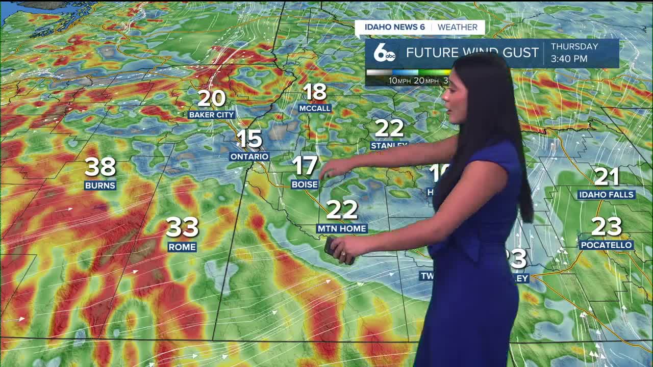
Wind Concerns
As the warm front lifts north, strong winds will develop, especially across southern Harney and Malheur Counties and south of the Snake Basin in Idaho.
Gusty conditions may make high-profile travel difficult, and a Wind Advisory remains in effect for eastern Oregon and Owyhee County.
While gusts are not expected to be as strong as yesterday’s event, it’s still a good idea to secure loose outdoor items and bring in patio furniture or pillows.

Friday: Mild, Windy, Then Turning Cooler
Friday will feel unseasonably warm, with temperatures running 15 to 20 degrees above normal, especially in the Snake Basin. Later in the day, a cold front moves south, quickly dropping snow levels—back to valley floors near Baker and McCall by Friday night. As precipitation tapers off behind the front, a brief rain-snow mix or light snow is possible.
Saturday: Quieter but Still Cool
Saturday looks cooler but quieter, with temperatures remaining slightly above average. There is only a 10–20% chance of snow, and forecast models are trending drier overall.
Stay up to date right here @SophiaCruzWX
