

Happy Friday, everyone! We've made it to the weekend.
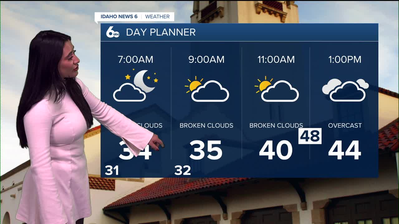
Friday starts off mild, with mostly cloudy skies through the afternoon.

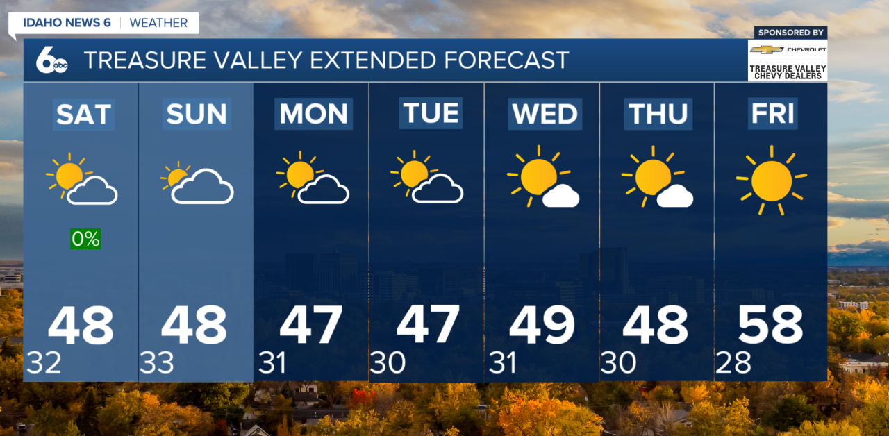
High pressure remains in control across Idaho through the weekend, keeping conditions dry with generally light winds. While high clouds have limited fog formation in some areas this morning, patchy fog is still possible, especially where skies briefly clear.
A strong temperature inversion remains locked in place, trapping moisture and pollutants near the ground. This has led to patchy fog and low clouds across the Treasure Valley and parts of the Snake River Plain. Light southeast winds this afternoon may help shift some of that trapped moisture toward the Lower Treasure Valley, making that area the most likely spot for fog and low clouds tonight into Saturday morning. Friendly reminder: in dense fog, turn on your low beams and increase your following distance.
Sunday brings a weak system passing to our north. While it won’t bring precipitation, it could briefly help mix the atmosphere and thin out fog in spots. Any improvement will likely be short-lived, as high pressure quickly rebuilds by Sunday night. Expect morning fog and low clouds to remain a common theme in the valleys through the weekend.
Looking Ahead: Stagnant Pattern Continues
High pressure strengthens early next week and may organize into a blocking pattern by midweek. That means stagnant air, recurring fog and low clouds in the valleys, and a noticeable temperature split — colder valley floors with milder conditions along the foothills and mid-slopes.
Hug your snow-loving friends tightly!
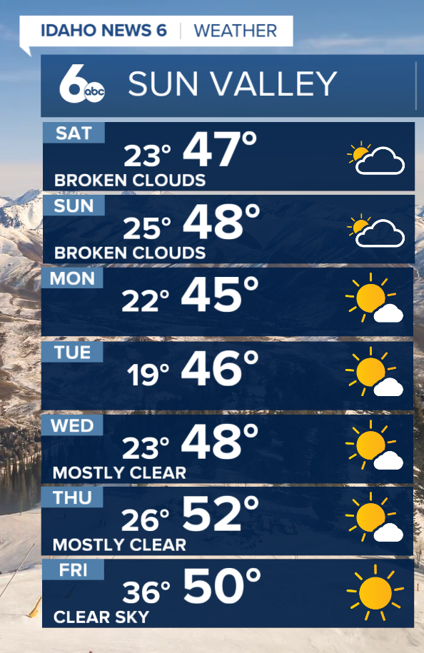
Seven-Day Forecast