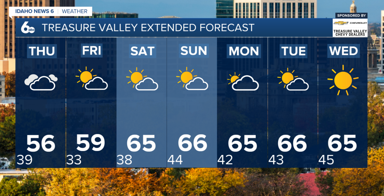
A quiet stretch of weather is ahead for southwest Idaho, with near-seasonal temperatures through the remainder of the workweek before unseasonably warm weather returns this weekend.
Wednesday will bring a mix of sunshine and clouds as skies gradually clear throughout the morning. Winds will remain light, with afternoon temperatures near to slightly above average for early November.
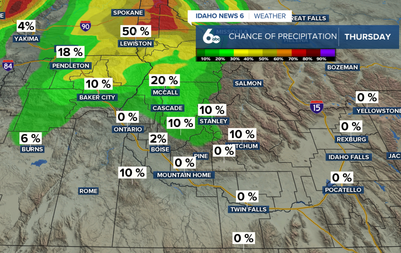
A weak disturbance will move through the region Thursday, bringing a 10–30% chance of scattered showers, mainly across northern mountain communities. Precipitation amounts will be minimal, with a light dusting of snow possible above 4,500 to 6,000 feet. Most valley locations will stay dry, although breezier winds and slightly cooler temperatures are expected.
By Friday, high pressure will begin building across the region, bringing dry conditions, lighter winds, and a gradual warming trend.
The biggest weather story arrives this weekend! Temperatures will climb to nearly 10 degrees above normal, with afternoon highs reaching the 60s across lower valleys. Despite a few passing high clouds and breezy southeast winds, dry conditions will continue through the weekend and into early next week.
Looking ahead, our next opportunity for unsettled weather arrives Wednesday as a stronger Pacific system approaches the coast. Precipitation chances will increase to 10–30%, along with breezier conditions.
Bottom line: A few mountain showers Thursday will be the only interruption to an otherwise quiet forecast. Expect a dry, unseasonably warm weekend with valley highs in the 60s!