

Good Morning, Everyone, it's baby Friday!
A stretch of unusually warm November weather continues across southwest Idaho and southeast Oregon today as mild southwest flow hangs on. Afternoon highs will run 15 to 20 degrees above normal, with Boise, Burns, and Twin Falls all flirting with record territory. An approaching frontal system off the northern California coast will increase winds this afternoon, causing atmospheric mixing, which in turn will further boost temperatures.
Afternoon highs-Records:
Boise 69°- 69° (1939)
McCall 58°- 61° (1999)
Twin Falls Airport 66°- 69° (1999)
Lucky Peak Dam 67°- 68° (1953)

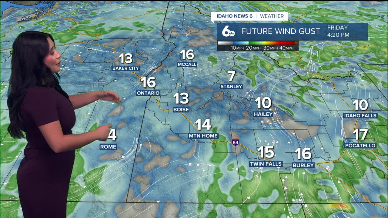
Scattered showers will begin pushing into eastern Oregon later today and into the west-central Idaho mountains by tonight. Most lower valleys, including the Snake Plain, stay mainly dry aside from a few light sprinkles. Friday brings partial clearing and still-mild temperatures as the system transitions into a cut-off low over southern California. By Saturday, conditions turn drier and partly sunny, with temperatures still running 10–15 degrees above average.
Changes arrive on Sunday as that cut-off low lifts north into the Great Basin, spreading showers back into the region by the afternoon. Snow levels remain high—around 7000 to 8000 feet—through Monday. A stronger trough diving in from the Gulf of Alaska then brings a cold front Monday, ushering in cooler air and lowering snow levels significantly to 3500–4500 feet by Tuesday. Expect a cooler, unsettled pattern with scattered showers through mid-week.
We are really going on a weather roller-coaster
this week.
Stay up to date right here https://www.instagram.com/sophiacruzwx/
