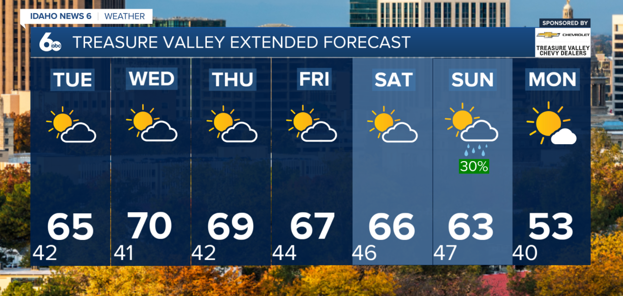
Good morning, everyone! Unseasonably warm temperatures will continue across southwest Idaho this week, with near-record highs possible by Wednesday. However, a pattern change is on the horizon, bringing increasing rain chances, mountain snow and cooler temperatures by the weekend.
Monday: Mild, Breezy and Increasing Clouds
Temperatures will remain 10–15 degrees above normal today as mild southwest flow continues across the region. Southerly winds will increase, with gusts between 15–30 mph.
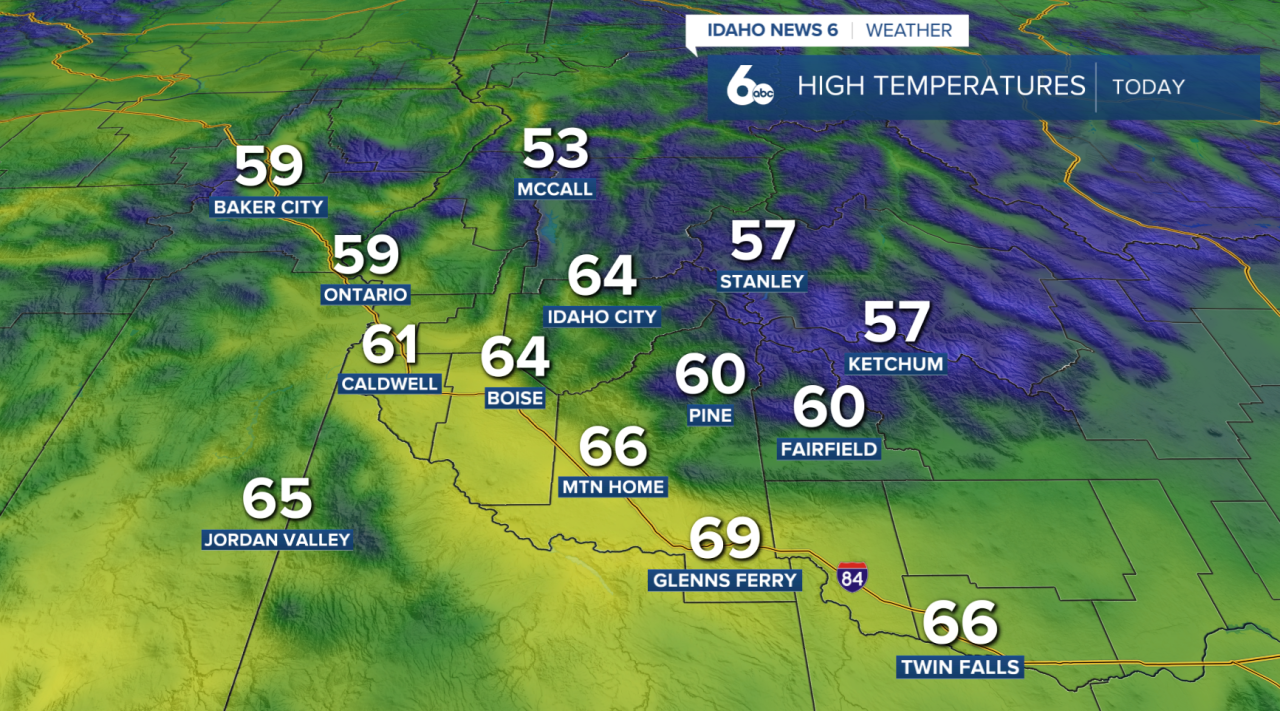
A weak weather system will move through tonight, bringing a 20–50% chance of rain to lower elevations north and west of Boise, with higher chances of 60–80% across west-central Idaho.
Rainfall totals will generally remain below a tenth of an inch, while mountain areas could receive up to a quarter inch. Snow levels will remain high, around 7,500–8,000 feet, limiting accumulation to the highest peaks.
Wednesday: Record Highs Within Reach
Dry conditions return Tuesday and Wednesday as high pressure builds across the region.
By Wednesday, temperatures could climb 15–20 degrees above normal, putting several locations near daily record highs.
Boise record high: 71° (1974)
Boise Wednesday high: 69°
Near-record warmth will continue Thursday and Friday, accompanied by increasingly breezy conditions.
Weekend: Rain and Mountain Snow Return
A more active weather pattern begins Friday night, with precipitation chances initially favoring the mountains and portions of eastern Oregon.
By Sunday and Monday, rain chances increase to 30–60% across the region, with the highest chances in the mountains.
Snow levels will initially remain high but could fall to 4,000–5,500 feet by Monday as colder air moves in. Afternoon temperatures are expected to return closer to seasonal averages early next week.
Enjoy the unusually warm November weather while it lasts. Near-record temperatures will dominate the middle of the week before a cooler, wetter pattern arrives this weekend.