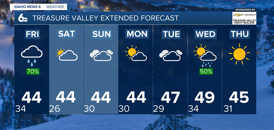
Keep the umbrella on hand, Idaho! An active weather pattern continues across southwestern Idaho and southeastern Oregon, bringing periods of valley rain, mountain snow and cooler temperatures through the end of the workweek.
Thursday will bring scattered rain showers to lower elevations, while mountain communities continue to see snow. Temperatures will climb slightly throughout the day, raising snow levels to between 4,500 and 5,500 feet. This means most valley locations, including Boise, will primarily see rain by the afternoon.
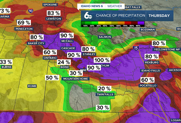
A more widespread round of precipitation is expected to develop Thursday night and continue into Friday morning. While valleys will see additional rainfall, higher elevations could pick up several more inches of snow.
By late Friday, higher terrain could see storm totals of 3 to 5 inches of snow, with up to 10 inches possible across the highest peaks. Some of the heavier snowfall is expected across portions of Malheur and Owyhee counties.
A Winter Weather Advisory remains in effect for the Camas Prairie until 11 a.m. Thursday.
A Brief Break Arrives Saturday
Rain and snow will gradually taper off Friday as the storm system moves east. Gusty northwest winds and cooler temperatures will follow, with lingering snow showers possible in the mountains.
Saturday will offer a break from the unsettled weather, with dry conditions expected across the region. Temperatures will remain close to seasonal averages.
More Rain and Snow Chances Return Sunday
The dry weather won't last long. Another Pacific storm system will bring a chance of precipitation back to the region Sunday.
For the Treasure Valley, there is a 10–20% chance of a rain and snow mix early Sunday morning. With temperatures cold enough to support snow at valley floors, a few flakes are possible, although precipitation is expected to be limited.
Mountain locations farther north will have a better chance of seeing snow, with a 40–60% chance of snow showers continuing through Sunday evening.
A few additional snow showers are possible across eastern portions of the region Monday morning before drier weather returns later Monday into Tuesday.
Another Storm Could Arrive by Midweek
Looking ahead to Thanksgiving week, another Pacific storm system could bring additional rain and mountain snow Wednesday and Thursday.
There is still uncertainty about the storm's exact path, which will determine how much precipitation reaches southwestern Idaho and southeastern Oregon.
For now, the forecast calls for another round of unsettled weather by the middle of next week, with temperatures remaining close to normal.