Today Through Saturday Night
The storm that brought us rain and snow yesterday is moving away, but we’re not totally done yet. A few spotty showers could pop up this afternoon near the Nevada border.
For most of us, it’s a mix of sun and clouds. Low clouds are sticking around in the Snake River Valley, and there could be some patchy fog early this morning — so give yourself a little extra time on the commute.

This afternoon will remain mild, so a light jacket should be sufficient.
Tonight into early Saturday, we get a short break in the action before the next system starts to build offshore.
By Saturday, winds will pick up a bit and mountain rain and snow move in late in the day and into Saturday night. Snow levels will be around 5,500 feet, so mainly the higher elevations see snow.
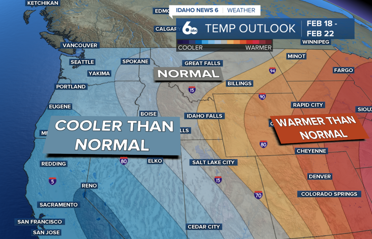
Overall, temperatures stay about 5 degrees above normal — fairly mild for February.
Sunday Through Thursday
The active weather pattern isn’t going anywhere.
Sunday and Monday will actually stay on the warmer side before our next system arrives.
Late Monday into Tuesday, that next storm moves in and brings better chances for rain in the valleys and snow in the mountains.
Unsettled weather sticks around through the middle of the week. By Wednesday, temperatures cool down to a few degrees below normal.
After that, Idaho trends closer to cooler and continues to see wetter-than-normal conditions.

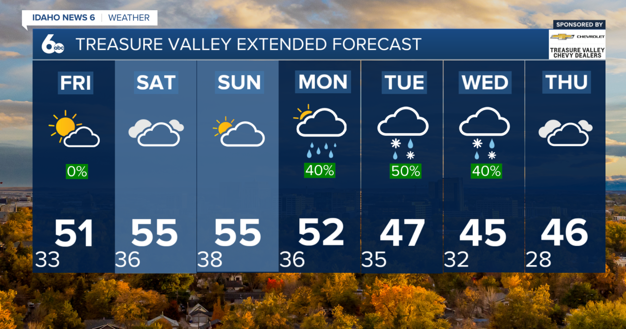
Seven-Day Forecast