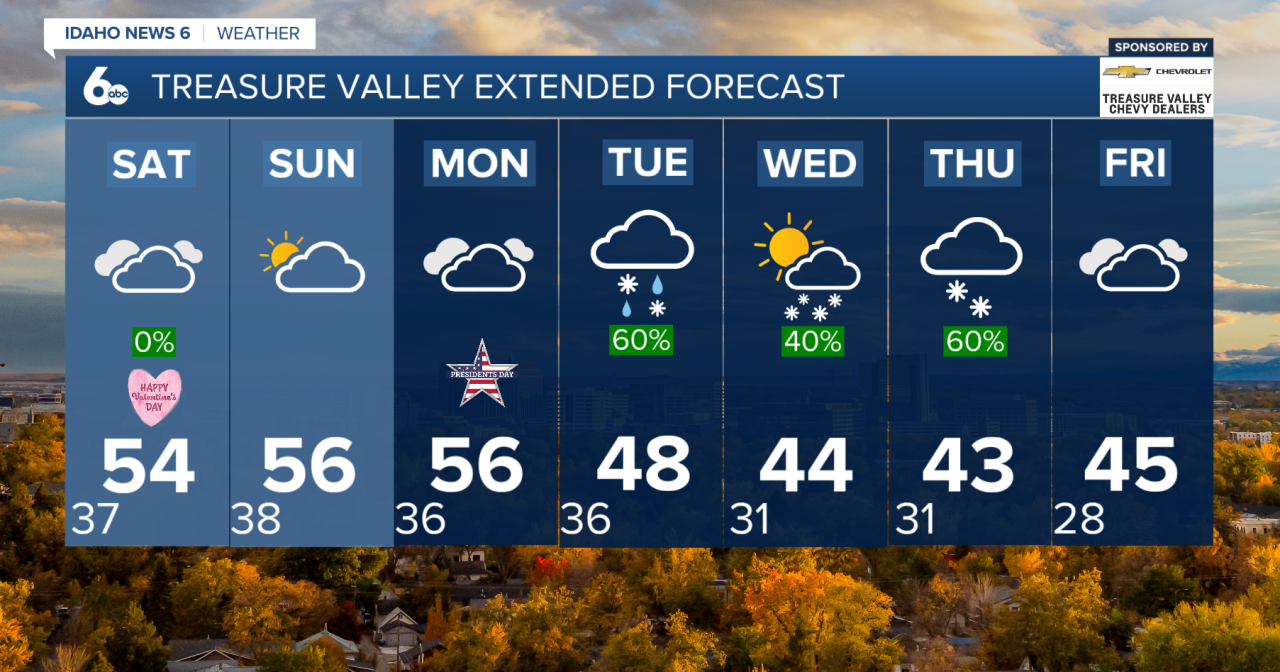


TGIF! We've made it to the weekend, and Valentine's Day is around the corner.
High pressure is keeping conditions stable and dry across the region. Expect low clouds and patchy fog to linger through late morning before giving way to a mostly quiet afternoon.
Weekend Outlook
Moisture increases Saturday into late Sunday, but impacts will be limited mainly to the mountains.
- Most mountain areas: up to 2 inches of snow
- Above 6,000 feet: up to 4 inches
- Lower elevations: generally dry, with only a slight chance of light rain (less than 0.05") in parts of southeast Oregon and the lower Treasure Valley
Overall, it will feel mild and fairly quiet for mid-February.


Next Week
A much more active weather pattern develops beginning Monday.
Monday remains mild — temperatures could run 10 to 15 degrees above normal — but precipitation chances increase Monday night rapidly as a colder system drops in from the Gulf of Alaska.
Snow levels will initially sit around 4,500 to 6,000 feet Monday night before lowering on Tuesday.
Expected Impacts
Lower Valleys:
- Primarily rain Monday night into Tuesday
- Rain totals up to a quarter inch possible
Mountain Valleys above 4,000 feet:
- 2 to 5 inches of snow likely
Above 6,000 feet:
- 6 to 12 inches possible, with locally higher amounts on peaks
Colder Air Arrives Midweek
Colder air moves in Tuesday night into Wednesday, dropping snow levels to near valley floors. By Wednesday, brief snow showers will be possible even in lower elevations.
Temperatures will cool significantly — roughly 10 to 15 degrees compared to the start of the week.
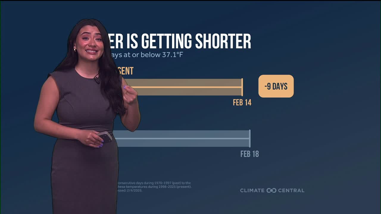
Watching Late-Week Snow Potential
Confidence is high that a colder pattern will remain in place on Thursday and Friday.
Current projections show:
- 50–70% chance of at least a dusting of snow in the Treasure and Magic Valleys
- 10–30% chance of 1 inch or more
- Additional light to moderate snow likely in the mountains
This system has a favorable track for lower elevation snow, but exact impacts may shift as we get closer.