

Good morning, Idaho!
Don't put away the umbrellas just yet.

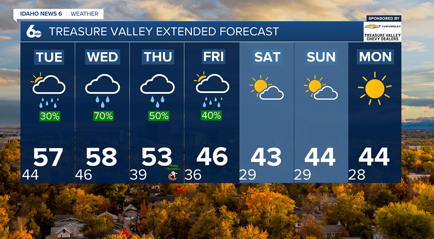
A mild and unsettled weather pattern continues this week across southwest Idaho and eastern Oregon through the middle of the week, bringing periods of rain, high-elevation snow, and increasing winds.
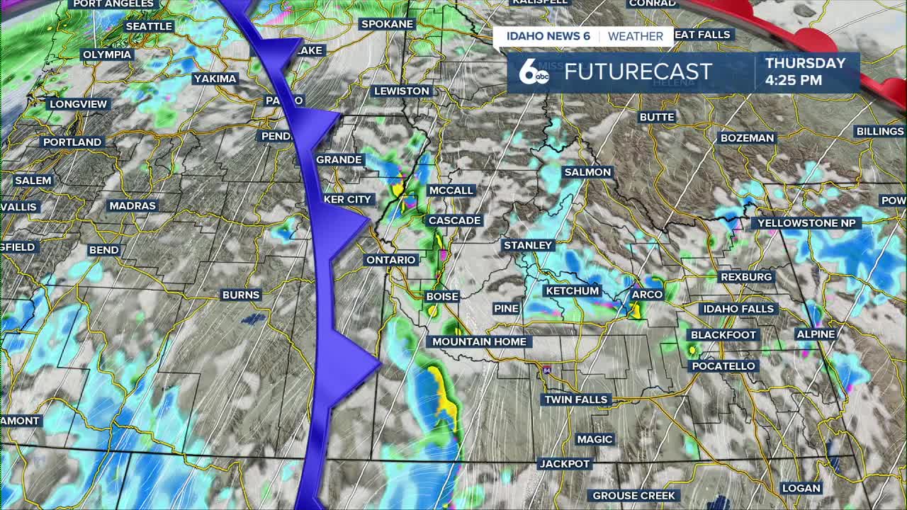
Today starts with a band of rain and mountain snow moving from eastern Oregon into central Idaho. The band weakens as it drifts south through the morning, allowing for some breaks in the clouds this afternoon. Temperatures remain well above normal, with snow levels varying from about 5,000 feet in eastern Oregon to near 8,000 feet in southern Idaho.
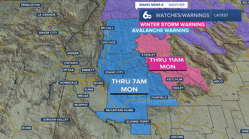
A winter storm warning remains in effect for the Sun Valley Region. Another 1 to 5 inches is possible through the morning, and winds are expected to gust up to 35 mph, making travel slick. In addition to this, an avalanche warning is in effect from McCall to Glenns Ferry. Avalanche danger is high; travel in avalanche terrain is not recommended.
Another round of precipitation develops late tonight into Tuesday morning, mainly affecting areas north of the Snake Plain. By Tuesday afternoon, conditions turn drier and warmer for much of southern Idaho. Highs in the Snake Plain reach the mid to upper 50s—roughly 15 to 20 degrees warmer than average—and some locations may approach record highs.
Winds begin to increase early Wednesday as a stronger system develops along the West Coast. Breezy to windy conditions are expected through the day, followed by a return of widespread rain showers Wednesday afternoon. Snow levels remain high, generally above 7,500 feet.
Looking ahead to the end of the week, a stronger storm system moves inland Thursday, bringing more widespread precipitation and gradually lowering snow levels. By Friday, snow levels drop to around 3,000 to 4,000 feet, allowing mountain towns to pick up light snow while higher elevations see heavier totals. Valley locations will mainly see rain with light amounts.
Temperatures cool closer to seasonal levels by the weekend. High pressure may briefly build in late Saturday into early next week, which could allow for a short-lived inversion before another unsettled pattern returns.