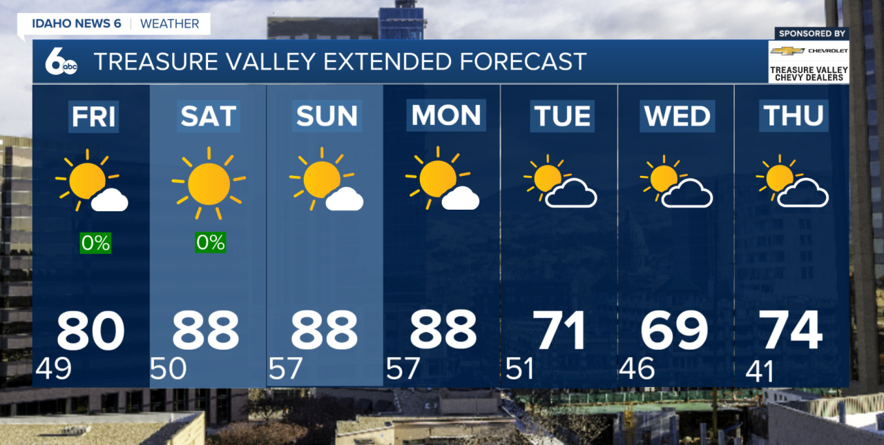
After a stretch of cooler weather, we are beginning a gradual warming trend that will continue through Memorial Day. Dry conditions are expected to dominate over the next several days, with mostly sunny skies, increasing afternoon temperatures, and only occasional passing high clouds.
Today marks the beginning of a steady warm-up as upper-level winds shift and allow warmer air to build back into the region. Afternoon highs will continue climbing day by day, with the warmest temperatures expected by Memorial Day. Many lower valley locations will likely see temperatures well above average for late May by the start of next week.
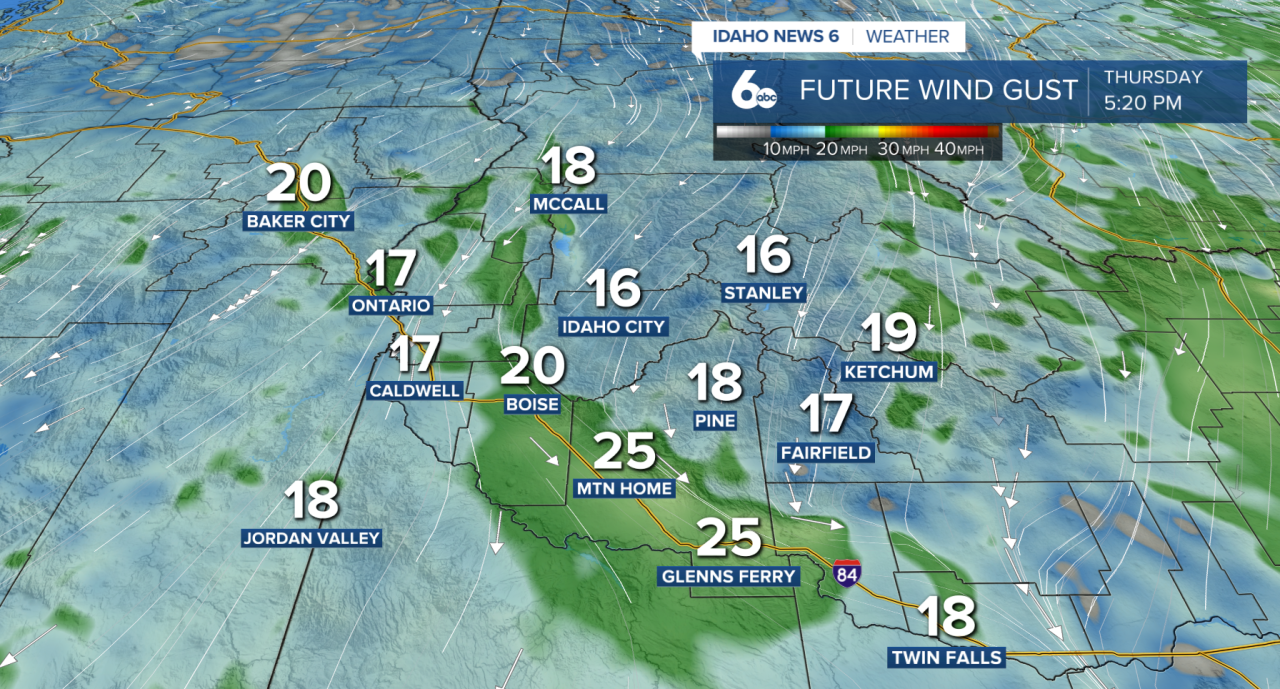
While sunshine will be the main weather story, breezy conditions are expected at times. Winds increase this afternoon across portions of the Snake Basin, where gusts up to 35 mph are possible. The breezy conditions may be noticeable for outdoor activities, but widespread impacts are not expected. Overnight, winds should weaken with calmer conditions returning into the morning hours.
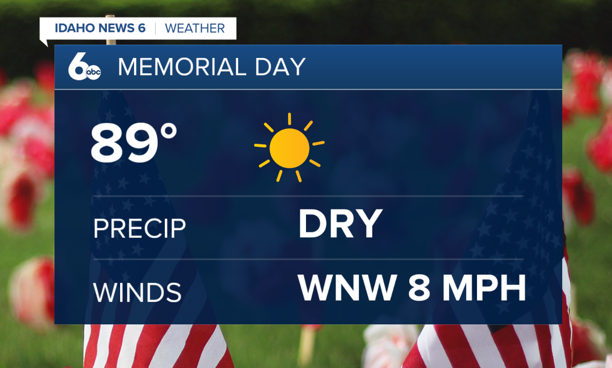
The overall weather pattern remains dry and sunny through the holiday weekend as southwesterly flow strengthens over the western United States. This setup supports continued warming and mostly quiet weather through Monday. Anyone with outdoor Memorial Day plans should expect toasty temperatures and sunshine.
The pattern begins to shift early next week as a Pacific cold front approaches the region. Current forecast guidance shows the front moving through Tuesday, bringing a return to gustier winds, noticeably cooler temperatures, and chances for scattered showers. Rainfall amounts look light overall, generally under one tenth of an inch for most areas, but the biggest change will be temperatures.
By Tuesday and Wednesday, highs could run nearly 20 degrees cooler compared to Memorial Day temperatures. The cooler air will create a much different feel across the region after several days of warming. Forecast models have trended slightly weaker with this system compared to earlier projections, but confidence remains high that a sharp cool down will occur.
The cooler pattern appears temporary, with temperatures expected to rebound again by Thursday. Until then, the main weather story remains the warming trend underway today and building into what looks to be a warm and mostly dry Memorial Day weekend.