


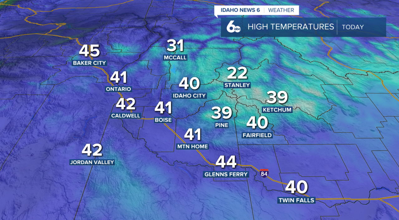
A weak upper-level disturbance moving through the region is bringing light snow showers this morning across southwest Idaho. So far, snowfall amounts have been minimal, with most areas picking up just a dusting to a few tenths of an inch. Lower valley locations could continue to see light snow through 11 am. Mountain areas above 4,500 feet may receive 1 to 2 inches throughout the morning.
Pockets of freezing rain will occur in the Lower (western) Treasure Valley, generally south of the Ontario-Caldwell area. This could create slick travel conditions, as ice could accumulate on some roadways and surfaces. Reminder: Use caution and allow extra time for your commute.

Good news, by late morning to midday, skies will begin to clear behind the system. Sunshine and slightly warmer temperatures will help melt any leftover snow, with valley highs climbing into the low 40s.
Tonight, conditions turn quieter but murkier. As winds go calm and an inversion strengthens, fog and low clouds are likely to develop, especially in the Snake River Valley and Baker Valley. The densest fog is expected between Ontario and Caldwell, which could impact the Thursday morning commute.
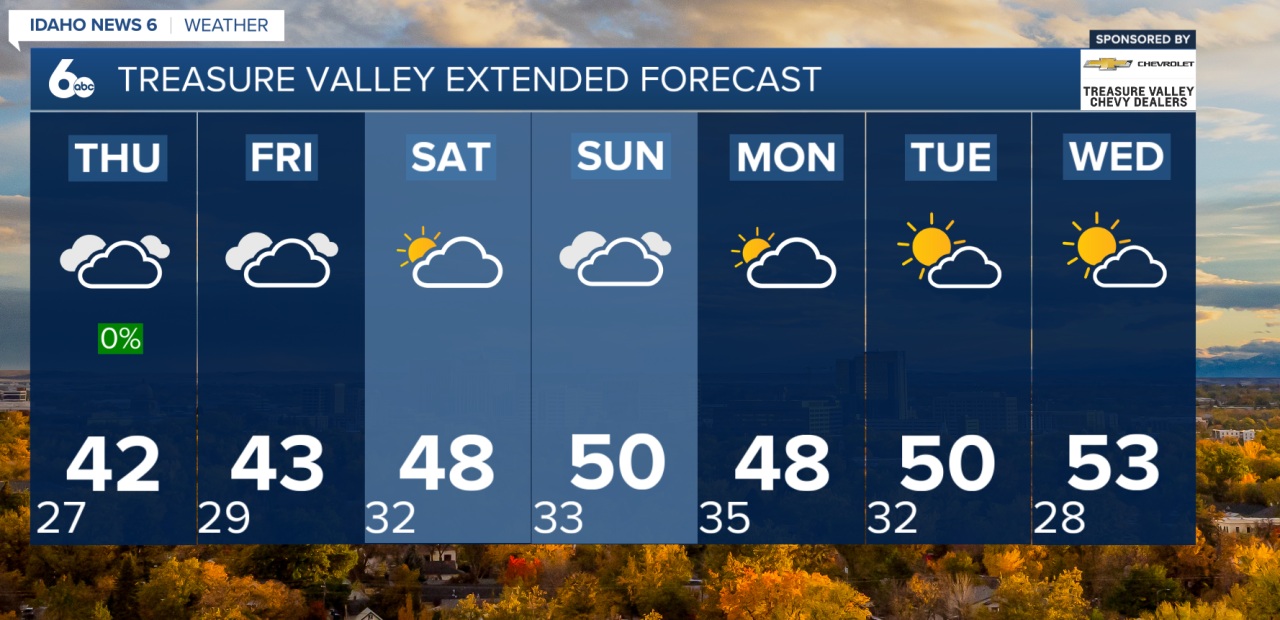
Thursday brings another weak system, mainly affecting northern areas with a small chance of showers. Most locations stay dry, with highs ranging from the low 30s in colder valleys to the low 40s in the Treasure Valley and Harney Basin.
By Friday, high pressure builds back in. That means dry weather continues, but inversions strengthen again, allowing fog and low clouds to redevelop Friday morning in valley locations. Afternoon highs will once again reach the 30s to low 40s, depending on cloud cover.
Looking Ahead:
The weekend stays dry and mild under strong high pressure, though morning fog remains possible in valleys. A passing system late Sunday into early Tuesday could bring light mountain precipitation, but chances remain low for the valleys. Temperatures cool slightly early next week before high pressure rebuilds by Wednesday.